Estimated Value: $408,798 - $510,000
--
Bed
1
Bath
2,475
Sq Ft
$183/Sq Ft
Est. Value
About This Home
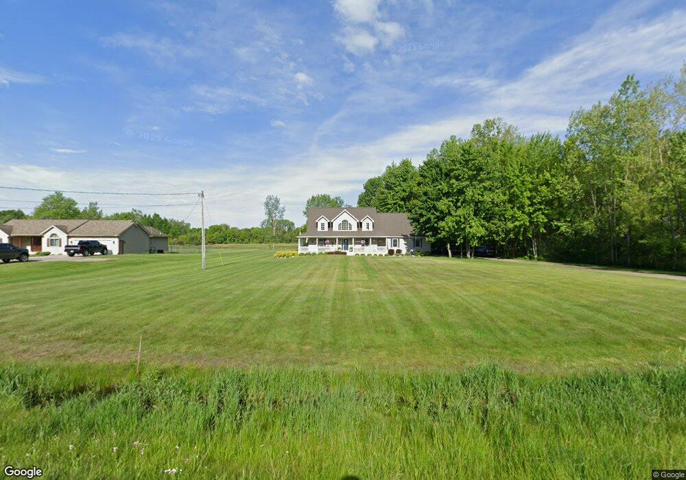
This home is located at 11443 N Webster Rd, Clio, MI 48420 and is currently estimated at $452,450, approximately $182 per square foot. 11443 N Webster Rd is a home located in Genesee County with nearby schools including George R. Carter Middle School and Clio Area High School.
Ownership History
Date
Name
Owned For
Owner Type
Purchase Details
Closed on
Jun 16, 2004
Sold by
Forsyth Cory and Forlenza Robert
Bought by
Forlenza Robert D and Forlenza Cory B
Current Estimated Value
Home Financials for this Owner
Home Financials are based on the most recent Mortgage that was taken out on this home.
Original Mortgage
$40,000
Outstanding Balance
$20,037
Interest Rate
6.37%
Mortgage Type
Credit Line Revolving
Estimated Equity
$432,413
Purchase Details
Closed on
Aug 14, 2002
Sold by
Ehrmantraut Gregory M and Ehrmantraut Elizabeth
Bought by
Forsyth Cory and Forlenza Robert
Create a Home Valuation Report for This Property
The Home Valuation Report is an in-depth analysis detailing your home's value as well as a comparison with similar homes in the area
Home Values in the Area
Average Home Value in this Area
Purchase History
| Date | Buyer | Sale Price | Title Company |
|---|---|---|---|
| Forlenza Robert D | -- | Title Michigan Agency Ltd | |
| Forsyth Cory | $42,000 | Sargents Title Company |
Source: Public Records
Mortgage History
| Date | Status | Borrower | Loan Amount |
|---|---|---|---|
| Open | Forlenza Robert D | $40,000 |
Source: Public Records
Tax History Compared to Growth
Tax History
| Year | Tax Paid | Tax Assessment Tax Assessment Total Assessment is a certain percentage of the fair market value that is determined by local assessors to be the total taxable value of land and additions on the property. | Land | Improvement |
|---|---|---|---|---|
| 2025 | $4,851 | $256,800 | $0 | $0 |
| 2024 | $2,137 | $214,300 | $0 | $0 |
| 2023 | $2,039 | $219,800 | $0 | $0 |
| 2022 | $4,346 | $188,800 | $0 | $0 |
| 2021 | $4,290 | $177,900 | $0 | $0 |
| 2020 | $1,866 | $169,300 | $0 | $0 |
| 2019 | $1,702 | $157,700 | $0 | $0 |
| 2018 | $3,711 | $131,400 | $0 | $0 |
| 2017 | $3,533 | $131,400 | $0 | $0 |
| 2016 | $3,503 | $128,000 | $0 | $0 |
| 2015 | $3,470 | $126,200 | $0 | $0 |
| 2012 | -- | $95,100 | $95,100 | $0 |
Source: Public Records
Map
Nearby Homes
- 5218 W Vienna Rd
- 5171 Field Rd
- Lot D N Linden Rd
- 11290 N Linden Rd
- 11107 N Elms Rd
- 13060 Country Club Dr
- 5212 W Farrand Rd
- 12409 Elms Rd
- 00 W Vienna Rd
- 0 W Wilson Rd Unit 50180050
- V/L Field Rd
- 13136 N Linden Rd
- 5217 Old Barn Ln
- 11275 Grand Oaks Dr
- 12046 Morrish Rd
- V/L Morrish Rd
- 11269 N Jennings Rd
- 7434 W Farrand Rd
- 10350 Morrish Rd
- 9465 N Linden Rd
- 11459 N Webster Rd
- 11421 N Webster Rd
- 11401 N Webster Rd
- 11465 N Webster Rd
- 6039 W Vienna Rd
- 11379 N Webster Rd
- 11501 N Webster Rd
- 11440 N Webster Rd
- 11375 N Webster Rd
- 11466 N Webster Rd
- 11424 N Webster Rd
- 11359 N Webster Rd
- 11362 N Webster Rd
- 11339 N Webster Rd
- 6137 W Vienna Rd
- 6137 W Vienna Rd
- 6137 W Vienna Rd
- 6121 W Vienna Rd
- 5514 W Vienna Rd
- 5504 W Vienna Rd