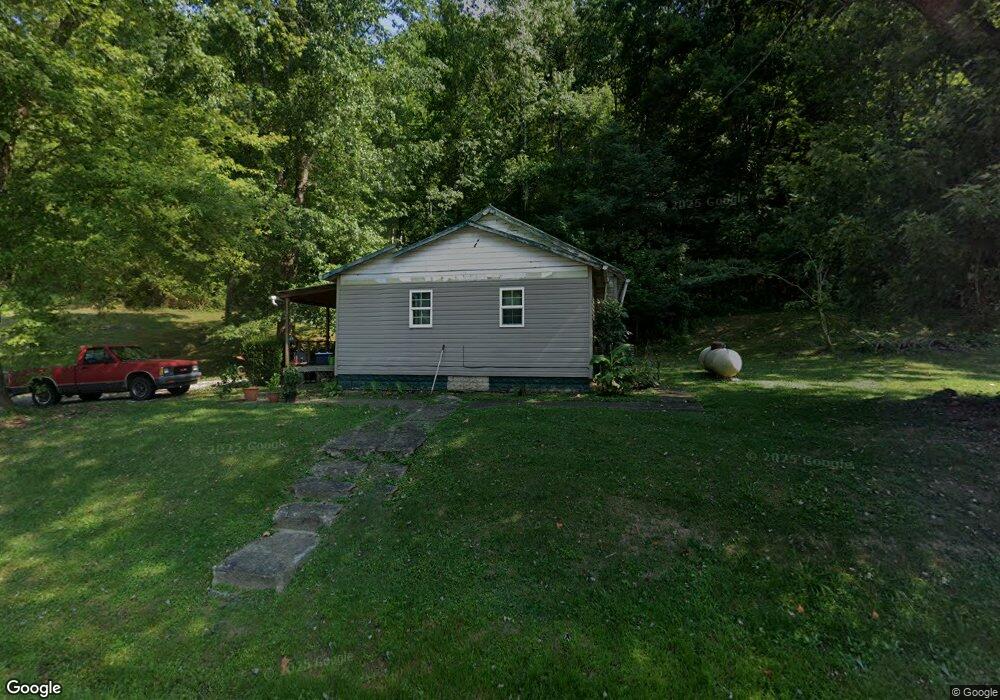
11447 State Route 217 Scottown, OH 45678
Estimated Value: $78,789 - $175,000
3
Beds
1
Bath
1,100
Sq Ft
$105/Sq Ft
Est. Value
About This Home
This home is located at 11447 State Route 217, Scottown, OH 45678 and is currently estimated at $115,697, approximately $105 per square foot. 11447 State Route 217 is a home located in Lawrence County with nearby schools including Symmes Valley Elementary School and Symmes Valley High School.
Ownership History
Date
Name
Owned For
Owner Type
Purchase Details
Closed on
Aug 10, 2022
Sold by
Stevenson and Darlene
Bought by
Dillon Julie
Current Estimated Value
Purchase Details
Closed on
Apr 27, 2011
Sold by
Hayes Jim and Hayes Debbie
Bought by
Stevenson Henry and Stevenson Darlene
Home Financials for this Owner
Home Financials are based on the most recent Mortgage that was taken out on this home.
Original Mortgage
$28,800
Interest Rate
4.77%
Mortgage Type
Future Advance Clause Open End Mortgage
Purchase Details
Closed on
Feb 3, 2011
Sold by
Potts Wanda
Bought by
Hayes Jim and Hayes Debbie
Purchase Details
Closed on
Mar 3, 2005
Sold by
Potts Virgil and Potts Wanda
Bought by
Potts Bradley Jake
Purchase Details
Closed on
Aug 24, 1990
Sold by
Mcwhorter Faye and Mcwhorter Rosemar
Bought by
Potts Virgil and Potts Wanda
Create a Home Valuation Report for This Property
The Home Valuation Report is an in-depth analysis detailing your home's value as well as a comparison with similar homes in the area
Home Values in the Area
Average Home Value in this Area
Purchase History
| Date | Buyer | Sale Price | Title Company |
|---|---|---|---|
| Dillon Julie | $21,000 | -- | |
| Stevenson Henry | $28,500 | Attorney | |
| Hayes Jim | $29,500 | Attorney | |
| Potts Bradley Jake | -- | None Available | |
| Potts Virgil | $20,000 | -- |
Source: Public Records
Mortgage History
| Date | Status | Borrower | Loan Amount |
|---|---|---|---|
| Previous Owner | Stevenson Henry | $28,800 |
Source: Public Records
Tax History Compared to Growth
Tax History
| Year | Tax Paid | Tax Assessment Tax Assessment Total Assessment is a certain percentage of the fair market value that is determined by local assessors to be the total taxable value of land and additions on the property. | Land | Improvement |
|---|---|---|---|---|
| 2024 | -- | $17,220 | $4,180 | $13,040 |
| 2023 | $499 | $17,220 | $4,180 | $13,040 |
| 2022 | $498 | $17,220 | $4,180 | $13,040 |
| 2021 | $446 | $15,600 | $3,960 | $11,640 |
| 2020 | $462 | $15,600 | $3,960 | $11,640 |
| 2019 | $485 | $15,600 | $3,960 | $11,640 |
| 2018 | $465 | $14,810 | $3,880 | $10,930 |
| 2017 | $465 | $14,810 | $3,880 | $10,930 |
| 2016 | $430 | $14,810 | $3,880 | $10,930 |
| 2015 | $380 | $12,910 | $3,860 | $9,050 |
| 2014 | $380 | $12,910 | $3,860 | $9,050 |
| 2013 | $380 | $12,910 | $3,860 | $9,050 |
Source: Public Records
Map
Nearby Homes
- 0 Ohio 217
- 11904 State Route 217
- Reeves Creek Rd
- 0 County Road 121
- 1115 Ohio 218
- 1805 Long Creek Rd E
- 0 Dillon Ridge Unit 23651508
- 0 Dillon Ridge Unit 181305
- State Route 790
- 2202 County Road 66
- 479 Township Road 122
- 647 Private Road 3952
- 168 Township Road 122 W
- 477 Township Road 88
- 15 Private Dr
- 123 Private Dr
- 97 Berry Rd
- 13498 County Road 2
- 2772 Twp Rd 177
- 1086 County Road 71
- 11236 State Route 217
- 11486 State Route 217
- 11509 State Route 217
- 11188 State Route 217
- 11366 State Route 217
- 11528 State Route 217
- 11132 State Route 217
- 11300 State Route 217 Unit ComO-1
- 11300 State Route 217
- 9662 Ohio 217
- 11278 State Route 217
- 11637 State Route 217
- 11528 Ohio 217
- 9198 State Route 775
- 11198 State Route 217
- 316 County Road 37
- 11189 State Route 217
- 175 County Road 37
- 332 County Road 67
- 464 County Road 37