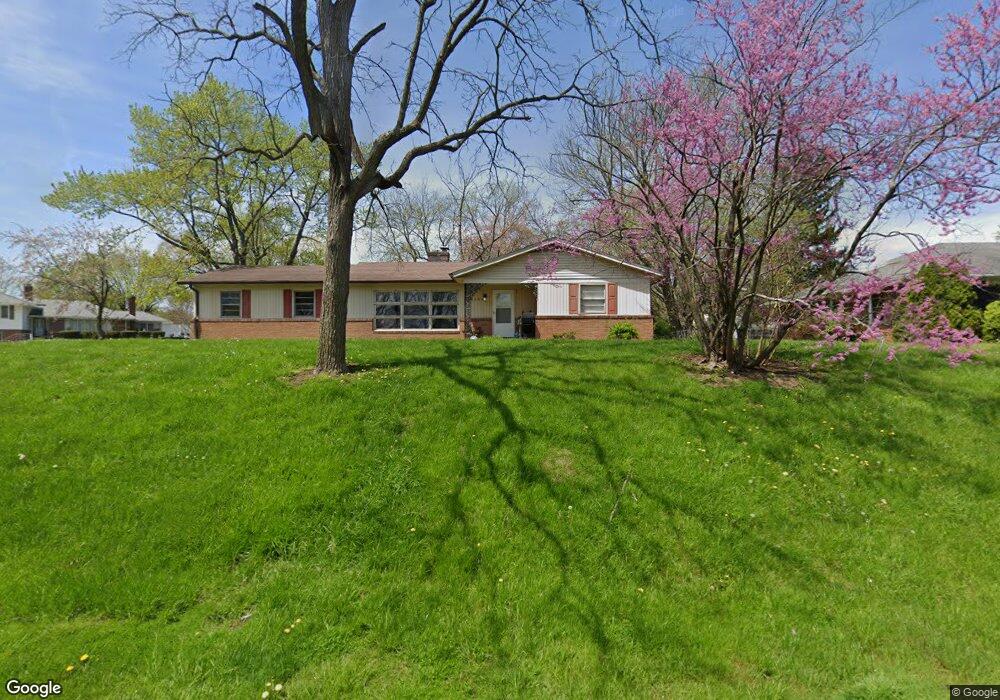
1145 Harter Blvd Anderson, IN 46011
Estimated Value: $139,000 - $161,000
2
Beds
1
Bath
1,274
Sq Ft
$119/Sq Ft
Est. Value
About This Home
This home is located at 1145 Harter Blvd, Anderson, IN 46011 and is currently estimated at $151,849, approximately $119 per square foot. 1145 Harter Blvd is a home located in Madison County with nearby schools including Anderson Elementary School, Highland Middle School, and Anderson High School.
Ownership History
Date
Name
Owned For
Owner Type
Purchase Details
Closed on
Sep 15, 2022
Sold by
Heck Michael Craig
Bought by
Simon David
Current Estimated Value
Home Financials for this Owner
Home Financials are based on the most recent Mortgage that was taken out on this home.
Original Mortgage
$97,600
Outstanding Balance
$93,048
Interest Rate
4.99%
Mortgage Type
New Conventional
Estimated Equity
$58,801
Purchase Details
Closed on
Nov 6, 2009
Sold by
Cunningham Patrick J and Estate Of Maverne G Ramsey
Bought by
Heck Michael Creig
Home Financials for this Owner
Home Financials are based on the most recent Mortgage that was taken out on this home.
Original Mortgage
$49,094
Interest Rate
5.05%
Mortgage Type
FHA
Create a Home Valuation Report for This Property
The Home Valuation Report is an in-depth analysis detailing your home's value as well as a comparison with similar homes in the area
Home Values in the Area
Average Home Value in this Area
Purchase History
| Date | Buyer | Sale Price | Title Company |
|---|---|---|---|
| Simon David | -- | Security Title | |
| Heck Michael Creig | -- | -- |
Source: Public Records
Mortgage History
| Date | Status | Borrower | Loan Amount |
|---|---|---|---|
| Open | Simon David | $97,600 | |
| Previous Owner | Heck Michael Creig | $49,094 |
Source: Public Records
Tax History Compared to Growth
Tax History
| Year | Tax Paid | Tax Assessment Tax Assessment Total Assessment is a certain percentage of the fair market value that is determined by local assessors to be the total taxable value of land and additions on the property. | Land | Improvement |
|---|---|---|---|---|
| 2024 | $897 | $84,600 | $22,500 | $62,100 |
| 2023 | $820 | $77,600 | $21,300 | $56,300 |
| 2022 | $757 | $74,800 | $20,000 | $54,800 |
| 2021 | $1,566 | $69,600 | $19,800 | $49,800 |
| 2020 | $1,496 | $66,200 | $19,000 | $47,200 |
| 2019 | $1,468 | $64,900 | $19,000 | $45,900 |
| 2018 | $1,406 | $60,900 | $19,000 | $41,900 |
| 2017 | $1,208 | $60,400 | $19,000 | $41,400 |
| 2016 | $1,208 | $60,400 | $19,000 | $41,400 |
| 2014 | $1,280 | $64,000 | $18,000 | $46,000 |
| 2013 | $1,280 | $64,000 | $18,000 | $46,000 |
Source: Public Records
Map
Nearby Homes
- 910 Raible Ave
- 3008 Nichol Ave
- 2308 W 16th St
- 2205 Nichol Ave
- 2104 W 16th St
- 1820 Euclid Dr
- 1827 Fulton St
- 1411 Halford St
- 1222 Irving Way
- 1830 Nichol Ave
- 1818 Dewey St
- 0 Fulton St Unit MBR22051501
- 3134 Meadowcrest Dr
- 2006 Costello Dr
- 2011 W 18th St
- 1808 Nichol Ave
- 45 Spring Valley Dr
- 1616 Reverend J T Menifee St
- 908 Wayside Ln
- 2121 Euclid Dr
- 1137 Harter Blvd
- 1138 Harter Blvd
- 1133 Balfour Rd
- 1141 Balfour Rd
- 1125 Balfour Rd
- 2710 W 12th St
- 1129 Harter Blvd
- 1149 Balfour Rd
- 1117 Balfour Rd
- 1134 Sunnymead Dr
- 1108 Balfour Rd
- 1142 Sunnymead Dr
- 1107 Thayer Ln
- 1132 Glendale Dr
- 1142 Sumnnymead
- 1121 Harter Blvd
- 1140 Glendale Dr
- 1126 Sunnymead Dr
- 2721 W 12th St
- 2748 W 12th St