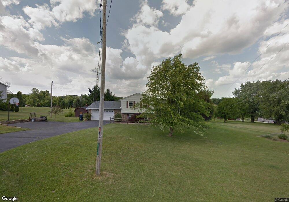
1145 Hoover Rd Mansfield, OH 44903
Estimated Value: $237,000 - $283,000
3
Beds
2
Baths
1,768
Sq Ft
$146/Sq Ft
Est. Value
About This Home
This home is located at 1145 Hoover Rd, Mansfield, OH 44903 and is currently estimated at $258,175, approximately $146 per square foot. 1145 Hoover Rd is a home located in Richland County with nearby schools including Madison High School, Temple-Christian School, and St. Mary Catholic School.
Ownership History
Date
Name
Owned For
Owner Type
Purchase Details
Closed on
Jun 10, 2019
Sold by
Bernhardt Jerry L and Bernhardt Sandra K
Bought by
Bernhardt Kyle J and Bernhardt April M
Current Estimated Value
Home Financials for this Owner
Home Financials are based on the most recent Mortgage that was taken out on this home.
Original Mortgage
$132,000
Outstanding Balance
$86,608
Interest Rate
4.1%
Mortgage Type
VA
Estimated Equity
$171,567
Purchase Details
Closed on
Dec 2, 1998
Sold by
Ladd Jack W
Bought by
Bernhardt Jerry L and Bernhardt Sandra K
Home Financials for this Owner
Home Financials are based on the most recent Mortgage that was taken out on this home.
Original Mortgage
$98,800
Interest Rate
6.39%
Mortgage Type
New Conventional
Purchase Details
Closed on
Mar 1, 1985
Create a Home Valuation Report for This Property
The Home Valuation Report is an in-depth analysis detailing your home's value as well as a comparison with similar homes in the area
Home Values in the Area
Average Home Value in this Area
Purchase History
| Date | Buyer | Sale Price | Title Company |
|---|---|---|---|
| Bernhardt Kyle J | $132,000 | Southern Title | |
| Bernhardt Jerry L | $123,500 | -- | |
| -- | $10,500 | -- |
Source: Public Records
Mortgage History
| Date | Status | Borrower | Loan Amount |
|---|---|---|---|
| Open | Bernhardt Kyle J | $132,000 | |
| Previous Owner | Bernhardt Jerry L | $98,800 |
Source: Public Records
Tax History Compared to Growth
Tax History
| Year | Tax Paid | Tax Assessment Tax Assessment Total Assessment is a certain percentage of the fair market value that is determined by local assessors to be the total taxable value of land and additions on the property. | Land | Improvement |
|---|---|---|---|---|
| 2024 | $3,021 | $62,200 | $12,750 | $49,450 |
| 2023 | $3,021 | $62,200 | $12,750 | $49,450 |
| 2022 | $2,746 | $50,190 | $11,390 | $38,800 |
| 2021 | $2,628 | $48,100 | $11,390 | $36,710 |
| 2020 | $2,648 | $48,100 | $11,390 | $36,710 |
| 2019 | $2,535 | $40,920 | $9,660 | $31,260 |
| 2018 | $2,369 | $40,920 | $9,660 | $31,260 |
| 2017 | $2,393 | $40,920 | $9,660 | $31,260 |
| 2016 | $2,465 | $42,010 | $9,170 | $32,840 |
| 2015 | $2,351 | $42,010 | $9,170 | $32,840 |
| 2014 | $2,342 | $42,010 | $9,170 | $32,840 |
| 2012 | $1,164 | $44,230 | $9,660 | $34,570 |
Source: Public Records
Map
Nearby Homes
- 1171 Hoover Rd
- 1791 Beal Rd
- 0 Hoover Rd
- 1585 Beal Rd
- 1292 Wolford Rd
- 920 Piper Rd
- 1245 N Stewart Rd
- 1158 Delwood Rd
- 1150 Delwood Dr
- 1151 Beal Rd
- 1106 Keller Dr Unit 1108
- 1140 5th Ave
- 1806 Richard Dr
- 1951 Woodmont Rd
- 0 Wesley
- 903 Mayflower Ave
- 1997 Hout Rd
- 2202 Lakewood Dr
- 741 Yale Ave
- 735 Pennsylvania Ave
- 1133 Hoover Rd
- 1121 Hoover Rd
- 1126 Hoover Rd
- 1144 Hoover Rd
- 1105 Hoover Rd
- 1192 Hoover Rd
- 1858 N Stewart Rd
- 1087 Hoover Rd
- 1804 N Stewart Rd
- 1844 N Stewart Rd
- 1227 Hoover Rd
- 1761 Beal Rd
- 1745 Beal Rd
- 1735 Beal Rd
- 1725 Beal Rd
- 1703 Beal Rd Unit 1705
- 1703 1705 Beal Rd
- 1692 N Stewart Rd
- 1760 Beal Rd
- 1705 Beal Rd