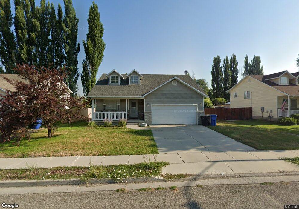
1145 W 400 S Logan, UT 84321
Woodruff NeighborhoodEstimated Value: $366,000 - $389,763
3
Beds
2
Baths
1,609
Sq Ft
$236/Sq Ft
Est. Value
About This Home
This home is located at 1145 W 400 S, Logan, UT 84321 and is currently estimated at $380,191, approximately $236 per square foot. 1145 W 400 S is a home located in Cache County with nearby schools including Woodruff School, Mount Logan Middle School, and Logan High School.
Ownership History
Date
Name
Owned For
Owner Type
Purchase Details
Closed on
Sep 26, 2019
Sold by
Thomas Carolyn and Albright Michael
Bought by
Albright Michael Phillips
Current Estimated Value
Home Financials for this Owner
Home Financials are based on the most recent Mortgage that was taken out on this home.
Original Mortgage
$31,250
Outstanding Balance
$27,377
Interest Rate
3.5%
Mortgage Type
Credit Line Revolving
Estimated Equity
$352,814
Purchase Details
Closed on
Oct 17, 2017
Sold by
Cowles Brett and Crosby Lindsey
Bought by
Albright Michael and Thomas Carolyn
Home Financials for this Owner
Home Financials are based on the most recent Mortgage that was taken out on this home.
Original Mortgage
$193,076
Outstanding Balance
$161,316
Interest Rate
3.83%
Mortgage Type
New Conventional
Estimated Equity
$218,875
Purchase Details
Closed on
Sep 13, 2012
Sold by
Burnham Jeffrey S and Burnham Heather K
Bought by
Cowles Brett and Crosby Lindsey
Home Financials for this Owner
Home Financials are based on the most recent Mortgage that was taken out on this home.
Original Mortgage
$6,996
Interest Rate
3.59%
Mortgage Type
Stand Alone Second
Purchase Details
Closed on
Mar 24, 2006
Sold by
Wilson Marlon James and Wilson Jill Brown
Bought by
Burnham Jeffrey S and Burnham Heather K
Home Financials for this Owner
Home Financials are based on the most recent Mortgage that was taken out on this home.
Original Mortgage
$11,250
Interest Rate
6.19%
Mortgage Type
Credit Line Revolving
Purchase Details
Closed on
Mar 6, 2006
Sold by
Wilson Marlon James and Wilson Jill Brown
Bought by
Burnham Jeffrey S and Burnham Heather K
Home Financials for this Owner
Home Financials are based on the most recent Mortgage that was taken out on this home.
Original Mortgage
$11,250
Interest Rate
6.19%
Mortgage Type
Credit Line Revolving
Purchase Details
Closed on
Aug 19, 2005
Sold by
Wilson Jill Brown
Bought by
Wilson Marlon James and Wilson Jill Brown
Create a Home Valuation Report for This Property
The Home Valuation Report is an in-depth analysis detailing your home's value as well as a comparison with similar homes in the area
Home Values in the Area
Average Home Value in this Area
Purchase History
| Date | Buyer | Sale Price | Title Company |
|---|---|---|---|
| Albright Michael Phillips | -- | American Secure Title Logan | |
| Albright Michael | -- | Advanced Title | |
| Cowles Brett | -- | American Secure Title Logan | |
| Burnham Jeffrey S | -- | Cache Title Company | |
| Burnham Jeffrey S | -- | Cache Title Company | |
| Wilson Marlon James | -- | None Available |
Source: Public Records
Mortgage History
| Date | Status | Borrower | Loan Amount |
|---|---|---|---|
| Open | Albright Michael Phillips | $31,250 | |
| Open | Albright Michael | $193,076 | |
| Previous Owner | Cowles Brett | $6,996 | |
| Previous Owner | Cowles Brett | $140,311 | |
| Previous Owner | Burnham Jeffrey S | $11,250 | |
| Previous Owner | Burnham Jeffrey S | $113,750 |
Source: Public Records
Tax History Compared to Growth
Tax History
| Year | Tax Paid | Tax Assessment Tax Assessment Total Assessment is a certain percentage of the fair market value that is determined by local assessors to be the total taxable value of land and additions on the property. | Land | Improvement |
|---|---|---|---|---|
| 2025 | $1,622 | $209,800 | $0 | $0 |
| 2024 | $1,678 | $210,135 | $0 | $0 |
| 2023 | $1,737 | $207,455 | $0 | $0 |
| 2022 | $1,525 | $170,055 | $0 | $0 |
| 2021 | $148 | $255,355 | $40,000 | $215,355 |
| 2020 | $1,259 | $195,216 | $40,000 | $155,216 |
| 2019 | $1,316 | $195,215 | $40,000 | $155,215 |
| 2018 | $1,292 | $174,970 | $40,000 | $134,970 |
| 2017 | $1,211 | $86,735 | $0 | $0 |
| 2016 | $1,256 | $86,735 | $0 | $0 |
| 2015 | $1,156 | $79,750 | $0 | $0 |
| 2014 | $1,045 | $79,750 | $0 | $0 |
| 2013 | -- | $79,750 | $0 | $0 |
Source: Public Records
Map
Nearby Homes
- 1099 Three Pointe Ave
- 370 S 1200 W Unit 2
- 1227 W 500 S Unit 151
- 506 S 1225 W
- 518 S 1225 W
- 542 S 1225 W Unit 116
- 548 S 1225 W Unit 115
- 1271 W 350 S
- 1220 W 575 S
- 1239 W 575 S Unit 152
- Hemlock Plan at Sugar Creek - Logan
- Eucalyptus Plan at Sugar Creek - Logan
- Blackberry Plan at Sugar Creek - Logan
- Magnolia Plan at Sugar Creek - Logan
- 2399 W 430 S Unit 33
- 248 Sunstone Ct
- 985 W 720 S
- 542 1225 W
- 1177 130 S
- 1585 W Silver Canoe Way
- 1163 W 400 S Unit 47
- 1163 W 400 S
- 1123 W 400 S
- 1177 W 400 S Unit 46
- 1177 W 400 S
- 1103 W 400 S
- 1156 W 400 S
- 1130 W 400 S Unit 41
- 1130 W 400 S
- 1174 W 400 S
- 1189 W 400 S
- 1104 W 400 S
- 1095 W 400 S
- 1182 W 400 S Unit 38
- 1182 W 400 S
- 430 Oakcreek Place
- 431 Oakcreek Place
- 380 S 1200 W Unit 3
- 1094 W 400 S
- 390 S 1200 W Unit 10