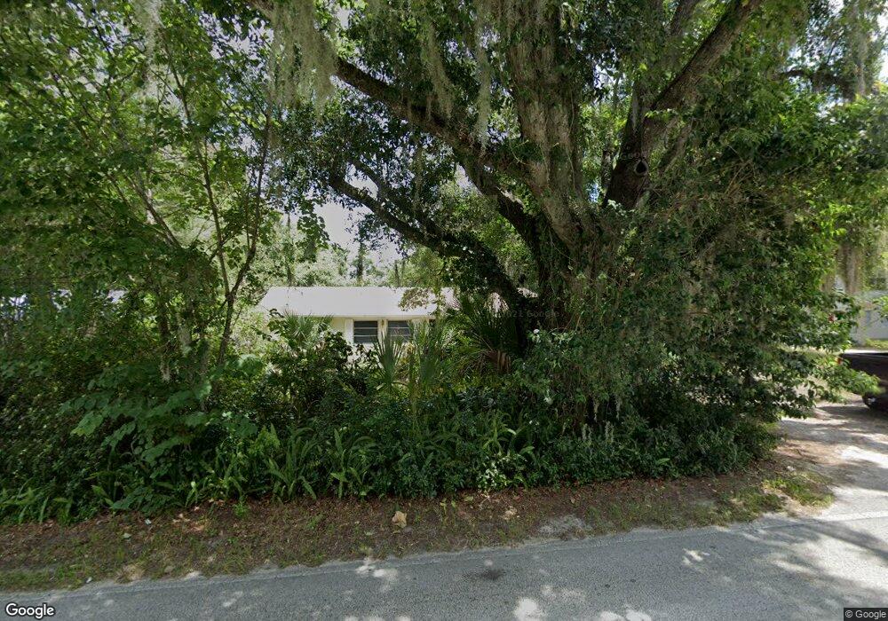
1145 W Euclid Ave Deland, FL 32720
West DeLand NeighborhoodEstimated Value: $298,000 - $362,092
4
Beds
3
Baths
2,452
Sq Ft
$139/Sq Ft
Est. Value
About This Home
This home is located at 1145 W Euclid Ave, Deland, FL 32720 and is currently estimated at $339,773, approximately $138 per square foot. 1145 W Euclid Ave is a home located in Volusia County with nearby schools including Woodward Avenue Elementary School, Deland High School, and Southwestern Middle School.
Ownership History
Date
Name
Owned For
Owner Type
Purchase Details
Closed on
Jun 17, 2002
Sold by
Bush Martha A
Bought by
Fleck Catherine A and Goodwin Gregory A
Current Estimated Value
Home Financials for this Owner
Home Financials are based on the most recent Mortgage that was taken out on this home.
Original Mortgage
$96,600
Outstanding Balance
$40,440
Interest Rate
6.67%
Mortgage Type
Purchase Money Mortgage
Estimated Equity
$299,333
Purchase Details
Closed on
Aug 15, 1979
Bought by
Goodwin Catherine Fleck
Purchase Details
Closed on
Sep 15, 1975
Bought by
Goodwin Catherine Fleck
Create a Home Valuation Report for This Property
The Home Valuation Report is an in-depth analysis detailing your home's value as well as a comparison with similar homes in the area
Home Values in the Area
Average Home Value in this Area
Purchase History
| Date | Buyer | Sale Price | Title Company |
|---|---|---|---|
| Fleck Catherine A | $99,900 | -- | |
| Goodwin Catherine Fleck | $27,500 | -- | |
| Goodwin Catherine Fleck | $5,000 | -- |
Source: Public Records
Mortgage History
| Date | Status | Borrower | Loan Amount |
|---|---|---|---|
| Open | Fleck Catherine A | $96,600 |
Source: Public Records
Tax History Compared to Growth
Tax History
| Year | Tax Paid | Tax Assessment Tax Assessment Total Assessment is a certain percentage of the fair market value that is determined by local assessors to be the total taxable value of land and additions on the property. | Land | Improvement |
|---|---|---|---|---|
| 2025 | $1,599 | $118,898 | -- | -- |
| 2024 | $1,599 | $115,548 | -- | -- |
| 2023 | $1,599 | $112,183 | $0 | $0 |
| 2022 | $1,545 | $108,916 | $0 | $0 |
| 2021 | $1,578 | $105,744 | $0 | $0 |
| 2020 | $1,548 | $104,284 | $0 | $0 |
| 2019 | $1,576 | $101,939 | $0 | $0 |
| 2018 | $1,553 | $100,038 | $0 | $0 |
| 2017 | $1,528 | $97,980 | $0 | $0 |
| 2016 | $1,450 | $95,965 | $0 | $0 |
| 2015 | $1,474 | $95,298 | $0 | $0 |
| 2014 | $1,459 | $94,542 | $0 | $0 |
Source: Public Records
Map
Nearby Homes
- 1141 W Euclid Ave
- 541 Rhodes Dr
- 1314 Talton Ave
- 1415 Talton Ave
- 780 Helen Ave
- 131 S Sheridan Ave
- 243 S Hull Ave
- 817 W Euclid Ave
- 320 S Woodward Ave
- 0 N Spring Garden Ave Unit MFRO6340602
- 0 N Spring Garden Ave Unit 1112700
- 0 N Spring Garden Ave Unit V4920996
- 128 S Montgomery Ave
- 800 W Hubbard Ave
- 536 W Hubbard Ave
- W SR 44, New York Ave W
- 816 W Franklin Ave
- 0 W Beresford Ave Unit MFRO6313334
- 0 W Beresford Ave Unit MFRV4940784
- 915 S Spring Garden Ave
- 1151 W Euclid Ave
- 1050 Dutton Ave
- 1040 Dutton Ave
- 1138 W Euclid Ave
- 1052 Dutton Ave
- 1148 W Euclid Ave
- 1032 Dutton Ave
- 1119 W Euclid Ave
- 1150 W Euclid Ave
- 1117 W Euclid Ave
- 1183 W Euclid Ave
- 1047 Dutton Ave
- 1037 Dutton Ave
- 1049 Dutton Ave
- 415 Westwood Ave
- 1022 Dutton Ave
- 1051 Dutton Ave
- 1115 W Euclid Ave
- 409 Westwood Ave
- 1024 Dutton Ave