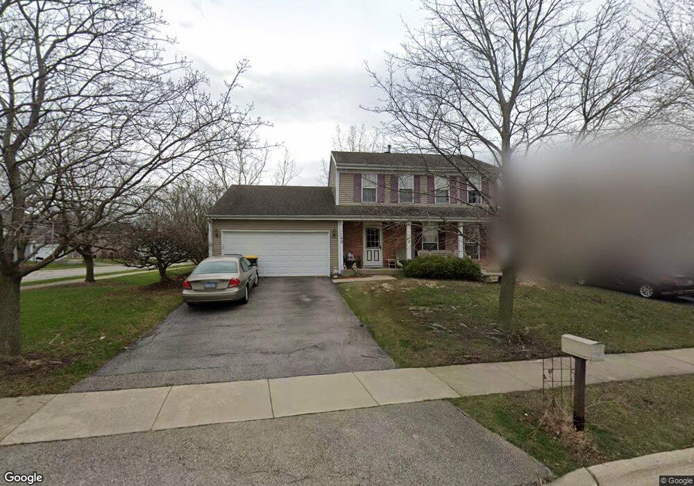
1146 Brookstone Dr Carol Stream, IL 60188
Estimated Value: $447,897 - $466,000
3
Beds
3
Baths
1,676
Sq Ft
$271/Sq Ft
Est. Value
About This Home
This home is located at 1146 Brookstone Dr, Carol Stream, IL 60188 and is currently estimated at $454,724, approximately $271 per square foot. 1146 Brookstone Dr is a home located in DuPage County with nearby schools including Field Kindergarten Center, Jordan Elementary School, and Heritage Lakes Elementary School.
Ownership History
Date
Name
Owned For
Owner Type
Purchase Details
Closed on
Apr 14, 2003
Sold by
Yurkiv Michael R and Yurkiv Pamela J
Bought by
Yurkiv Michael R and Yurkiv Pamela J
Current Estimated Value
Home Financials for this Owner
Home Financials are based on the most recent Mortgage that was taken out on this home.
Original Mortgage
$205,300
Outstanding Balance
$85,276
Interest Rate
5.3%
Mortgage Type
Purchase Money Mortgage
Estimated Equity
$369,448
Purchase Details
Closed on
Oct 6, 2001
Sold by
Rateno A Ronald and Rateno Deborah C
Bought by
Yurkiv Michael R and Yurkiv Pamela J
Home Financials for this Owner
Home Financials are based on the most recent Mortgage that was taken out on this home.
Original Mortgage
$204,000
Interest Rate
6.88%
Create a Home Valuation Report for This Property
The Home Valuation Report is an in-depth analysis detailing your home's value as well as a comparison with similar homes in the area
Home Values in the Area
Average Home Value in this Area
Purchase History
| Date | Buyer | Sale Price | Title Company |
|---|---|---|---|
| Yurkiv Michael R | -- | -- | |
| Yurkiv Michael R | $255,000 | -- |
Source: Public Records
Mortgage History
| Date | Status | Borrower | Loan Amount |
|---|---|---|---|
| Open | Yurkiv Michael R | $205,300 | |
| Closed | Yurkiv Michael R | $204,000 | |
| Closed | Yurkiv Michael R | $38,250 |
Source: Public Records
Tax History Compared to Growth
Tax History
| Year | Tax Paid | Tax Assessment Tax Assessment Total Assessment is a certain percentage of the fair market value that is determined by local assessors to be the total taxable value of land and additions on the property. | Land | Improvement |
|---|---|---|---|---|
| 2024 | $10,695 | $132,705 | $35,469 | $97,236 |
| 2023 | $10,047 | $120,400 | $32,180 | $88,220 |
| 2022 | $9,771 | $111,900 | $29,910 | $81,990 |
| 2021 | $9,311 | $106,220 | $28,390 | $77,830 |
| 2020 | $9,111 | $103,040 | $27,540 | $75,500 |
| 2019 | $8,777 | $99,370 | $26,560 | $72,810 |
| 2018 | $8,261 | $95,090 | $25,420 | $69,670 |
| 2017 | $8,580 | $96,330 | $24,410 | $71,920 |
| 2016 | $8,424 | $92,020 | $23,320 | $68,700 |
| 2015 | $8,362 | $87,100 | $22,070 | $65,030 |
| 2014 | $8,273 | $84,890 | $21,510 | $63,380 |
| 2013 | $8,223 | $86,920 | $22,020 | $64,900 |
Source: Public Records
Map
Nearby Homes
- 1304 Yorkshire Ln
- 848 Birchbark Trail
- 716 Sand Creek Dr
- 1297 Woodlake Dr Unit 1
- 911 Hampton Dr
- 1065 Brighton Dr
- 1329 Gloucester Cir
- 1080 Ridgefield Cir
- 808 Trinity Ct
- 1340 Nantucket Ct
- 1333 Petersburg Ct
- 654 Tacoma Dr
- 1410 Georgetown Dr
- 1318 Antigo Trail
- 526 Alton Ct
- 515 Dakota Ct
- 27W270 Jefferson St
- 641 Kingsbridge Dr
- 607 Kingsbridge Dr
- 445 Cromwell Cir Unit 3
- 1154 Brookstone Dr
- 924 Rocky Valley Way
- 1160 Brookstone Dr
- 929 Rocky Valley Way
- 933 Rocky Valley Way
- 916 Rocky Valley Way
- 925 Rocky Valley Way
- 1164 Brookstone Dr
- 912 Rocky Valley Way
- 923 Rocky Valley Way
- 910 Rocky Valley Way
- 1170 Brookstone Dr
- 928 High Ridge Pass
- 921 Rocky Valley Way
- 934 High Ridge Pass
- 922 High Ridge Pass
- 1165 Brookstone Dr
- 917 Rocky Valley Way
- 918 High Ridge Pass
- 915 Rocky Valley Way