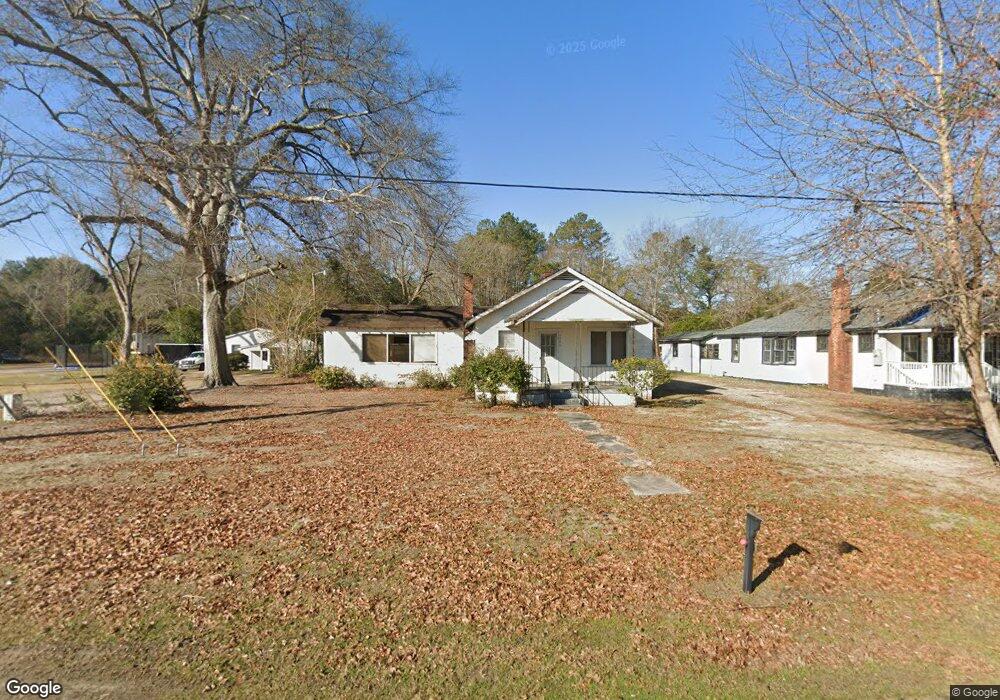
1146 Manning Rd Sumter, SC 29150
South Sumter NeighborhoodEstimated Value: $61,725 - $91,000
--
Bed
--
Bath
1,478
Sq Ft
$50/Sq Ft
Est. Value
About This Home
This home is located at 1146 Manning Rd, Sumter, SC 29150 and is currently estimated at $73,931, approximately $50 per square foot. 1146 Manning Rd is a home located in Sumter County with nearby schools including Wilder Elementary School, Bates Middle School, and Sumter High School.
Ownership History
Date
Name
Owned For
Owner Type
Purchase Details
Closed on
Mar 30, 2020
Sold by
Surfside Boys Llc
Bought by
Enterprise Properties Ii Llc
Current Estimated Value
Purchase Details
Closed on
Aug 16, 2017
Sold by
C B S Properties L L C
Bought by
Surfside Boys L L C
Purchase Details
Closed on
Sep 21, 2007
Sold by
Lee James A
Bought by
Cbs Properties Llc
Purchase Details
Closed on
Aug 22, 2003
Sold by
Pack Ronnie C
Bought by
Lee James A
Create a Home Valuation Report for This Property
The Home Valuation Report is an in-depth analysis detailing your home's value as well as a comparison with similar homes in the area
Home Values in the Area
Average Home Value in this Area
Purchase History
| Date | Buyer | Sale Price | Title Company |
|---|---|---|---|
| Enterprise Properties Ii Llc | $40,000 | None Available | |
| Surfside Boys L L C | -- | None Available | |
| Cbs Properties Llc | $85,000 | None Available | |
| Lee James A | -- | -- |
Source: Public Records
Tax History Compared to Growth
Tax History
| Year | Tax Paid | Tax Assessment Tax Assessment Total Assessment is a certain percentage of the fair market value that is determined by local assessors to be the total taxable value of land and additions on the property. | Land | Improvement |
|---|---|---|---|---|
| 2025 | $985 | $2,200 | $460 | $1,740 |
| 2024 | $985 | $2,200 | $460 | $1,740 |
| 2023 | $810 | $2,200 | $460 | $1,740 |
| 2022 | $804 | $2,200 | $460 | $1,740 |
| 2021 | $765 | $2,200 | $460 | $1,740 |
| 2020 | $765 | $2,040 | $460 | $1,580 |
| 2019 | $756 | $2,040 | $460 | $1,580 |
| 2018 | $754 | $2,040 | $460 | $1,580 |
| 2017 | $764 | $2,080 | $460 | $1,620 |
| 2016 | $762 | $2,080 | $460 | $1,620 |
| 2015 | $820 | $2,330 | $650 | $1,680 |
| 2014 | $820 | $2,330 | $650 | $1,680 |
| 2013 | -- | $2,330 | $650 | $1,680 |
Source: Public Records
Map
Nearby Homes
- 1234 Ivey St
- 1130 Gilbert St
- 110 Webb Ave
- 1116 Pocalla Rd
- 201 Webb Ave
- 220 Alexander Place
- 230 Alexander Place
- 924 S Main St
- 501 Knightbridge Rd
- 528 Kingsbury Dr
- 1051 Decatur St
- 13 Harrison St
- 974 Meadowbrook Rd
- 706 Nelson St
- 255 Tullah Dr
- 118 & 116 Hoyt St
- 206 Memorial Ave Unit 147
- 725 S Sumter St
- 956 Meadowbrook Rd
- Marley Ct
- 1144 Manning Rd
- 1142 Manning Rd
- 1148 Manning Rd
- 1143 Manning Rd
- 1149 Manning Rd
- 1141 Manning Rd
- 1136 Manning Rd
- 1201 Manning Rd
- 1208 Manning Rd
- 9 Vernon Dr
- 1203 Manning Rd
- 1137 Manning Rd
- 8 Dollard Dr
- 1132 Manning Rd
- 1210 Manning Rd
- 10 Vernon Dr
- 1133 Manning Rd
- 1133 Manning Rd
- 12 Dollard Dr
- 13 Vernon Dr