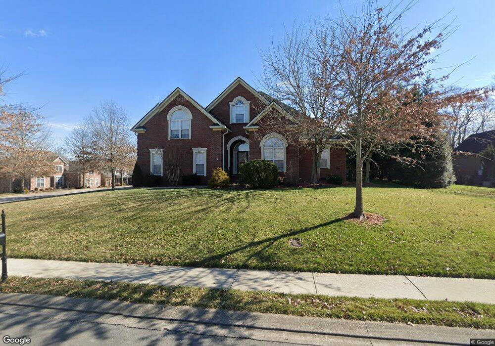
1146 Olmstead Dr Murfreesboro, TN 37128
Estimated Value: $616,960 - $682,000
Studio
4
Baths
3,233
Sq Ft
$203/Sq Ft
Est. Value
About This Home
This home is located at 1146 Olmstead Dr, Murfreesboro, TN 37128 and is currently estimated at $657,240, approximately $203 per square foot. 1146 Olmstead Dr is a home located in Rutherford County with nearby schools including Blackman Elementary School, Overall Creek Elementary School, and Blackman Middle School.
Ownership History
Date
Name
Owned For
Owner Type
Purchase Details
Closed on
Apr 16, 2010
Sold by
U S Bank Na
Bought by
Dobbs Jimmy R
Current Estimated Value
Home Financials for this Owner
Home Financials are based on the most recent Mortgage that was taken out on this home.
Original Mortgage
$261,000
Interest Rate
4.94%
Mortgage Type
Purchase Money Mortgage
Purchase Details
Closed on
Oct 29, 2009
Sold by
Hemphill Kevin
Bought by
U S Bank Na
Purchase Details
Closed on
Jul 7, 2004
Sold by
Superior Built Homes Llc
Bought by
Hemphill Kevin L and Hemphill Crylia L
Home Financials for this Owner
Home Financials are based on the most recent Mortgage that was taken out on this home.
Original Mortgage
$247,200
Interest Rate
5%
Create a Home Valuation Report for This Property
The Home Valuation Report is an in-depth analysis detailing your home's value as well as a comparison with similar homes in the area
Home Values in the Area
Average Home Value in this Area
Purchase History
| Date | Buyer | Sale Price | Title Company |
|---|---|---|---|
| Dobbs Jimmy R | $290,000 | -- | |
| U S Bank Na | $299,880 | -- | |
| Hemphill Kevin L | $309,900 | -- |
Source: Public Records
Mortgage History
| Date | Status | Borrower | Loan Amount |
|---|---|---|---|
| Closed | Hemphill Kevin L | $261,000 | |
| Previous Owner | Hemphill Kevin L | $247,200 |
Source: Public Records
Tax History
| Year | Tax Paid | Tax Assessment Tax Assessment Total Assessment is a certain percentage of the fair market value that is determined by local assessors to be the total taxable value of land and additions on the property. | Land | Improvement |
|---|---|---|---|---|
| 2025 | $1,283 | $132,250 | $16,875 | $115,375 |
| 2024 | $3,741 | $132,250 | $16,875 | $115,375 |
| 2023 | $2,481 | $132,250 | $16,875 | $115,375 |
| 2022 | $2,137 | $132,250 | $16,875 | $115,375 |
| 2021 | $2,198 | $99,025 | $16,875 | $82,150 |
| 2020 | $2,198 | $99,025 | $16,875 | $82,150 |
| 2019 | $2,198 | $99,025 | $16,875 | $82,150 |
| 2018 | $3,019 | $99,025 | $0 | $0 |
| 2017 | $3,267 | $84,050 | $0 | $0 |
| 2016 | $3,267 | $84,050 | $0 | $0 |
| 2015 | $3,267 | $84,050 | $0 | $0 |
| 2014 | $2,090 | $84,050 | $0 | $0 |
| 2013 | -- | $83,925 | $0 | $0 |
Source: Public Records
Map
Nearby Homes
- 1329 Balson Dr
- 1359 Middlebury Ct
- 5159 Starnes Dr
- 5726 Colchester Ct
- 1212 Stockwell Dr
- 1214 Timber Creek Dr
- 5037 Saint Ives Dr
- 5014 Saint Ives Dr
- 1311 Heather Place
- 1221 Avery Dr
- 1410 Dublin Ct
- 5923 Enclave Dr
- 5751 Enclave Dr
- 1413 Burrows Ave
- 5350 Tony Lama Ln
- 5810 Enclave Dr
- 5311 Tony Lama Ln
- 427 Creekview Dr
- 5326 Dan Post Way
- 5304 Dan Post Way
- 1140 Olmstead Dr
- 5350 Cavendish Dr
- 1147 Olmstead Dr
- 5343 Cavendish Dr
- 5346 Cavendish Dr
- 1141 Olmstead Dr
- 5344 Sherrington Rd
- 1134 Olmstead Dr
- 5408 Cavendish Dr
- 5342 Cavendish Dr
- 5339 Cavendish Dr
- 5340 Sherrington Rd
- 5409 Cavendish Dr
- 1135 Olmstead Dr
- 5338 Cavendish Dr
- 5412 Cavendish Dr
- 5353 Saint Ives Dr
- 5349 Saint Ives Dr
- 5335 Cavendish Dr
- 5336 Sherrington Rd
Your Personal Tour Guide
Ask me questions while you tour the home.