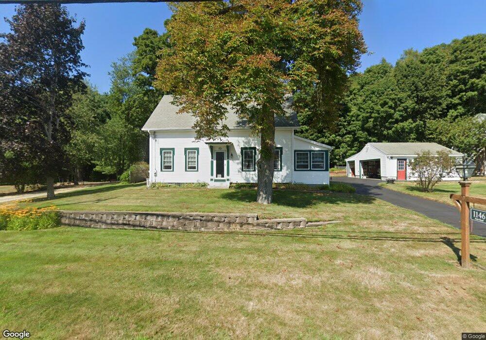
1146 State Rd Eliot, ME 03903
South Eliot NeighborhoodEstimated Value: $541,386 - $665,000
4
Beds
2
Baths
1,822
Sq Ft
$320/Sq Ft
Est. Value
About This Home
This home is located at 1146 State Rd, Eliot, ME 03903 and is currently estimated at $583,347, approximately $320 per square foot. 1146 State Rd is a home located in York County with nearby schools including Marshwood High School and Seacoast Waldorf School.
Create a Home Valuation Report for This Property
The Home Valuation Report is an in-depth analysis detailing your home's value as well as a comparison with similar homes in the area
Home Values in the Area
Average Home Value in this Area
Tax History Compared to Growth
Tax History
| Year | Tax Paid | Tax Assessment Tax Assessment Total Assessment is a certain percentage of the fair market value that is determined by local assessors to be the total taxable value of land and additions on the property. | Land | Improvement |
|---|---|---|---|---|
| 2024 | $4,433 | $374,100 | $137,300 | $236,800 |
| 2023 | $4,400 | $359,200 | $130,500 | $228,700 |
| 2022 | $4,346 | $359,200 | $130,500 | $228,700 |
| 2021 | $3,945 | $321,700 | $99,300 | $222,400 |
| 2020 | $4,185 | $315,400 | $94,500 | $220,900 |
| 2019 | $4,636 | $315,400 | $94,500 | $220,900 |
| 2018 | $0 | $315,400 | $94,500 | $220,900 |
| 2017 | $4,510 | $315,400 | $94,500 | $220,900 |
| 2016 | $0 | $315,400 | $94,500 | $220,900 |
| 2015 | $4,416 | $315,400 | $94,500 | $220,900 |
| 2014 | $4,376 | $317,100 | $94,500 | $222,600 |
| 2013 | $4,176 | $317,100 | $94,500 | $222,600 |
Source: Public Records
Map
Nearby Homes
- 850 Main St
- 8 Caslyn Dr
- 956 Main St
- 18 Shipping Ln
- 35 Leach Rd
- 493 Main St
- 0 Franks Fort Island Unit 1631886
- 7 Fernald Rd
- 5 Spinney Way Unit 9
- 46 Littlebrook Ln
- 124 Spinnaker Way
- 3 Shearwater Dr Unit 1900
- 19 Shearwater Dr Unit 1903
- 15 Shearwater Dr Unit 1902
- 37 Shearwater Dr Unit 1906
- 201 Kearsarge Way
- 25 Oak Terrace
- 27 Oak Terrace
- 25 Mangrove St
- 197 State Rd