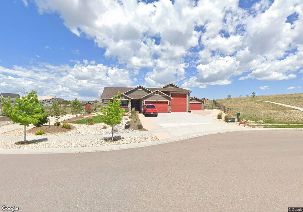
11462 Pyramid Peak Dr Peyton, CO 80831
Falcon NeighborhoodEstimated Value: $848,000 - $921,000
4
Beds
4
Baths
1,970
Sq Ft
$452/Sq Ft
Est. Value
About This Home
This home is located at 11462 Pyramid Peak Dr, Peyton, CO 80831 and is currently estimated at $890,472, approximately $452 per square foot. 11462 Pyramid Peak Dr is a home with nearby schools including Meridian Ranch International School, Falcon Middle School, and Falcon High School.
Ownership History
Date
Name
Owned For
Owner Type
Purchase Details
Closed on
Dec 18, 2017
Sold by
Campbell Homes Llc
Bought by
Watts Erik S and Watts Priscilla A
Current Estimated Value
Home Financials for this Owner
Home Financials are based on the most recent Mortgage that was taken out on this home.
Original Mortgage
$554,027
Outstanding Balance
$466,442
Interest Rate
3.94%
Mortgage Type
New Conventional
Estimated Equity
$424,030
Purchase Details
Closed on
Jul 10, 2017
Sold by
Gtl Inc
Bought by
Campbell Homes Llc
Create a Home Valuation Report for This Property
The Home Valuation Report is an in-depth analysis detailing your home's value as well as a comparison with similar homes in the area
Home Values in the Area
Average Home Value in this Area
Purchase History
| Date | Buyer | Sale Price | Title Company |
|---|---|---|---|
| Watts Erik S | $615,600 | Unified Title Company | |
| Campbell Homes Llc | $130,000 | Heritage Title Co |
Source: Public Records
Mortgage History
| Date | Status | Borrower | Loan Amount |
|---|---|---|---|
| Open | Watts Erik S | $554,027 |
Source: Public Records
Tax History Compared to Growth
Tax History
| Year | Tax Paid | Tax Assessment Tax Assessment Total Assessment is a certain percentage of the fair market value that is determined by local assessors to be the total taxable value of land and additions on the property. | Land | Improvement |
|---|---|---|---|---|
| 2025 | $5,666 | $57,340 | -- | -- |
| 2024 | $5,521 | $58,850 | $12,180 | $46,670 |
| 2022 | $4,303 | $42,640 | $10,630 | $32,010 |
| 2021 | $4,461 | $43,870 | $10,940 | $32,930 |
| 2020 | $4,694 | $42,800 | $9,910 | $32,890 |
| 2019 | $4,667 | $42,800 | $9,910 | $32,890 |
| 2018 | $4,744 | $43,060 | $11,340 | $31,720 |
| 2017 | $1,655 | $43,060 | $11,340 | $31,720 |
| 2016 | $133 | $1,310 | $1,310 | $0 |
Source: Public Records
Map
Nearby Homes
- 11133 Lobo Peak Dr
- 11504 Blackcomb Trail
- 11134 Lobo Peak Dr
- 12695 Black Hills Dr
- 12150 Fox Brush Dr
- 12190 Smoke Bluffs Rd
- 12071 Smokes Bluffs Rd
- 12692 Clark Peak Ct
- 12804 Clark Peak Ct
- The Peak Plan at Latigo
- The Brooklyn Plan at Latigo
- The Grand Royal Plan at Latigo
- 12708 Sunrise Ridge Dr
- 12010 S Conestoga Trail
- 12020 S Conestoga Trail
- 12756 Sunrise Ridge Dr
- 11824 Black Hills Dr
- 10965 Long Summer Ct
- 12780 Sunrise Ridge Dr
- 13027 Sunrise Ridge Dr
- 11436 Pyramid Peak Dr
- 11471 Lobo Peak Dr
- 11410 Pyramid Peak Dr
- 11409 Pyramid Peak Dr
- 11445 Lobo Peak Dr
- 11487 Pyramid Peak Dr
- 11419 Lobo Peak Dr
- 11435 Pyramid Peak Dr
- 11461 Pyramid Peak Dr
- 11383 Pyramid Peak Dr
- 11384 Pyramid Peak Dr
- 11393 Lobo Peak Dr
- 11505 Blackcomb Trail
- 11498 Lobo Peak Dr
- 11358 Pyramid Peak Dr
- 11367 Lobo Peak Dr
- 11159 Lobo Peak Dr
- 11185 Lobo Peak Dr
- 11420 Lobo Peak Dr
- 11341 Lobo Peak Dr