Estimated Value: $209,000 - $240,000
3
Beds
3
Baths
2,360
Sq Ft
$96/Sq Ft
Est. Value
About This Home
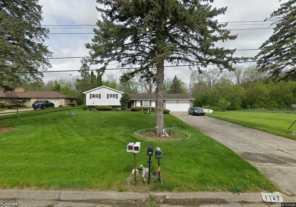
This home is located at 1147 Carter Dr, Flint, MI 48532 and is currently estimated at $225,562, approximately $95 per square foot. 1147 Carter Dr is a home located in Genesee County with nearby schools including Carman-Ainsworth High School, Genesee STEM Academy, and St. Paul Lutheran School.
Ownership History
Date
Name
Owned For
Owner Type
Purchase Details
Closed on
Aug 16, 2007
Sold by
Powell Andre and Powell Maria A
Bought by
Thompson Deborah
Current Estimated Value
Purchase Details
Closed on
Sep 19, 2002
Sold by
Green Gordon R and Green Joanna F
Bought by
Kindall John and Kindall Alberta
Create a Home Valuation Report for This Property
The Home Valuation Report is an in-depth analysis detailing your home's value as well as a comparison with similar homes in the area
Home Values in the Area
Average Home Value in this Area
Purchase History
| Date | Buyer | Sale Price | Title Company |
|---|---|---|---|
| Thompson Deborah | $165,000 | Sargents Title Company | |
| Kindall John | $72,000 | Sargents Title Company | |
| Powell Andre | $155,700 | Sargents Title Company |
Source: Public Records
Tax History
| Year | Tax Paid | Tax Assessment Tax Assessment Total Assessment is a certain percentage of the fair market value that is determined by local assessors to be the total taxable value of land and additions on the property. | Land | Improvement |
|---|---|---|---|---|
| 2025 | $2,009 | $102,700 | $0 | $0 |
| 2024 | $1,034 | $98,800 | $0 | $0 |
| 2023 | $986 | $81,200 | $0 | $0 |
| 2022 | $877 | $65,000 | $0 | $0 |
| 2021 | $1,769 | $58,400 | $0 | $0 |
| 2020 | $886 | $52,700 | $0 | $0 |
| 2019 | $873 | $44,700 | $0 | $0 |
| 2018 | $1,653 | $41,400 | $0 | $0 |
| 2017 | $1,592 | $41,400 | $0 | $0 |
| 2016 | $1,632 | $38,400 | $0 | $0 |
| 2015 | $1,467 | $38,400 | $0 | $0 |
| 2014 | $870 | $36,800 | $0 | $0 |
| 2012 | -- | $39,600 | $39,600 | $0 |
Source: Public Records
Map
Nearby Homes
- 4075 Townview Dr
- 4022 Beecher Rd
- Graham Rd N Graham Rd
- 1368 Autumn Dr
- 1095 Devenish Ln
- 000 Devenish Ln
- 3528 Beecher Rd
- 1137 S Graham Rd
- 1090 Cabot Dr
- 1034 Normandy Terrace Dr
- 1396 Westerrace Dr
- 2174 Mill Rd
- 3360 Beecher Rd
- 3350 Beecher Rd
- 2 Charter Dr
- 4199 Sheraton Dr
- 3522 Ridgecliffe Dr
- 5021 Forest Side Dr
- 3493 Ridgecliffe Dr
- 3309 Beecher Rd
Your Personal Tour Guide
Ask me questions while you tour the home.