Estimated Value: $235,463 - $512,000
3
Beds
2
Baths
2,380
Sq Ft
$150/Sq Ft
Est. Value
About This Home
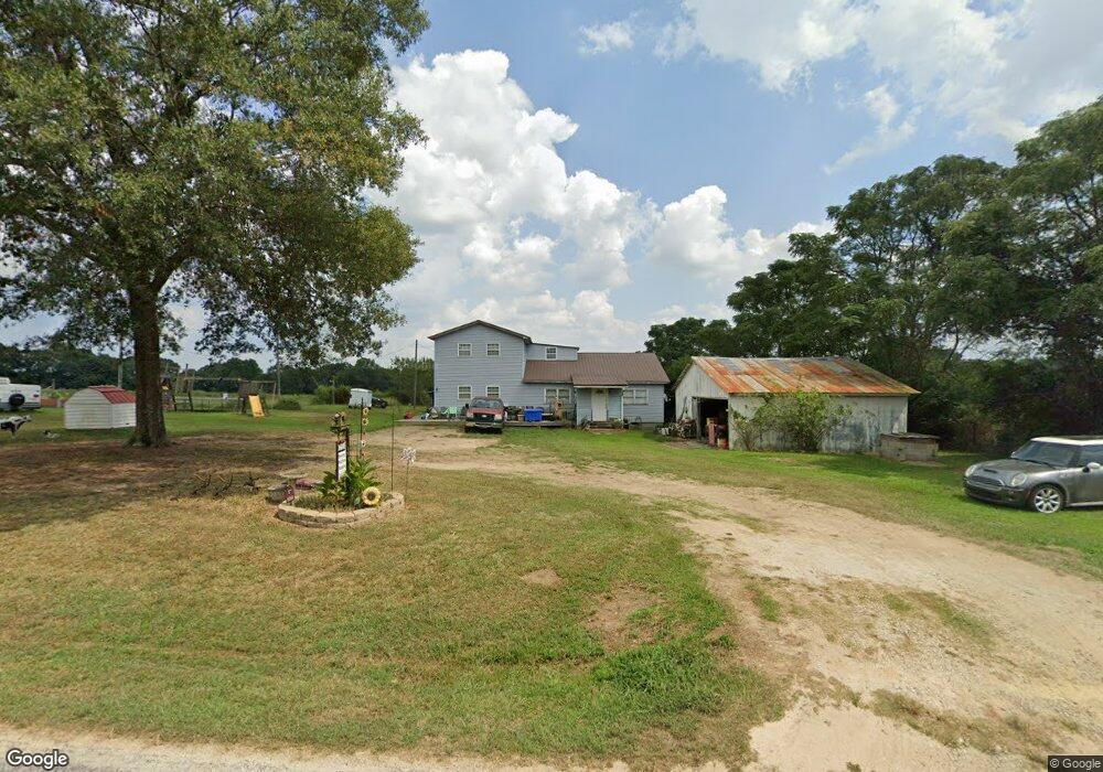
This home is located at 1147 Farm Rd, Canon, GA 30520 and is currently estimated at $358,116, approximately $150 per square foot. 1147 Farm Rd is a home located in Hart County with nearby schools including Hart County High School and Grace Ranch Academy.
Ownership History
Date
Name
Owned For
Owner Type
Purchase Details
Closed on
Aug 3, 2007
Sold by
Degrave Michael H
Bought by
Degrave Michael H and Degrave Kathy
Current Estimated Value
Purchase Details
Closed on
May 24, 2007
Sold by
Degrave Michael H
Bought by
Degrave Michael H
Home Financials for this Owner
Home Financials are based on the most recent Mortgage that was taken out on this home.
Original Mortgage
$90,000
Interest Rate
6.16%
Mortgage Type
New Conventional
Purchase Details
Closed on
May 1, 2000
Purchase Details
Closed on
Nov 1, 1988
Create a Home Valuation Report for This Property
The Home Valuation Report is an in-depth analysis detailing your home's value as well as a comparison with similar homes in the area
Home Values in the Area
Average Home Value in this Area
Purchase History
| Date | Buyer | Sale Price | Title Company |
|---|---|---|---|
| Degrave Michael H | -- | -- | |
| Degrave Michael H | -- | -- | |
| -- | -- | -- | |
| -- | -- | -- |
Source: Public Records
Mortgage History
| Date | Status | Borrower | Loan Amount |
|---|---|---|---|
| Previous Owner | Degrave Michael H | $90,000 |
Source: Public Records
Tax History Compared to Growth
Tax History
| Year | Tax Paid | Tax Assessment Tax Assessment Total Assessment is a certain percentage of the fair market value that is determined by local assessors to be the total taxable value of land and additions on the property. | Land | Improvement |
|---|---|---|---|---|
| 2024 | $888 | $59,428 | $10,175 | $49,253 |
| 2023 | $829 | $51,762 | $8,462 | $43,300 |
| 2022 | $731 | $45,925 | $7,461 | $38,464 |
| 2021 | $673 | $38,303 | $3,959 | $34,344 |
| 2020 | $676 | $36,911 | $3,854 | $33,057 |
| 2019 | $666 | $36,090 | $3,854 | $32,236 |
| 2018 | $702 | $37,496 | $3,854 | $33,642 |
| 2017 | $698 | $37,088 | $3,854 | $33,234 |
| 2016 | $705 | $36,378 | $2,684 | $33,694 |
| 2015 | $683 | $37,064 | $3,429 | $33,635 |
| 2014 | $647 | $34,569 | $2,085 | $32,484 |
| 2013 | -- | $35,676 | $2,084 | $33,591 |
Source: Public Records
Map
Nearby Homes
- 204 Detter Rd Unit 5 HOMES ON 3.26 ACRE
- 5041 Airline-Goldmine Rd
- 342 Phillips Cir
- 0 Rice Creek Rd Unit 10403913
- 00 Georgia 17
- 406 Abc Farm Rd
- 256 Adams Place Rd
- 134 College St
- LOT 6 Pine Valley Dr
- 157 Grizzle St
- 320 Pine Valley Dr
- 157 Hartwell St
- 331 College St Unit 331 & 333
- 190 Jordan St
- 651 Otis Skelton Rd
- 121 Cook St
- 641 Church St
- 0 Wildcat Bridge Rd Unit 23872265
- 0 Wildcat Bridge Rd Unit 10544672
- 464 Church St
- 1121 Farm Rd
- 1110 Farm Rd
- 1213 Farm Rd
- 1079 Farm Rd
- 1304 Farm Rd
- 1304 Farm Rd
- 1518 Farm Rd
- 940 Farm Rd
- 85 Stone Ln
- 573 Andrew Floyd Rd
- 721 Andrew Floyd Rd
- 1050 Farm Rd
- 417 Andrew Floyd Rd
- 0000 Farm Rd
- 313 Andrew Floyd Rd
- 235 Andrew Floyd Rd
- 0 Stone Ln
- 866 Andrew Floyd Rd
- 705 Farm Rd
- 1026 Tom Rice Rd