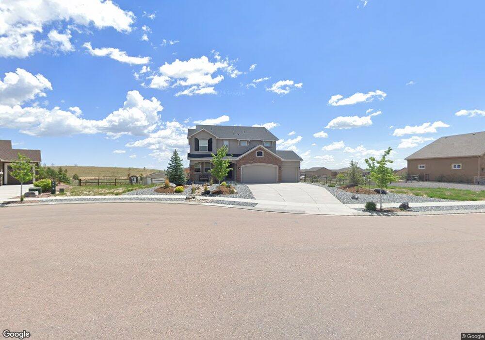
11471 Lobo Peak Dr Peyton, CO 80831
Falcon NeighborhoodEstimated Value: $820,000 - $906,000
6
Beds
4
Baths
3,132
Sq Ft
$276/Sq Ft
Est. Value
About This Home
This home is located at 11471 Lobo Peak Dr, Peyton, CO 80831 and is currently estimated at $865,321, approximately $276 per square foot. 11471 Lobo Peak Dr is a home with nearby schools including Meridian Ranch International School, Falcon Middle School, and Falcon High School.
Ownership History
Date
Name
Owned For
Owner Type
Purchase Details
Closed on
Jan 13, 2017
Sold by
Elite Properties Of America Inc
Bought by
Olson Eric M and Olson Hailey M
Current Estimated Value
Home Financials for this Owner
Home Financials are based on the most recent Mortgage that was taken out on this home.
Original Mortgage
$424,100
Outstanding Balance
$349,097
Interest Rate
4.08%
Mortgage Type
New Conventional
Estimated Equity
$516,224
Purchase Details
Closed on
Aug 2, 2016
Sold by
Gtl Inc
Bought by
Elite Properties Of America Inc
Create a Home Valuation Report for This Property
The Home Valuation Report is an in-depth analysis detailing your home's value as well as a comparison with similar homes in the area
Home Values in the Area
Average Home Value in this Area
Purchase History
| Date | Buyer | Sale Price | Title Company |
|---|---|---|---|
| Olson Eric M | $478,174 | Capstone Title | |
| Elite Properties Of America Inc | $122,314 | Heritage Title Co |
Source: Public Records
Mortgage History
| Date | Status | Borrower | Loan Amount |
|---|---|---|---|
| Open | Olson Eric M | $424,100 |
Source: Public Records
Tax History Compared to Growth
Tax History
| Year | Tax Paid | Tax Assessment Tax Assessment Total Assessment is a certain percentage of the fair market value that is determined by local assessors to be the total taxable value of land and additions on the property. | Land | Improvement |
|---|---|---|---|---|
| 2025 | $5,750 | $58,250 | -- | -- |
| 2024 | $5,604 | $59,660 | $12,180 | $47,480 |
| 2022 | $4,082 | $40,450 | $10,630 | $29,820 |
| 2021 | $4,232 | $41,620 | $10,940 | $30,680 |
| 2020 | $4,357 | $39,730 | $9,090 | $30,640 |
| 2019 | $4,332 | $39,730 | $9,090 | $30,640 |
| 2018 | $3,681 | $33,410 | $7,560 | $25,850 |
| 2017 | $3,481 | $33,410 | $7,560 | $25,850 |
| 2016 | $1,898 | $18,650 | $18,650 | $0 |
| 2015 | $1,899 | $18,650 | $18,650 | $0 |
| 2014 | $1,674 | $16,240 | $16,240 | $0 |
Source: Public Records
Map
Nearby Homes
- 11504 Blackcomb Trail
- 11133 Lobo Peak Dr
- 12150 Fox Brush Dr
- 11134 Lobo Peak Dr
- 12071 Smokes Bluffs Rd
- 12695 Black Hills Dr
- 12190 Smoke Bluffs Rd
- 11824 Black Hills Dr
- 12692 Clark Peak Ct
- 11825 Black Hills Dr
- 12804 Clark Peak Ct
- 12708 Sunrise Ridge Dr
- 12714 Sunrise Ridge Dr
- 10965 Long Summer Ct
- The Peak Plan at Latigo
- The Brooklyn Plan at Latigo
- The Grand Royal Plan at Latigo
- 12756 Sunrise Ridge Dr
- 10932 Huron Peak Place
- 10973 Torreys Peak Way
- 11445 Lobo Peak Dr
- 11436 Pyramid Peak Dr
- 11419 Lobo Peak Dr
- 11462 Pyramid Peak Dr
- 11410 Pyramid Peak Dr
- 11498 Lobo Peak Dr
- 11393 Lobo Peak Dr
- 11384 Pyramid Peak Dr
- 11420 Lobo Peak Dr
- 11409 Pyramid Peak Dr
- 12230 Fox Brush Dr
- 11367 Lobo Peak Dr
- 11383 Pyramid Peak Dr
- 11394 Lobo Peak Dr
- 11487 Pyramid Peak Dr
- 11358 Pyramid Peak Dr
- 12210 Fox Brush Dr
- 11435 Pyramid Peak Dr
- 11341 Lobo Peak Dr
- 11383 Mount Gateway Dr