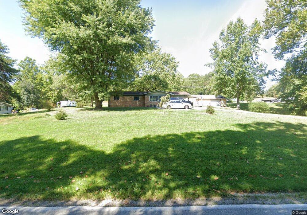
11476 N State Road 135 Freetown, IN 47235
Estimated Value: $180,159
3
Beds
2
Baths
1,440
Sq Ft
$125/Sq Ft
Est. Value
About This Home
This home is located at 11476 N State Road 135, Freetown, IN 47235 and is currently estimated at $180,159, approximately $125 per square foot. 11476 N State Road 135 is a home located in Jackson County with nearby schools including Brownstown Elementary School, Brownstown Central Middle School, and Brownstown Central High School.
Ownership History
Date
Name
Owned For
Owner Type
Purchase Details
Closed on
Apr 15, 2020
Sold by
Aynes Robert and Aynes Alberta R
Bought by
Cloe John E and Cloe Beverly
Current Estimated Value
Home Financials for this Owner
Home Financials are based on the most recent Mortgage that was taken out on this home.
Original Mortgage
$86,000
Outstanding Balance
$76,041
Interest Rate
3.3%
Mortgage Type
New Conventional
Estimated Equity
$104,118
Purchase Details
Closed on
Apr 28, 2011
Sold by
Aynes Robert
Bought by
Aynes Robert and Aynes Alberta R
Purchase Details
Closed on
Jan 24, 2011
Sold by
Leonard Timothy D
Bought by
Aynes Robert
Create a Home Valuation Report for This Property
The Home Valuation Report is an in-depth analysis detailing your home's value as well as a comparison with similar homes in the area
Home Values in the Area
Average Home Value in this Area
Purchase History
| Date | Buyer | Sale Price | Title Company |
|---|---|---|---|
| Cloe John E | -- | None Available | |
| Aynes Robert | -- | None Available | |
| Aynes Robert | $36,000 | Markel Markel & Lambring | |
| Aynes Robert | $36,000 | None Available |
Source: Public Records
Mortgage History
| Date | Status | Borrower | Loan Amount |
|---|---|---|---|
| Open | Cloe John E | $86,000 |
Source: Public Records
Tax History Compared to Growth
Tax History
| Year | Tax Paid | Tax Assessment Tax Assessment Total Assessment is a certain percentage of the fair market value that is determined by local assessors to be the total taxable value of land and additions on the property. | Land | Improvement |
|---|---|---|---|---|
| 2024 | $19 | $1,100 | $1,100 | $0 |
| 2023 | $16 | $900 | $900 | $0 |
| 2022 | $769 | $700 | $700 | $0 |
| 2021 | $10 | $600 | $600 | $0 |
| 2020 | $1,514 | $87,300 | $13,700 | $73,600 |
| 2019 | $1,444 | $87,900 | $13,800 | $74,100 |
| 2018 | $1,422 | $88,900 | $13,800 | $75,100 |
| 2017 | $494 | $32,700 | $14,000 | $18,700 |
| 2016 | $503 | $32,700 | $14,000 | $18,700 |
| 2014 | $532 | $32,700 | $14,100 | $18,600 |
| 2013 | $532 | $32,100 | $14,500 | $17,600 |
Source: Public Records
Map
Nearby Homes
- 11000 N County Road 650 W
- 8650 Mount Nebo Rd
- 9601 Buffalo Pike
- 9649 N County Road 450 W
- 2000 Block W 1125 N
- 7594 W County Road 925 N
- 7693 S Bob Allen Rd
- 3000 W Block Co Rd 900 N
- 7275 Hamilton Creek Rd
- XXXX Keith Donaldson Rd
- 7932 S Mount Nebo Rd
- 00 Lutheran Lake Rd
- 6913 Poplar Grove Rd
- 6985 Poplar Grove Rd
- 6000 W County Road 700 N
- 6100 W County Road 700 N
- 5000 W County Road 700 N
- 6947 Poplar Grove Rd
- 14000 W Lake Rd
- 6725 W County Road 700 N
- 11432 N State Road 135
- 11476 Indiana 135
- 11428 N State Road 135
- 11568 N State Road 135
- 11682 Indiana 135
- 11682 N State Road 135
- 5892 W County Road 1100 N
- 11736 Indiana 135
- 11764 N State Road 135
- 11910 N State Road 135
- 5449 W County Road 1190 N
- 5941 1100 N
- 11764 Indiana 135
- 11813 N State Road 135
- 5992 W County Road 1100 N
- 11821 N State Road 135
- 11000 N State Road 135
- 11972 N State Road 135
- 6020 W County Road 1100 N