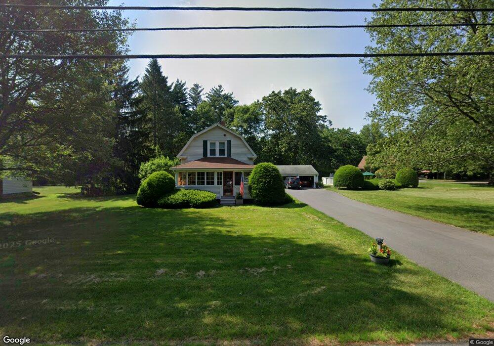
1148 Bernardston Rd Greenfield, MA 01301
Estimated Value: $369,312 - $483,000
3
Beds
2
Baths
1,924
Sq Ft
$218/Sq Ft
Est. Value
About This Home
This home is located at 1148 Bernardston Rd, Greenfield, MA 01301 and is currently estimated at $419,828, approximately $218 per square foot. 1148 Bernardston Rd is a home located in Franklin County with nearby schools including Greenfield Center School, Cornerstone Christian School, and Stoneleigh-Burnham School.
Ownership History
Date
Name
Owned For
Owner Type
Purchase Details
Closed on
May 10, 2000
Sold by
Borkowski Eugene J
Bought by
Dow Barry L and Allen Patricia M
Current Estimated Value
Create a Home Valuation Report for This Property
The Home Valuation Report is an in-depth analysis detailing your home's value as well as a comparison with similar homes in the area
Home Values in the Area
Average Home Value in this Area
Purchase History
| Date | Buyer | Sale Price | Title Company |
|---|---|---|---|
| Dow Barry L | $120,000 | -- | |
| Dow Barry L | $120,000 | -- |
Source: Public Records
Mortgage History
| Date | Status | Borrower | Loan Amount |
|---|---|---|---|
| Open | Dow Barry L | $50,000 | |
| Open | Dow Barry L | $123,750 |
Source: Public Records
Tax History
| Year | Tax Paid | Tax Assessment Tax Assessment Total Assessment is a certain percentage of the fair market value that is determined by local assessors to be the total taxable value of land and additions on the property. | Land | Improvement |
|---|---|---|---|---|
| 2025 | $6,173 | $315,600 | $79,700 | $235,900 |
| 2024 | $5,554 | $272,400 | $67,900 | $204,500 |
| 2023 | $4,852 | $246,900 | $67,900 | $179,000 |
| 2022 | $4,971 | $222,700 | $68,000 | $154,700 |
| 2021 | $4,860 | $209,300 | $71,900 | $137,400 |
| 2020 | $4,678 | $204,000 | $71,900 | $132,100 |
| 2019 | $4,353 | $194,700 | $62,600 | $132,100 |
| 2018 | $4,280 | $190,800 | $61,400 | $129,400 |
| 2017 | $4,146 | $190,800 | $61,400 | $129,400 |
| 2016 | $4,209 | $193,000 | $61,400 | $131,600 |
| 2015 | $4,144 | $184,100 | $63,000 | $121,100 |
| 2014 | $3,780 | $184,100 | $63,000 | $121,100 |
Source: Public Records
Map
Nearby Homes
- 001 Adams Rd
- 85 Verde Dr
- 75 South St Unit 3
- 23 Industrial Dr
- 1 Northfield Rd
- 0 Fox Hill Rd Unit 73477185
- 402 Country Side Rd
- 539 Fox Hill Rd
- 306 Country Side Rd
- 182 Main Rd
- 208 Silver St
- 187 Leyden Rd
- 96 Bald Mountain Rd
- 37 Cleveland St
- 116 Bald Mountain Rd
- 171 Cleveland St
- 19 Arnold Ln
- 63 Davis St
- 151 Smead Hill Rd
- 0 French King Hwy
- 1144 Bernardston Rd
- 221 Log Plain Rd
- 218 Log Plain Rd
- 1138 Bernardston Rd
- 1164 Bernardston Rd
- 225 Log Plain Rd
- 1134 Bernardston Rd
- 1130 Bernardston Rd
- 252 Log Plain Rd
- 1124 Bernardston Rd
- 1173 Bernardston Rd
- 1182 Bernardston Rd
- 29 Fargo St
- 1118 Bernardston Rd
- 8 Fargo St
- 0 Fargo St
- 260 Log Plain Rd
- 189 Log Plain Rd
- 39 Fargo St
- 259 Log Plain Rd
Your Personal Tour Guide
Ask me questions while you tour the home.