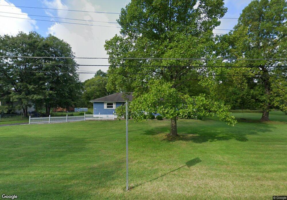
1148 Collar Price Rd Hubbard, OH 44425
Estimated Value: $127,000 - $228,000
3
Beds
1
Bath
1,550
Sq Ft
$117/Sq Ft
Est. Value
About This Home
This home is located at 1148 Collar Price Rd, Hubbard, OH 44425 and is currently estimated at $181,085, approximately $116 per square foot. 1148 Collar Price Rd is a home located in Trumbull County with nearby schools including Brookfield Elementary School, Brookfield Middle School, and Brookfield High School.
Ownership History
Date
Name
Owned For
Owner Type
Purchase Details
Closed on
May 9, 2007
Sold by
Kozarich Dorothy
Bought by
Yersky Pamela J and Heasley Paula J
Current Estimated Value
Purchase Details
Closed on
May 7, 2007
Sold by
Kozarich Dorothy
Bought by
Yersky Pamela J and Heasley Paula J
Purchase Details
Closed on
Jan 1, 1990
Sold by
Kozarich Frank M
Bought by
Dorothy Kozarich
Create a Home Valuation Report for This Property
The Home Valuation Report is an in-depth analysis detailing your home's value as well as a comparison with similar homes in the area
Home Values in the Area
Average Home Value in this Area
Purchase History
| Date | Buyer | Sale Price | Title Company |
|---|---|---|---|
| Yersky Pamela J | -- | None Available | |
| Yersky Pamela J | -- | None Available | |
| Dorothy Kozarich | -- | -- |
Source: Public Records
Tax History Compared to Growth
Tax History
| Year | Tax Paid | Tax Assessment Tax Assessment Total Assessment is a certain percentage of the fair market value that is determined by local assessors to be the total taxable value of land and additions on the property. | Land | Improvement |
|---|---|---|---|---|
| 2024 | $1,820 | $39,660 | $7,700 | $31,960 |
| 2023 | $1,820 | $39,660 | $7,700 | $31,960 |
| 2022 | $1,764 | $31,160 | $7,040 | $24,120 |
| 2021 | $1,653 | $31,160 | $7,040 | $24,120 |
| 2020 | $1,642 | $31,160 | $7,040 | $24,120 |
| 2019 | $1,585 | $28,040 | $6,510 | $21,530 |
| 2018 | $1,571 | $28,040 | $6,510 | $21,530 |
| 2017 | $1,569 | $28,040 | $6,510 | $21,530 |
| 2016 | $1,601 | $27,510 | $7,210 | $20,300 |
| 2015 | $1,604 | $27,510 | $7,210 | $20,300 |
| 2014 | $1,596 | $27,510 | $7,210 | $20,300 |
| 2013 | $1,655 | $29,050 | $7,210 | $21,840 |
Source: Public Records
Map
Nearby Homes
- 6855 Stewart Sharon Rd
- 7111 Pine Grove Dr
- 6984 Warren Sharon Rd
- 6220 Warren Sharon Rd
- 6333 Warren Sharon Rd
- 6130 Warren Sharon Rd
- 1441 Warner Rd
- 7086 Warren Sharon Rd
- 7370 Brookwood Dr
- 7091 Warren Sharon Rd
- 718 State Route 7 NE
- 5910 Chestnut Ridge Rd
- 1472 Warner Rd
- 1354 Stevenson Rd
- 5683 Chestnut Ridge Rd
- 1911 Hubbard Thomas Rd
- 7085 Sunnydell Dr
- 7159 Springdale Dr
- 7737 Elm St
- 209 Wyngate Dr
- 1121 Collar Price Rd SE
- 1121 Collar Price Rd
- 548 Collar Price
- 1118 Collar Price Rd
- 1188 Collar Price Rd
- 1159 Collar Price Rd
- 6539 Stewart Sharon Rd
- 1171 Collar Price Rd
- 6554 Stewart Sharon Rd
- 6582 Stewart Sharon Rd
- 6596 Stewart Sharon Rd
- 6494 Stewart Sharon Rd
- 6559 Stewart Sharon Rd
- 6484 Stewart Sharon Rd
- 1183 Collar Price Rd
- 1210 Collar Price Rd
- 6482 Stewart Sharon Rd
- 1081 Collar Price Rd SE
- 1195 Collar Price Rd
- 1220 Collar Price Rd