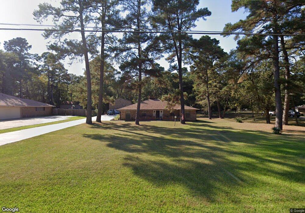
1148 Mcdaniel Dr Shreveport, LA 71107
Estimated Value: $43,000 - $86,000
3
Beds
1
Bath
920
Sq Ft
$74/Sq Ft
Est. Value
About This Home
This home is located at 1148 Mcdaniel Dr, Shreveport, LA 71107 and is currently estimated at $67,737, approximately $73 per square foot. 1148 Mcdaniel Dr is a home located in Caddo Parish with nearby schools including Blanchard Elementary School, Judson Fundamental Elementary School, and Fairfield Magnet School.
Ownership History
Date
Name
Owned For
Owner Type
Purchase Details
Closed on
Jan 13, 2021
Sold by
Millender Calvin Eugene and Millender Gloria Bradford
Bought by
Gcc Enterprises Inc
Current Estimated Value
Purchase Details
Closed on
Jul 12, 2019
Sold by
Bradford Anthony Charles and Bradford Cartia Dominique
Bought by
Millender Calvin E and Millender Gloria B
Purchase Details
Closed on
Jun 28, 2019
Sold by
Millender Calvin E and Millender Gloria B
Bought by
Bradford Anthony Charles and Bradford Cartia Dominique
Create a Home Valuation Report for This Property
The Home Valuation Report is an in-depth analysis detailing your home's value as well as a comparison with similar homes in the area
Home Values in the Area
Average Home Value in this Area
Purchase History
| Date | Buyer | Sale Price | Title Company |
|---|---|---|---|
| Gcc Enterprises Inc | $2,500 | None Available | |
| Millender Calvin E | -- | None Available | |
| Bradford Anthony Charles | $12,000 | None Available |
Source: Public Records
Tax History
| Year | Tax Paid | Tax Assessment Tax Assessment Total Assessment is a certain percentage of the fair market value that is determined by local assessors to be the total taxable value of land and additions on the property. | Land | Improvement |
|---|---|---|---|---|
| 2025 | $490 | $3,129 | $343 | $2,786 |
| 2024 | $488 | $3,129 | $343 | $2,786 |
| 2023 | $496 | $3,113 | $327 | $2,786 |
| 2022 | $496 | $3,113 | $327 | $2,786 |
| 2021 | $489 | $3,113 | $327 | $2,786 |
| 2020 | $489 | $3,113 | $327 | $2,786 |
| 2019 | $498 | $3,082 | $327 | $2,755 |
| 2018 | $397 | $3,082 | $327 | $2,755 |
| 2017 | $506 | $3,082 | $327 | $2,755 |
| 2015 | $391 | $3,020 | $330 | $2,690 |
| 2014 | $394 | $3,020 | $330 | $2,690 |
| 2013 | -- | $3,020 | $330 | $2,690 |
Source: Public Records
Map
Nearby Homes
- 4823 N Market St
- 4821 N Market St
- 4697 Pine Hill Rd
- 5037 N Market St
- 5001 Asaff Ave
- 5036 Asaff Ave
- 843 Eds Blvd
- 1000 Woodshire Cir
- 5221 N Market St
- 5218 Dalewood Dr
- 5244 N Market St
- 721 Jenkins Rd
- 5268 Dalewood Dr
- 707 Pine Acres Rd
- 6095 Pine Hill Rd
- 630 Irving Bluff Rd
- 5000 Highway 71
- 964 Winter Garden Dr Unit 1
- 964 Winter Garden Dr Unit 37
- 921 Pine Hill Rd
- 1148 Mcdaniel Dr
- 1148 Mcdaniel Dr
- 1148 Mcdaniel Dr
- 1148 Mcdaniel Dr
- 1148 Mcdaniel Dr
- 1148 Mcdaniel Dr
- 1148 Mcdaniel Dr
- 1148 Mcdaniel Dr
- 1148 Mcdaniel Dr
- 1148 Mcdaniel Dr
- 1148 Mcdaniel Dr
- 1148 Mcdaniel Dr
- 1148 Mcdaniel Dr
- 1148 Mcdaniel Dr
- 1148 Mcdaniel Dr
- 1148 Mcdaniel Dr
- 1148 Mcdaniel Dr
- 1148 Mcdaniel Dr
- 1148 Mcdaniel Dr
- 1148 Mcdaniel Dr
Your Personal Tour Guide
Ask me questions while you tour the home.