Estimated Value: $1,108,000 - $1,210,000
7
Beds
6
Baths
4,791
Sq Ft
$245/Sq Ft
Est. Value
About This Home
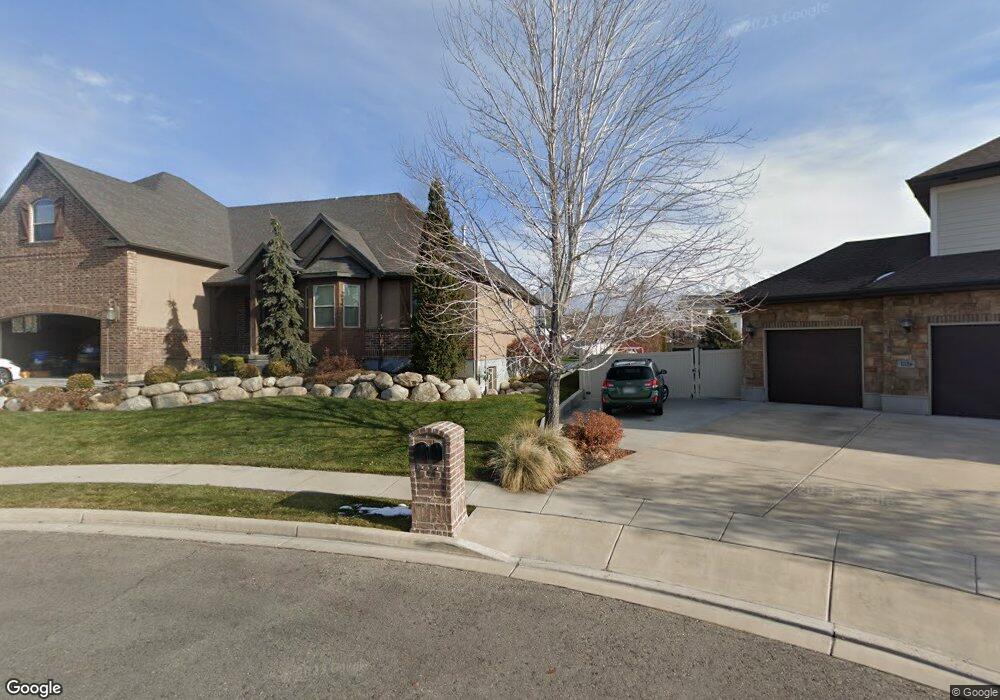
This home is located at 1148 N 1610 E, Lehi, UT 84043 and is currently estimated at $1,175,072, approximately $245 per square foot. 1148 N 1610 E is a home located in Utah County with nearby schools including Freedom Elementary School, Lehi Junior High School, and Skyridge High School.
Ownership History
Date
Name
Owned For
Owner Type
Purchase Details
Closed on
Jan 12, 2011
Sold by
Nielson Jack and Nielson Pamela K
Bought by
Hessing Michael L and Hessing Sara
Current Estimated Value
Home Financials for this Owner
Home Financials are based on the most recent Mortgage that was taken out on this home.
Original Mortgage
$368,600
Outstanding Balance
$251,780
Interest Rate
4.82%
Mortgage Type
New Conventional
Estimated Equity
$923,292
Purchase Details
Closed on
Feb 9, 2009
Sold by
Nielson Jack
Bought by
Nielson Jack and Nielson Pamela K
Purchase Details
Closed on
Dec 31, 2008
Sold by
Jones Tori K and Jones Cody M
Bought by
Nielson Jack
Purchase Details
Closed on
Mar 29, 2007
Sold by
Bmd Enterprises Llc
Bought by
Jones Cody M and Jones Tori K
Home Financials for this Owner
Home Financials are based on the most recent Mortgage that was taken out on this home.
Original Mortgage
$435,990
Interest Rate
6.29%
Mortgage Type
Construction
Create a Home Valuation Report for This Property
The Home Valuation Report is an in-depth analysis detailing your home's value as well as a comparison with similar homes in the area
Home Values in the Area
Average Home Value in this Area
Purchase History
| Date | Buyer | Sale Price | Title Company |
|---|---|---|---|
| Hessing Michael L | -- | Select Title Insurance Agen | |
| Nielson Jack | -- | Title West Title Company | |
| Nielson Jack | -- | Title West Title Company | |
| Jones Cody M | -- | Title West Title Company |
Source: Public Records
Mortgage History
| Date | Status | Borrower | Loan Amount |
|---|---|---|---|
| Open | Hessing Michael L | $368,600 | |
| Previous Owner | Jones Cody M | $435,990 |
Source: Public Records
Tax History
| Year | Tax Paid | Tax Assessment Tax Assessment Total Assessment is a certain percentage of the fair market value that is determined by local assessors to be the total taxable value of land and additions on the property. | Land | Improvement |
|---|---|---|---|---|
| 2025 | $4,703 | $630,630 | -- | -- |
| 2024 | $4,703 | $550,330 | $0 | $0 |
| 2023 | $4,283 | $544,280 | $0 | $0 |
| 2022 | $4,629 | $570,185 | $0 | $0 |
| 2021 | $4,141 | $771,100 | $242,600 | $528,500 |
| 2020 | $3,903 | $718,500 | $224,600 | $493,900 |
| 2019 | $3,736 | $715,000 | $224,600 | $490,400 |
| 2018 | $3,531 | $638,800 | $212,400 | $426,400 |
| 2017 | $3,030 | $291,390 | $0 | $0 |
| 2016 | $3,137 | $279,895 | $0 | $0 |
| 2015 | $3,304 | $279,895 | $0 | $0 |
| 2014 | $2,817 | $237,215 | $0 | $0 |
Source: Public Records
Map
Nearby Homes
- 9435 N Aspen Hollow Cir
- 893 N 1580 E
- 4007 W 1000 N
- 3947 W 1000 N Unit 439
- 3971 W 1000 N Unit 441
- 3959 W 1000 N
- 3995 W 1000 N
- 1175 E 900 N
- 1272 N Cedar Hollow Blvd
- 556 N 1440 E
- 499 N 1520 E
- 1370 N Cedar Hollow Blvd
- 764 W 880 North St Unit 308
- 822 N 860 W Unit 317
- 672 W 900 N
- 822 W 800 St N Unit LOT319
- 414 N 1322 E
- 890 N Whipple Dr
- 525 W 990 N
- 6576 W 9810 N
- 1126 N 1610 E
- 6915 W 9401 N
- 1612 E 1130 N Unit 17
- 1612 E 1130 N
- 1589 E 1130 N
- 1119 N 1710 E Unit 26
- 1125 N 1710 E Unit 27
- 1584 E 1130 N
- 1635 E 1060 N
- 1663 E 1060 N
- 1609 E 1060 N
- 1689 E 1060 N Unit 25
- 1583 E 1060 N Unit 21
- 1122 N 1540 E
- 1562 E 1130 N Unit 19
- 1122 N 1710 E Unit 28
- 6891 W 9401 N
- 9421 N 6935 W
- 1561 E 1060 N
- 1094 N 1710 E Unit 29
Your Personal Tour Guide
Ask me questions while you tour the home.