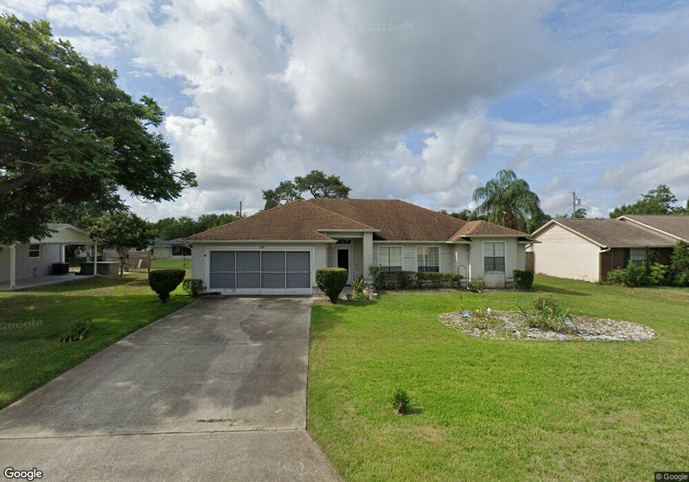
1149 Ring St Deltona, FL 32725
Estimated Value: $297,000 - $326,000
3
Beds
2
Baths
1,727
Sq Ft
$178/Sq Ft
Est. Value
About This Home
This home is located at 1149 Ring St, Deltona, FL 32725 and is currently estimated at $308,040, approximately $178 per square foot. 1149 Ring St is a home located in Volusia County with nearby schools including Spirit Elementary School, Deltona Middle School, and Deltona High School.
Ownership History
Date
Name
Owned For
Owner Type
Purchase Details
Closed on
Dec 4, 2017
Sold by
Pyne Stanley H and Pyne Daphne
Bought by
Pyne Stanley H and Pyne Daphne
Current Estimated Value
Purchase Details
Closed on
Apr 8, 1994
Sold by
Kirby Carlen Joe and Kirby Deborah Jane
Bought by
Pyne Stanley H and Pyne Daphne
Home Financials for this Owner
Home Financials are based on the most recent Mortgage that was taken out on this home.
Original Mortgage
$72,000
Interest Rate
7.47%
Purchase Details
Closed on
Jun 15, 1992
Bought by
Pyne Stanley H and Pyne Daphne
Purchase Details
Closed on
Jan 15, 1990
Bought by
Pyne Stanley H and Pyne Daphne
Purchase Details
Closed on
Sep 15, 1989
Bought by
Pyne Stanley H and Pyne Daphne
Purchase Details
Closed on
Aug 15, 1989
Bought by
Pyne Stanley H and Pyne Daphne
Purchase Details
Closed on
Mar 15, 1988
Bought by
Pyne Stanley H and Pyne Daphne
Create a Home Valuation Report for This Property
The Home Valuation Report is an in-depth analysis detailing your home's value as well as a comparison with similar homes in the area
Home Values in the Area
Average Home Value in this Area
Purchase History
| Date | Buyer | Sale Price | Title Company |
|---|---|---|---|
| Pyne Stanley H | -- | Attorney | |
| Pyne Stanley H | $80,000 | -- | |
| Pyne Stanley H | $81,500 | -- | |
| Pyne Stanley H | $83,900 | -- | |
| Pyne Stanley H | $100 | -- | |
| Pyne Stanley H | $13,200 | -- | |
| Pyne Stanley H | $13,000 | -- | |
| Pyne Stanley H | $11,500 | -- |
Source: Public Records
Mortgage History
| Date | Status | Borrower | Loan Amount |
|---|---|---|---|
| Closed | Pyne Stanley H | $72,000 |
Source: Public Records
Tax History
| Year | Tax Paid | Tax Assessment Tax Assessment Total Assessment is a certain percentage of the fair market value that is determined by local assessors to be the total taxable value of land and additions on the property. | Land | Improvement |
|---|---|---|---|---|
| 2026 | $1,384 | $93,320 | -- | -- |
| 2025 | $1,384 | $93,320 | -- | -- |
| 2024 | $1,212 | $90,690 | -- | -- |
| 2023 | $1,212 | $88,049 | $0 | $0 |
| 2022 | $1,183 | $85,484 | $0 | $0 |
| 2021 | $1,189 | $82,994 | $0 | $0 |
| 2020 | $1,169 | $81,848 | $0 | $0 |
| 2019 | $1,163 | $80,008 | $0 | $0 |
| 2018 | $1,131 | $78,516 | $0 | $0 |
| 2017 | $1,093 | $76,901 | $0 | $0 |
| 2016 | $1,055 | $75,319 | $0 | $0 |
| 2015 | $1,072 | $74,795 | $0 | $0 |
| 2014 | $1,049 | $74,201 | $0 | $0 |
Source: Public Records
Map
Nearby Homes
- 1154 S Cooper Dr
- 1115 S Cooper Dr
- 1086 Platinum Ct
- 1217 Gladstone Dr
- 1651 Sterling Silver Blvd
- 1246 Kearney Ct
- 2034 Claremont Dr
- 1266 Gladstone Dr
- 1196 Pearl Tree Rd
- 1308 Sterling Pointe Dr
- 1317 Sterling Pointe Dr
- 987 Trumbull St
- 1336 Star Ct
- 1612 Hill Park Dr
- 1611 Meadowlark Dr
- 1699 Urbana Ave
- 2061 Greenview Dr
- 1423 Alexington Ave
- 1007 Sullivan St
- 1422 Sharon Rose Trace
Your Personal Tour Guide
Ask me questions while you tour the home.