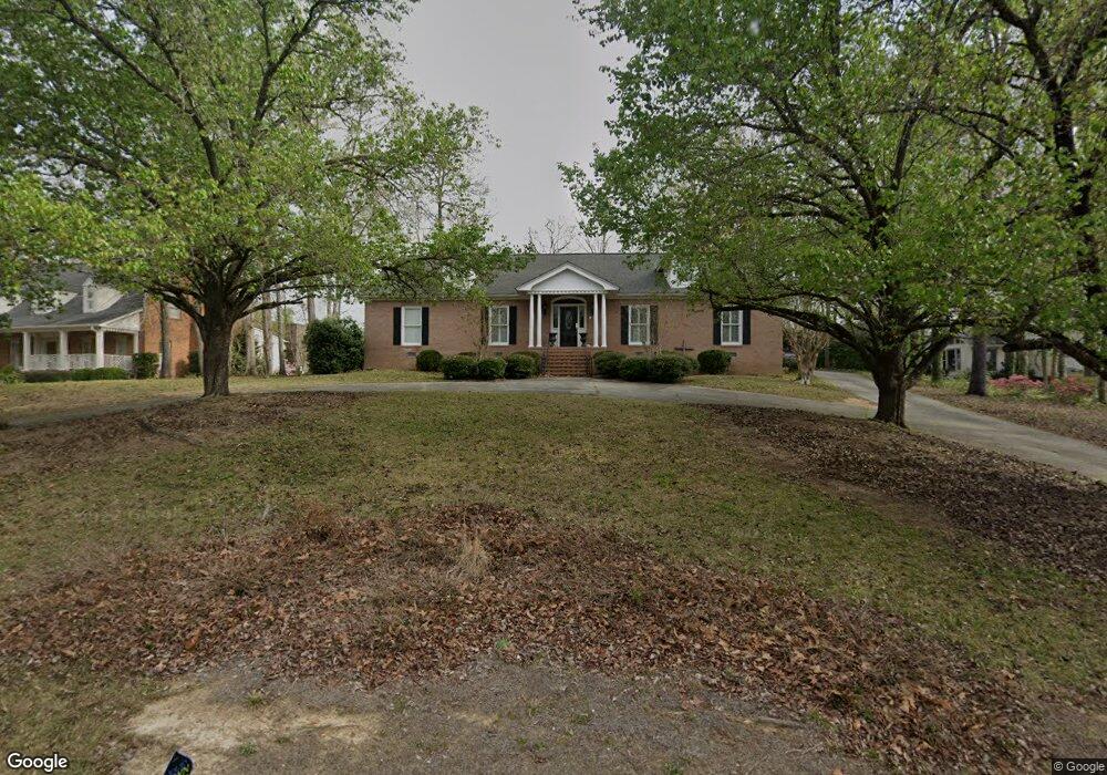
1149 Saint Andrews Dr Macon, GA 31210
Estimated Value: $644,000 - $695,226
3
Beds
3
Baths
3,531
Sq Ft
$191/Sq Ft
Est. Value
About This Home
This home is located at 1149 Saint Andrews Dr, Macon, GA 31210 and is currently estimated at $674,742, approximately $191 per square foot. 1149 Saint Andrews Dr is a home located in Bibb County with nearby schools including Carter Elementary School, Howard Middle School, and Howard High School.
Ownership History
Date
Name
Owned For
Owner Type
Purchase Details
Closed on
Sep 25, 2007
Sold by
Armstrong Barbara A
Bought by
Leachman Craig
Current Estimated Value
Home Financials for this Owner
Home Financials are based on the most recent Mortgage that was taken out on this home.
Original Mortgage
$438,000
Interest Rate
6.41%
Mortgage Type
Unknown
Purchase Details
Closed on
Oct 2, 2002
Create a Home Valuation Report for This Property
The Home Valuation Report is an in-depth analysis detailing your home's value as well as a comparison with similar homes in the area
Home Values in the Area
Average Home Value in this Area
Purchase History
| Date | Buyer | Sale Price | Title Company |
|---|---|---|---|
| Leachman Craig | $438,000 | None Available | |
| -- | $300,000 | -- |
Source: Public Records
Mortgage History
| Date | Status | Borrower | Loan Amount |
|---|---|---|---|
| Closed | Leachman Craig | $438,000 |
Source: Public Records
Tax History Compared to Growth
Tax History
| Year | Tax Paid | Tax Assessment Tax Assessment Total Assessment is a certain percentage of the fair market value that is determined by local assessors to be the total taxable value of land and additions on the property. | Land | Improvement |
|---|---|---|---|---|
| 2025 | $5,267 | $221,350 | $54,000 | $167,350 |
| 2024 | $5,444 | $221,350 | $54,000 | $167,350 |
| 2023 | $4,635 | $207,510 | $54,000 | $153,510 |
| 2022 | $5,943 | $178,663 | $28,800 | $149,863 |
| 2021 | $6,161 | $169,139 | $28,800 | $140,339 |
| 2020 | $5,850 | $157,672 | $24,000 | $133,672 |
| 2019 | $5,413 | $145,290 | $24,000 | $121,290 |
| 2018 | $8,470 | $145,290 | $24,000 | $121,290 |
| 2017 | $5,181 | $145,290 | $24,000 | $121,290 |
| 2016 | $4,784 | $145,290 | $24,000 | $121,290 |
| 2015 | $6,773 | $145,290 | $24,000 | $121,290 |
| 2014 | $6,783 | $145,290 | $24,000 | $121,290 |
Source: Public Records
Map
Nearby Homes
- 1145 Saint Andrews Dr
- 1145 St Andrews Dr
- 1146 Saint Andrews Dr
- 1157 St Andrews Dr
- 1157 Saint Andrews Dr
- 1141 Saint Andrews Dr
- 1150 Saint Andrews Dr
- 1140 Saint Andrews Dr
- 1140 St Andrews Dr
- 1161 Saint Andrews Dr
- 1158 Saint Andrews Dr
- 1160 Saint Andrews Dr
- 111 Prestwick Park
- 1136 Saint Andrews Dr
- 1164 Saint Andrews Dr
- 1132 Saint Andrews Dr
- 109 Gleneagles Cir
- 100 Prestwick Park
- 115 Gleneagles Cir
- 104 Prestwick Park