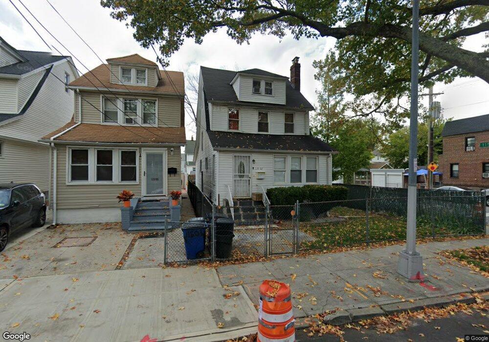
115-02 197th St Jamaica, NY 11412
Saint Albans NeighborhoodEstimated Value: $690,000 - $766,000
4
Beds
2
Baths
1,800
Sq Ft
$401/Sq Ft
Est. Value
About This Home
This home is located at 115-02 197th St, Jamaica, NY 11412 and is currently estimated at $722,241, approximately $401 per square foot. 115-02 197th St is a home located in Queens County with nearby schools including P.S. 136 Roy Wilkins, I.S. 192 The Linden, and Riverton Street Charter School.
Ownership History
Date
Name
Owned For
Owner Type
Purchase Details
Closed on
Feb 28, 2008
Sold by
Swinney Sheila
Bought by
Moore Marion N
Current Estimated Value
Home Financials for this Owner
Home Financials are based on the most recent Mortgage that was taken out on this home.
Original Mortgage
$415,000
Interest Rate
5.72%
Mortgage Type
Purchase Money Mortgage
Purchase Details
Closed on
Jun 18, 2004
Sold by
Afshin Holding Corp
Bought by
Swinney Sheila
Home Financials for this Owner
Home Financials are based on the most recent Mortgage that was taken out on this home.
Original Mortgage
$68,000
Interest Rate
6.3%
Purchase Details
Closed on
Apr 20, 2004
Sold by
Griffiths Janet
Bought by
Afshin Holding Corp
Home Financials for this Owner
Home Financials are based on the most recent Mortgage that was taken out on this home.
Original Mortgage
$272,000
Interest Rate
6.3%
Mortgage Type
Purchase Money Mortgage
Purchase Details
Closed on
Jul 28, 1999
Sold by
Mays Blanche and Long Charlotte
Bought by
Long Charlotte A
Home Financials for this Owner
Home Financials are based on the most recent Mortgage that was taken out on this home.
Original Mortgage
$132,000
Interest Rate
7.53%
Purchase Details
Closed on
Feb 27, 1998
Sold by
Mays Blande
Bought by
Mays Blande and Long Charlotte
Home Financials for this Owner
Home Financials are based on the most recent Mortgage that was taken out on this home.
Original Mortgage
$61,000
Interest Rate
7.11%
Purchase Details
Closed on
Mar 10, 1995
Sold by
Mays Blanche and Sanford William E
Bought by
Mays Blanche
Home Financials for this Owner
Home Financials are based on the most recent Mortgage that was taken out on this home.
Original Mortgage
$47,000
Interest Rate
8.34%
Create a Home Valuation Report for This Property
The Home Valuation Report is an in-depth analysis detailing your home's value as well as a comparison with similar homes in the area
Home Values in the Area
Average Home Value in this Area
Purchase History
| Date | Buyer | Sale Price | Title Company |
|---|---|---|---|
| Moore Marion N | $428,000 | -- | |
| Moore Marion N | $428,000 | -- | |
| Swinney Sheila | $339,500 | -- | |
| Swinney Sheila | $339,500 | -- | |
| Afshin Holding Corp | $260,000 | -- | |
| Afshin Holding Corp | $260,000 | -- | |
| Long Charlotte A | -- | -- | |
| Long Charlotte A | -- | -- | |
| Mays Blande | -- | Commonwealth Land Title Ins | |
| Mays Blande | -- | Commonwealth Land Title Ins | |
| Mays Blanche | -- | Uslife Title Insurance Compa | |
| Mays Blanche | -- | Uslife Title Insurance Compa |
Source: Public Records
Mortgage History
| Date | Status | Borrower | Loan Amount |
|---|---|---|---|
| Previous Owner | Moore Marion N | $415,000 | |
| Previous Owner | Swinney Sheila | $68,000 | |
| Previous Owner | Swinney Sheila | $272,000 | |
| Previous Owner | Long Charlotte A | $132,000 | |
| Previous Owner | Mays Blande | $61,000 | |
| Previous Owner | Mays Blanche | $47,000 |
Source: Public Records
Tax History Compared to Growth
Tax History
| Year | Tax Paid | Tax Assessment Tax Assessment Total Assessment is a certain percentage of the fair market value that is determined by local assessors to be the total taxable value of land and additions on the property. | Land | Improvement |
|---|---|---|---|---|
| 2025 | $5,432 | $28,664 | $7,278 | $21,386 |
| 2024 | $1,688 | $27,043 | $7,733 | $19,310 |
| 2023 | $5,127 | $25,528 | $6,537 | $18,991 |
| 2022 | $4,808 | $35,640 | $10,740 | $24,900 |
| 2021 | $5,069 | $35,040 | $10,740 | $24,300 |
| 2020 | $5,056 | $30,480 | $10,740 | $19,740 |
| 2019 | $4,714 | $28,260 | $10,740 | $17,520 |
| 2018 | $4,336 | $21,273 | $9,333 | $11,940 |
| 2017 | $4,091 | $20,071 | $9,118 | $10,953 |
| 2016 | $4,012 | $20,071 | $9,118 | $10,953 |
| 2015 | $2,284 | $19,906 | $10,706 | $9,200 |
| 2014 | $2,284 | $18,780 | $11,940 | $6,840 |
Source: Public Records
Map
Nearby Homes
- 114-64 198th St
- 115-37 197th St
- 114-22 197th St
- 114-28 198th St
- 11516 199th St
- 194-34 115th Rd
- 194-19 115th Rd
- 194-56 Murdock Ave
- 114-37 199th St
- 19431 114th Rd
- 19705 116th Ave
- 194-42 Murdock Ave
- 194-23 114th Rd
- 115-47 199th St
- 114-40 200th St
- 113-40 198th St
- 196-10 116th Ave
- 19445 Murdock Ave
- 191-47 114th Dr
- 11608 196th St
- 11502 197th St
- 11504 197th St
- 11508 197th St
- 11510 197th St
- 114-70 197th St
- 11470 197th St
- 115-12 197th St
- 11512 197th St
- 19702 115th Ave
- 11468 197th St
- 11501 196th St
- 11505 196th St
- 197-06 115th Ave Unit 2
- 114-66 197th St
- 11466 197th St
- 11466 197th St Unit 2nd Fl
- 11514 197th St
- 19706 115th Ave
- 11511 196th St
- 115-11 197th St Unit 2