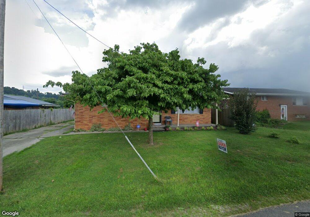
115 11th St South Point, OH 45680
Estimated Value: $148,000 - $202,000
2
Beds
1
Bath
984
Sq Ft
$166/Sq Ft
Est. Value
About This Home
This home is located at 115 11th St, South Point, OH 45680 and is currently estimated at $163,371, approximately $166 per square foot. 115 11th St is a home located in Lawrence County with nearby schools including South Point High School.
Ownership History
Date
Name
Owned For
Owner Type
Purchase Details
Closed on
May 12, 2016
Sold by
Mcclure Fred K and Mcclure Annie M
Bought by
Mcclure Eddie Darrin and Mcclure Susan Maria
Current Estimated Value
Purchase Details
Closed on
Feb 26, 2015
Sold by
Halstead Lisa G and Halstead James R
Bought by
Mcclure Fred K and Mcclure Annie M
Home Financials for this Owner
Home Financials are based on the most recent Mortgage that was taken out on this home.
Original Mortgage
$75,862
Outstanding Balance
$58,017
Interest Rate
3.64%
Mortgage Type
New Conventional
Estimated Equity
$105,354
Purchase Details
Closed on
Dec 22, 2010
Sold by
Boston John W and Boston Kristy
Bought by
Thacker Lisa G
Purchase Details
Closed on
May 10, 2010
Sold by
Meadows Earl F
Bought by
Boston John W and Boston Kristy
Purchase Details
Closed on
Jan 1, 1987
Bought by
Meadows Earl F
Create a Home Valuation Report for This Property
The Home Valuation Report is an in-depth analysis detailing your home's value as well as a comparison with similar homes in the area
Home Values in the Area
Average Home Value in this Area
Purchase History
| Date | Buyer | Sale Price | Title Company |
|---|---|---|---|
| Mcclure Eddie Darrin | -- | None Available | |
| Mcclure Fred K | $89,250 | Bestitle | |
| Thacker Lisa G | $85,000 | None Available | |
| Boston John W | $45,000 | Attorney | |
| Meadows Earl F | -- | -- |
Source: Public Records
Mortgage History
| Date | Status | Borrower | Loan Amount |
|---|---|---|---|
| Open | Mcclure Fred K | $75,862 |
Source: Public Records
Tax History Compared to Growth
Tax History
| Year | Tax Paid | Tax Assessment Tax Assessment Total Assessment is a certain percentage of the fair market value that is determined by local assessors to be the total taxable value of land and additions on the property. | Land | Improvement |
|---|---|---|---|---|
| 2024 | -- | $32,570 | $5,160 | $27,410 |
| 2023 | $1,115 | $32,570 | $5,160 | $27,410 |
| 2022 | $1,111 | $32,570 | $5,160 | $27,410 |
| 2021 | $1,064 | $29,410 | $4,260 | $25,150 |
| 2020 | $1,078 | $29,410 | $4,260 | $25,150 |
| 2019 | $1,072 | $29,410 | $4,260 | $25,150 |
| 2018 | $994 | $26,730 | $3,870 | $22,860 |
| 2017 | $992 | $26,730 | $3,870 | $22,860 |
| 2016 | $929 | $26,730 | $3,870 | $22,860 |
| 2015 | $862 | $22,690 | $3,870 | $18,820 |
| 2014 | $861 | $22,690 | $3,870 | $18,820 |
| 2013 | $781 | $22,690 | $3,870 | $18,820 |
Source: Public Records
Map
Nearby Homes
- 205 Michael St
- 105 Orchard Dr
- 408 Brubaker Dr
- 119 Meadow Ln
- 101 Henray Dr
- 102 Park Ave
- 609 4th St E
- 00 County Road 1
- 110 Kitts Ln
- 0 Twp R 135
- 404 Township Road 135
- 0 Township Road 135
- 0 Township Road 161 Unit 182331
- 1184 County Road 18
- 2708 Panola St
- 2904 County Road 1
- 217 17th St
- 1524 Beech St
- 2800 Walnut St
- 304 15th St