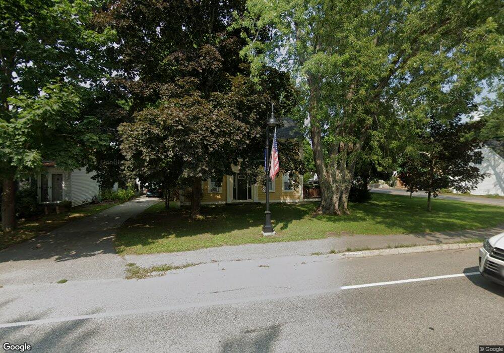
115 Alfred Rd Kennebunk, ME 04043
Estimated Value: $493,219 - $846,000
4
Beds
3
Baths
2,016
Sq Ft
$316/Sq Ft
Est. Value
About This Home
This home is located at 115 Alfred Rd, Kennebunk, ME 04043 and is currently estimated at $636,805, approximately $315 per square foot. 115 Alfred Rd is a home located in York County with nearby schools including Kennebunk High School and The New School.
Ownership History
Date
Name
Owned For
Owner Type
Purchase Details
Closed on
Apr 18, 2007
Sold by
Mitchell David M and Mitchell Kristen N
Bought by
Guay Daniel R and Guay Diane M
Current Estimated Value
Home Financials for this Owner
Home Financials are based on the most recent Mortgage that was taken out on this home.
Original Mortgage
$253,000
Outstanding Balance
$153,307
Interest Rate
6.19%
Mortgage Type
Unknown
Estimated Equity
$483,498
Purchase Details
Closed on
Nov 2, 2005
Sold by
Smith Madelyn A and Hammond James O
Bought by
Farda Michelle J and Farda Michael E
Purchase Details
Closed on
May 31, 2005
Sold by
Berube Kristen N
Bought by
Mitchell Kristen N and Mitchell David M
Home Financials for this Owner
Home Financials are based on the most recent Mortgage that was taken out on this home.
Original Mortgage
$191,000
Interest Rate
5.94%
Mortgage Type
Purchase Money Mortgage
Create a Home Valuation Report for This Property
The Home Valuation Report is an in-depth analysis detailing your home's value as well as a comparison with similar homes in the area
Home Values in the Area
Average Home Value in this Area
Purchase History
| Date | Buyer | Sale Price | Title Company |
|---|---|---|---|
| Guay Daniel R | -- | -- | |
| Farda Michelle J | -- | -- | |
| Mitchell Kristen N | -- | -- |
Source: Public Records
Mortgage History
| Date | Status | Borrower | Loan Amount |
|---|---|---|---|
| Open | Guay Daniel R | $253,000 | |
| Previous Owner | Mitchell Kristen N | $191,000 |
Source: Public Records
Tax History Compared to Growth
Tax History
| Year | Tax Paid | Tax Assessment Tax Assessment Total Assessment is a certain percentage of the fair market value that is determined by local assessors to be the total taxable value of land and additions on the property. | Land | Improvement |
|---|---|---|---|---|
| 2024 | $3,868 | $228,200 | $57,900 | $170,300 |
| 2023 | $3,663 | $228,200 | $57,900 | $170,300 |
| 2022 | $3,332 | $228,200 | $57,900 | $170,300 |
| 2021 | $2,896 | $228,200 | $57,900 | $170,300 |
| 2020 | $3,229 | $228,200 | $57,900 | $170,300 |
| 2019 | $3,138 | $228,200 | $57,900 | $170,300 |
| 2018 | $2,994 | $171,100 | $43,400 | $127,700 |
| 2017 | $4,008 | $171,100 | $43,400 | $127,700 |
| 2016 | $2,720 | $171,100 | $43,400 | $127,700 |
| 2015 | $2,472 | $171,100 | $43,400 | $127,700 |
| 2014 | $2,408 | $171,100 | $43,400 | $127,700 |
Source: Public Records
Map
Nearby Homes
- 30 Twine Mill Rd
- 9 Patterson Dr
- 23 Cascade Cir Unit 22
- 0 Potvin Rd
- 24-4,25-10 Chapman Ln
- 141 Thompson Rd
- 274 Alfred Rd
- 276 Alfred Rd
- 284 Alfred Rd Unit Lot F13
- 5 Meander Ln Unit 2
- 19 Old Alewive Rd
- 23 Lilac Ln
- 3 Nichols Ln
- 9 Hammond Rd
- 056 Cat Mousam Rd
- 20 Cascade Cir Unit 11
- 6 Dunnhill Dr Unit 28
- lot #3 Salvato Ln
- 29 Bentley Place Unit 50
- 18 Cascade Cir Unit 12
- 123 Alfred Rd
- 113 Alfred Rd
- 0 Warrens Way Unit 823880
- 0 Warrens Way Unit 800179
- 0 Warrens Way Unit 259174
- 0 Warrens Way Unit 799500
- 0 Warrens Way Unit 799568
- 0 Warrens Way Unit 764545
- 0 Warrens Way Unit 1263531
- 0 Warrens Way Unit 1215862
- 0 Warrens Way Unit 1216367
- 125 Alfred Rd
- 3 Warrens Way
- 118 Alfred Rd
- 127 Alfred Rd
- 8 Warrens Way
- 7 Warrens Way
- 124 Alfred Rd
- 107 Alfred Rd
- 10 Warrens Way