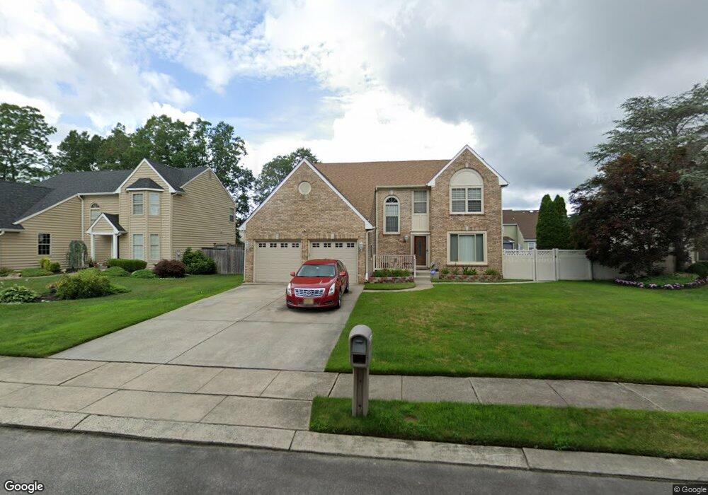
115 Beresford Dr Egg Harbor Township, NJ 08234
Estimated Value: $461,000 - $494,000
--
Bed
--
Bath
2,588
Sq Ft
$184/Sq Ft
Est. Value
About This Home
This home is located at 115 Beresford Dr, Egg Harbor Township, NJ 08234 and is currently estimated at $476,938, approximately $184 per square foot. 115 Beresford Dr is a home located in Atlantic County with nearby schools including Egg Harbor Township High School, Principle Academy Charter, and English Creek Academy.
Ownership History
Date
Name
Owned For
Owner Type
Purchase Details
Closed on
Jul 26, 1995
Sold by
Baratta Jerry M and Baratta Marcia M
Bought by
Marable William T and Marable Sheryl L
Current Estimated Value
Purchase Details
Closed on
Jun 17, 1994
Sold by
English Creek Homes Inc
Bought by
Baratta Jerry and Baratta Marcia
Home Financials for this Owner
Home Financials are based on the most recent Mortgage that was taken out on this home.
Original Mortgage
$186,000
Interest Rate
8.74%
Create a Home Valuation Report for This Property
The Home Valuation Report is an in-depth analysis detailing your home's value as well as a comparison with similar homes in the area
Home Values in the Area
Average Home Value in this Area
Purchase History
| Date | Buyer | Sale Price | Title Company |
|---|---|---|---|
| Marable William T | $189,900 | The Title Company | |
| Baratta Jerry | $195,550 | -- |
Source: Public Records
Mortgage History
| Date | Status | Borrower | Loan Amount |
|---|---|---|---|
| Previous Owner | Baratta Jerry | $186,000 |
Source: Public Records
Tax History Compared to Growth
Tax History
| Year | Tax Paid | Tax Assessment Tax Assessment Total Assessment is a certain percentage of the fair market value that is determined by local assessors to be the total taxable value of land and additions on the property. | Land | Improvement |
|---|---|---|---|---|
| 2025 | $8,536 | $254,500 | $50,800 | $203,700 |
| 2024 | $8,536 | $254,500 | $50,800 | $203,700 |
| 2023 | $8,488 | $254,500 | $50,800 | $203,700 |
| 2022 | $8,488 | $254,500 | $50,800 | $203,700 |
| 2021 | $8,556 | $254,500 | $50,800 | $203,700 |
| 2020 | $8,401 | $254,500 | $50,800 | $203,700 |
| 2019 | $8,172 | $254,500 | $50,800 | $203,700 |
| 2018 | $7,996 | $254,500 | $50,800 | $203,700 |
| 2017 | $7,968 | $254,500 | $50,800 | $203,700 |
| 2016 | $7,653 | $254,500 | $50,800 | $203,700 |
| 2015 | $7,541 | $254,500 | $50,800 | $203,700 |
| 2014 | $7,391 | $254,500 | $50,800 | $203,700 |
Source: Public Records
Map
Nearby Homes
- 6 Esher Way
- 26 Baltusrol Dr
- 94 Baltusrol Dr
- 78 Oakmont Dr
- 124 Amherst Dr
- 103 Bernard Ave
- 21 Brandywine Ct
- 182 Pebble Beach Dr
- 105 Leo Ave
- 7 Golf Dr
- 106 Leo Ave
- 172 Turnberry Ct
- 205 Gravel Bend Rd
- 165 Turnberry Ct
- 20 Monet Dr
- 66 Monet Dr
- 156 Muirfield Ct
- 117 Bernard Ave
- 154 Muirfield Ct
- 4127 Black Horse Pike
- 113 Beresford Dr
- 117 Beresford Dr
- 129 Treetop Ln
- 127 Treetop Ln
- 111 Beresford Dr
- 131 Treetop Ln
- 119 Beresford Dr
- 116 Beresford Dr
- 114 Beresford Dr
- 118 Beresford Dr
- 40 Tower Ave
- 109 Beresford Dr
- 112 Beresford Dr
- 120 Beresford Dr
- 133 Treetop Ln
- 107 Beresford Dr
- 125 Treetop Ln
- 110 Beresford Dr
- 37 Tower Ave
- 130 Treetop Ln