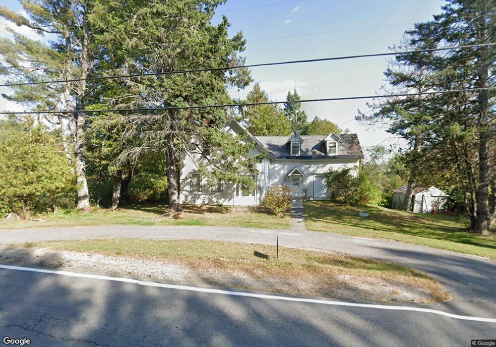
115 Blackswoods Rd Unit 1 Franklin, ME 04634
Estimated Value: $91,000 - $114,000
2
Beds
2
Baths
320
Sq Ft
$324/Sq Ft
Est. Value
About This Home
This home is located at 115 Blackswoods Rd Unit 1, Franklin, ME 04634 and is currently estimated at $103,788, approximately $324 per square foot. 115 Blackswoods Rd Unit 1 is a home located in Hancock County with nearby schools including Mountain View School and Sumner Memorial High School.
Ownership History
Date
Name
Owned For
Owner Type
Purchase Details
Closed on
Apr 11, 2025
Sold by
Wilbur Robert H
Bought by
Nagasena Dona
Current Estimated Value
Home Financials for this Owner
Home Financials are based on the most recent Mortgage that was taken out on this home.
Original Mortgage
$82,800
Outstanding Balance
$82,293
Interest Rate
6.76%
Mortgage Type
New Conventional
Estimated Equity
$21,495
Create a Home Valuation Report for This Property
The Home Valuation Report is an in-depth analysis detailing your home's value as well as a comparison with similar homes in the area
Home Values in the Area
Average Home Value in this Area
Purchase History
| Date | Buyer | Sale Price | Title Company |
|---|---|---|---|
| Nagasena Dona | $92,000 | Misc Company | |
| Nagasena Dona | $92,000 | Misc Company |
Source: Public Records
Mortgage History
| Date | Status | Borrower | Loan Amount |
|---|---|---|---|
| Open | Nagasena Dona | $82,800 | |
| Closed | Nagasena Dona | $82,800 |
Source: Public Records
Tax History Compared to Growth
Tax History
| Year | Tax Paid | Tax Assessment Tax Assessment Total Assessment is a certain percentage of the fair market value that is determined by local assessors to be the total taxable value of land and additions on the property. | Land | Improvement |
|---|---|---|---|---|
| 2024 | $1,092 | $84,010 | $29,840 | $54,170 |
| 2023 | $1,094 | $84,150 | $29,840 | $54,310 |
| 2022 | $1,079 | $84,280 | $29,840 | $54,440 |
| 2021 | $1,282 | $92,910 | $29,840 | $63,070 |
| 2020 | $1,493 | $92,910 | $29,840 | $63,070 |
| 2019 | $1,273 | $92,910 | $29,840 | $63,070 |
| 2018 | $1,273 | $92,910 | $29,840 | $63,070 |
| 2017 | $1,254 | $92,910 | $29,840 | $63,070 |
| 2016 | $1,115 | $92,910 | $29,840 | $63,070 |
| 2015 | $948 | $92,910 | $29,840 | $63,070 |
| 2014 | $883 | $92,900 | $29,800 | $63,100 |
| 2013 | $901 | $92,900 | $29,800 | $63,100 |
Source: Public Records
Map
Nearby Homes
- 50 Blackwoods Rd
- 43 Blackswoods Rd
- 2 Blackswoods Rd
- 17 Main St
- 3 Mcneil Ln
- Green Field Off Georges Pond Rd
- 42 Dwelly Point Rd
- 218 Georges Pond Rd
- 109 Main St
- 296 Georges Pond Rd
- 352 Georges Pond Rd
- Lot 21-2 Great Pond Rd
- L1 Unit 4911 Martins Ridge R
- MAP13LOT4 Martins Ridge Rd
- L1,4,9,11 Martins Ridge Rd
- MAP13LOT11 Martins Ridge Rd
- MAP13LOT1 Martins Ridge Rd
- MAP13LOT9 Martins Ridge Rd
- 200 Eastbrook Rd
- 35 Patten Ln
- 121 Blackswoods Rd
- 15 Woods Edge Ln
- 125 Blackswoods Rd
- 127 Blackswoods Rd
- 3 Woods Edge Ln
- 7 Woods Edge Ln
- 0 Blackswoods Rd
- 11 Woods Edge Ln
- 101 Blackswoods Rd
- 101 Blackwoods
- 132 Blackswoods Rd
- 17 Woods Edge Ln
- 135 Blackswoods Rd
- 138 Blackswoods Rd
- 27 Woods Edge Ln
- 137 Blackswoods Rd
- 144 Blackswoods Rd
- 3 Georges Pond Rd
- 00 George's Pond Rd
- 0 Murch Island On Georges Pond Unit 883108