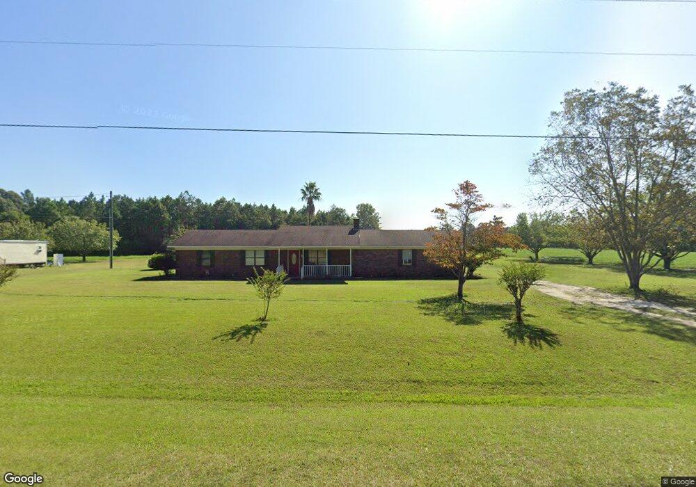
115 Brantley Rd Hazlehurst, GA 31539
Estimated Value: $123,000 - $275,000
2
Beds
2
Baths
1,950
Sq Ft
$97/Sq Ft
Est. Value
About This Home
This home is located at 115 Brantley Rd, Hazlehurst, GA 31539 and is currently estimated at $188,506, approximately $96 per square foot. 115 Brantley Rd is a home located in Jeff Davis County with nearby schools including Jeff Davis Primary School, Jeff Davis Elementary School, and Jeff Davis Middle School.
Ownership History
Date
Name
Owned For
Owner Type
Purchase Details
Closed on
Feb 29, 2024
Sold by
Harris B Janet
Bought by
Hall Christy and Thornton Charles Brantley
Current Estimated Value
Purchase Details
Closed on
Jul 5, 2000
Bought by
Harris Janet B
Purchase Details
Closed on
Feb 5, 1999
Bought by
Harris Janet B
Purchase Details
Closed on
Jun 27, 1997
Bought by
Harris Janet B
Purchase Details
Closed on
Nov 3, 1995
Bought by
Jowers Ronnie C and Jowers Lisa
Purchase Details
Closed on
Jan 1, 1979
Bought by
Brantley Hugh L
Create a Home Valuation Report for This Property
The Home Valuation Report is an in-depth analysis detailing your home's value as well as a comparison with similar homes in the area
Home Values in the Area
Average Home Value in this Area
Purchase History
| Date | Buyer | Sale Price | Title Company |
|---|---|---|---|
| Hall Christy | -- | -- | |
| Harris Janet B | -- | -- | |
| Harris Janet B | $1,000 | -- | |
| Harris Janet B | $57,000 | -- | |
| Jowers Ronnie C | $32,000 | -- | |
| Brantley Hugh L | -- | -- |
Source: Public Records
Tax History
| Year | Tax Paid | Tax Assessment Tax Assessment Total Assessment is a certain percentage of the fair market value that is determined by local assessors to be the total taxable value of land and additions on the property. | Land | Improvement |
|---|---|---|---|---|
| 2025 | $905 | $64,880 | $3,360 | $61,520 |
| 2024 | $1,020 | $41,560 | $3,360 | $38,200 |
| 2023 | $683 | $2,813 | $0 | $2,813 |
| 2022 | $683 | $30,119 | $2,018 | $28,101 |
| 2021 | $683 | $30,119 | $2,018 | $28,101 |
| 2020 | $683 | $30,119 | $2,018 | $28,101 |
| 2019 | $826 | $30,119 | $2,018 | $28,101 |
| 2018 | $826 | $30,119 | $2,018 | $28,101 |
| 2017 | $828 | $30,667 | $2,018 | $28,649 |
| 2016 | $814 | $30,667 | $2,018 | $28,649 |
| 2015 | -- | $30,666 | $2,018 | $28,649 |
| 2014 | -- | $30,206 | $2,018 | $28,188 |
Source: Public Records
Map
Nearby Homes
- 60 Fred Hutchinson Rd
- 00 Henry Mims Rd
- 00 Herrington Rd
- 0 Herrington Rd
- Tm Mims Rd
- 0 Henry-Mimbs Rd Unit 10701612
- 0088 003A Pine Level Church Rd
- 469 Dyal Rd
- 908 Bethel Freewill Rd
- TRACT 3 Rhonda Coleman Rd
- TRACT 2 Rhonda Coleman Rd
- TRACT 4 Rhonda Coleman Rd
- Tract 1 Rhonda Coleman Rd
- 2612 Buck Head Rd
- 120 Elizabeth Church Rd
- 765 Max Deen Dr
- 000 Tract 1 Lake Mayers Rd
- 1832 Douglas Hwy
- 00 Tract 3 Lake Mayers Rd
- 0 Tract 3 Lake Mayers Rd
Your Personal Tour Guide
Ask me questions while you tour the home.