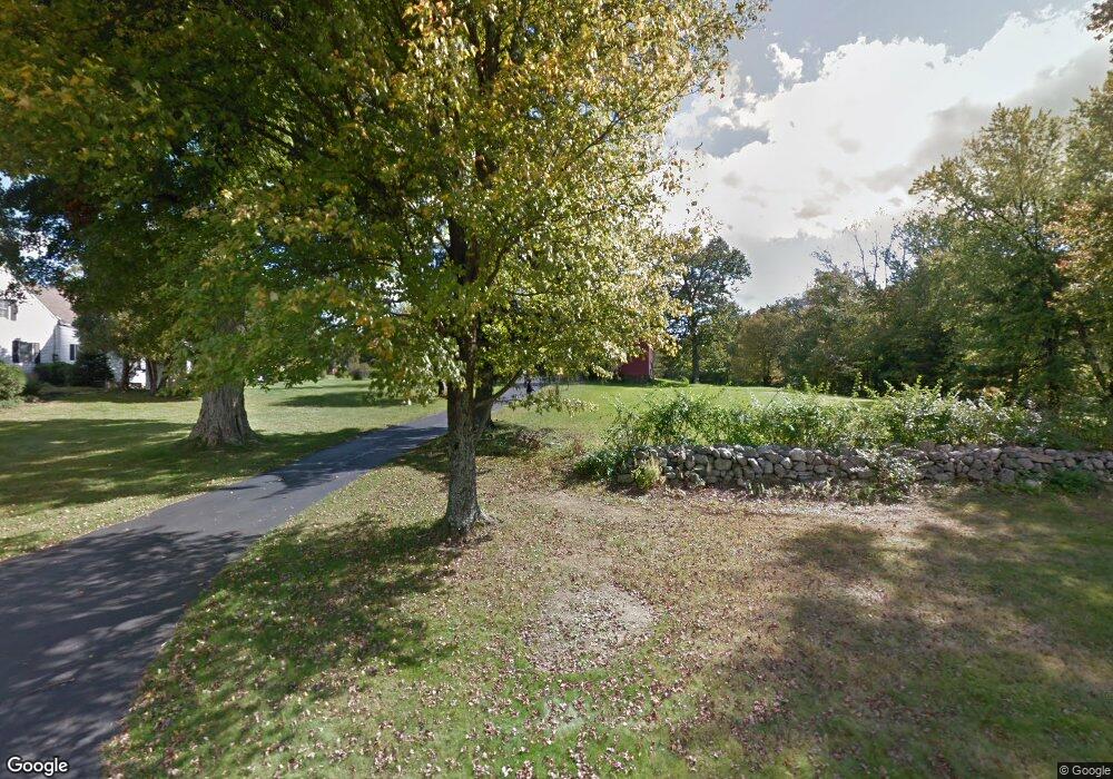
115 Bull Rd Harwinton, CT 06791
Estimated Value: $628,000 - $934,000
3
Beds
3
Baths
3,550
Sq Ft
$216/Sq Ft
Est. Value
About This Home
This home is located at 115 Bull Rd, Harwinton, CT 06791 and is currently estimated at $765,034, approximately $215 per square foot. 115 Bull Rd is a home located in Litchfield County with nearby schools including Harwinton Consolidated School, Har-Bur Middle School, and Lewis S. Mills High School.
Ownership History
Date
Name
Owned For
Owner Type
Purchase Details
Closed on
Jun 26, 2017
Sold by
Ferry Christine J and Ferry Maynard V
Bought by
Ferry Maynard V and Ferry Christine J
Current Estimated Value
Purchase Details
Closed on
Nov 27, 2012
Sold by
Ferry Maynard V and Ferry Christine
Bought by
Christine J Ferry Ret
Purchase Details
Closed on
Aug 12, 2009
Sold by
Ferry Maynard V and Ferry Christine
Bought by
Ferry Maynard and Ferry Christine
Purchase Details
Closed on
Feb 29, 1984
Bought by
Ferry Maynard and Ferry Christine J
Create a Home Valuation Report for This Property
The Home Valuation Report is an in-depth analysis detailing your home's value as well as a comparison with similar homes in the area
Home Values in the Area
Average Home Value in this Area
Purchase History
| Date | Buyer | Sale Price | Title Company |
|---|---|---|---|
| Ferry Maynard V | -- | -- | |
| Ferry Maynard V | -- | -- | |
| Christine J Ferry Ret | -- | -- | |
| Christine J Ferry Ret | -- | -- | |
| Ferry Maynard | -- | -- | |
| Ferry Maynard V | -- | -- | |
| Ferry Maynard | $210,000 | -- |
Source: Public Records
Mortgage History
| Date | Status | Borrower | Loan Amount |
|---|---|---|---|
| Previous Owner | Ferry Maynard | $65,000 |
Source: Public Records
Tax History Compared to Growth
Tax History
| Year | Tax Paid | Tax Assessment Tax Assessment Total Assessment is a certain percentage of the fair market value that is determined by local assessors to be the total taxable value of land and additions on the property. | Land | Improvement |
|---|---|---|---|---|
| 2024 | $9,669 | $422,230 | $124,150 | $298,080 |
| 2023 | $7,854 | $268,980 | $92,950 | $176,030 |
| 2022 | $7,666 | $268,980 | $92,950 | $176,030 |
| 2021 | $7,720 | $268,980 | $92,950 | $176,030 |
| 2020 | $6,936 | $247,720 | $71,690 | $176,030 |
| 2019 | $6,936 | $247,720 | $71,690 | $176,030 |
| 2018 | $8,452 | $301,870 | $121,480 | $180,390 |
| 2017 | $8,392 | $301,870 | $121,480 | $180,390 |
| 2016 | $8,392 | $301,870 | $121,480 | $180,390 |
| 2015 | $8,241 | $301,870 | $121,480 | $180,390 |
| 2014 | $8,120 | $301,870 | $121,480 | $180,390 |
Source: Public Records
Map
Nearby Homes
- 25 Plymouth Rd
- 28 Lily Pond Rd
- 83 Shingle Mill Rd
- 21 South Rd
- 18 Highview Dr
- 164 Birge Park Rd
- 0 Hill Rd Unit 24132154
- 0 Hill Rd Unit 24110331
- 74 Pine Ridge Dr
- 195 Catlin Rd Unit Map F3/04/0001
- 289 Woodchuck Ln
- 12 Break Maiden Ln
- 183 Wildcat Hill Rd
- 39 Orchard Hill Rd
- 29 Partridge Ln
- 92 Shafer Rd
- 66 Warren Glen
- 67 Warren Glen
- 23 Mountain Top Pass
- 530 Wildcat Hill Rd
