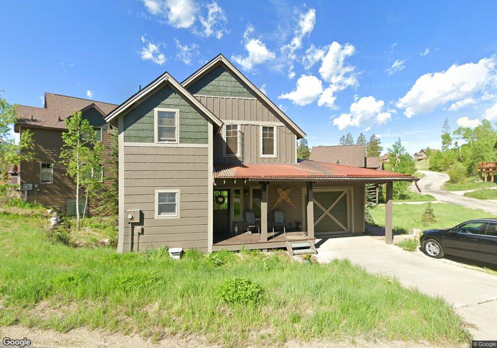
115 Campfire Ln Fraser, CO 80442
Estimated Value: $1,191,000 - $1,641,000
3
Beds
3
Baths
1,944
Sq Ft
$728/Sq Ft
Est. Value
About This Home
This home is located at 115 Campfire Ln, Fraser, CO 80442 and is currently estimated at $1,414,728, approximately $727 per square foot. 115 Campfire Ln is a home located in Grand County with nearby schools including Middle Park High School.
Ownership History
Date
Name
Owned For
Owner Type
Purchase Details
Closed on
Aug 16, 2018
Sold by
Fired Barbara M
Bought by
Ward Adam Joe and Ward Elizabeth Grant
Current Estimated Value
Home Financials for this Owner
Home Financials are based on the most recent Mortgage that was taken out on this home.
Original Mortgage
$524,250
Outstanding Balance
$451,473
Interest Rate
4.5%
Mortgage Type
New Conventional
Estimated Equity
$963,255
Purchase Details
Closed on
Jun 29, 2005
Sold by
Colonnade Resort Communities Llc
Bought by
Fried Barbara M
Home Financials for this Owner
Home Financials are based on the most recent Mortgage that was taken out on this home.
Original Mortgage
$71,450
Interest Rate
7.5%
Mortgage Type
Credit Line Revolving
Create a Home Valuation Report for This Property
The Home Valuation Report is an in-depth analysis detailing your home's value as well as a comparison with similar homes in the area
Home Values in the Area
Average Home Value in this Area
Purchase History
| Date | Buyer | Sale Price | Title Company |
|---|---|---|---|
| Ward Adam Joe | $699,000 | Land Title Guarantee Co | |
| Fried Barbara M | $479,000 | Land Title Guarantee Company |
Source: Public Records
Mortgage History
| Date | Status | Borrower | Loan Amount |
|---|---|---|---|
| Open | Ward Adam Joe | $524,250 | |
| Previous Owner | Fried Barbara M | $71,450 | |
| Previous Owner | Fried Barbara M | $359,650 |
Source: Public Records
Tax History
| Year | Tax Paid | Tax Assessment Tax Assessment Total Assessment is a certain percentage of the fair market value that is determined by local assessors to be the total taxable value of land and additions on the property. | Land | Improvement |
|---|---|---|---|---|
| 2025 | $7,167 | $84,870 | $20,380 | $64,490 |
| 2024 | $8,723 | $104,110 | $19,220 | $84,890 |
| 2023 | $8,723 | $104,110 | $19,220 | $84,890 |
| 2022 | $6,889 | $60,260 | $7,650 | $52,610 |
| 2021 | $7,001 | $61,990 | $7,870 | $54,120 |
| 2020 | $5,832 | $54,180 | $7,870 | $46,310 |
| 2019 | $5,756 | $54,180 | $7,870 | $46,310 |
| 2018 | $4,384 | $40,320 | $7,920 | $32,400 |
| 2017 | $4,581 | $40,320 | $7,920 | $32,400 |
| 2016 | $4,939 | $45,020 | $8,760 | $36,260 |
| 2015 | $4,464 | $45,020 | $8,760 | $36,260 |
| 2014 | $4,464 | $39,900 | $0 | $39,900 |
Source: Public Records
Map
Nearby Homes
- 57 Moffat Way
- 80 Pinecone Trail
- 50 Reunion Ct
- 9 Explorers Ave
- 15 Adventure Ave
- 466 Hi Country Dr Unit 109
- 35 Sunny Ridge Ln
- 99 Promontory Point
- 40 Journey Way
- 93 Promontory Point
- 411 Hi Country Dr Unit 16
- 83 Promontory Point
- 29 Kingfisher Point
- 77 Promontory Point
- 357 Hi Country Dr Unit 1
- 357 Hi Country Dr Unit 231
- 88 Wheeler Rd
- 115 Wheeler Rd
- 60 Wheeler Rd
- 66 Wheeler Rd
- 115 Campfire Ln
- 95 Campfire Ln
- 95 Campfire Ln
- 145 Campfire Ln
- 145 Campfire Ln
- 130 Campfire Ln
- 110 Campfire Ln
- 120 Campfire Ln
- 110 Campfire Ln
- 85 Campfire Ln
- 85 Campfire Ln
- 100 Campfire Ln
- 100 Campfire Ln
- 140 Campfire Ln
- 150 Campfire Ln
- 155 Campfire Ln
- 90 Campfire Ln
- 90 Campfire Ln
- 155 Campfire Ln
- 160 Campfire Ln
Your Personal Tour Guide
Ask me questions while you tour the home.