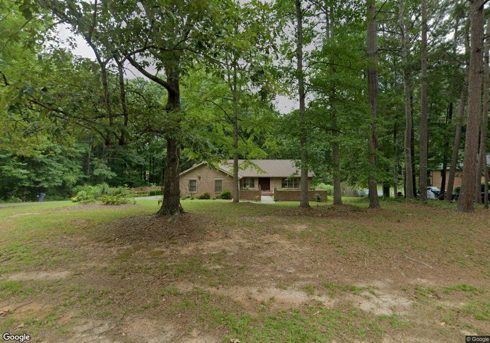
115 Cedar Cir Fayetteville, GA 30214
Estimated Value: $376,143 - $448,000
--
Bed
--
Bath
2,486
Sq Ft
$167/Sq Ft
Est. Value
About This Home
This home is located at 115 Cedar Cir, Fayetteville, GA 30214 and is currently estimated at $414,536, approximately $166 per square foot. 115 Cedar Cir is a home located in Fayette County with nearby schools including Bennett's Mill Middle School, Fayette County High School, and Rising Star Montessori School.
Ownership History
Date
Name
Owned For
Owner Type
Purchase Details
Closed on
May 19, 2003
Sold by
Shaw Richard E and Shaw Fellie M
Bought by
Brown Wanda L
Current Estimated Value
Home Financials for this Owner
Home Financials are based on the most recent Mortgage that was taken out on this home.
Original Mortgage
$174,600
Outstanding Balance
$75,885
Interest Rate
5.79%
Mortgage Type
New Conventional
Estimated Equity
$338,651
Purchase Details
Closed on
Aug 14, 2001
Sold by
Brunson Glen A
Bought by
Shaw Richard E and Shaw Fellie M
Home Financials for this Owner
Home Financials are based on the most recent Mortgage that was taken out on this home.
Original Mortgage
$176,700
Interest Rate
7.19%
Mortgage Type
New Conventional
Purchase Details
Closed on
Jul 25, 1995
Sold by
Bui Andy Trinh
Bought by
Brunson Glenn
Create a Home Valuation Report for This Property
The Home Valuation Report is an in-depth analysis detailing your home's value as well as a comparison with similar homes in the area
Home Values in the Area
Average Home Value in this Area
Purchase History
| Date | Buyer | Sale Price | Title Company |
|---|---|---|---|
| Brown Wanda L | $180,000 | -- | |
| Shaw Richard E | $186,000 | -- | |
| Brunson Glenn | $115,000 | -- |
Source: Public Records
Mortgage History
| Date | Status | Borrower | Loan Amount |
|---|---|---|---|
| Open | Brown Wanda L | $174,600 | |
| Previous Owner | Shaw Richard E | $176,700 | |
| Closed | Brunson Glenn | $0 |
Source: Public Records
Tax History Compared to Growth
Tax History
| Year | Tax Paid | Tax Assessment Tax Assessment Total Assessment is a certain percentage of the fair market value that is determined by local assessors to be the total taxable value of land and additions on the property. | Land | Improvement |
|---|---|---|---|---|
| 2024 | $1,520 | $156,584 | $25,600 | $130,984 |
| 2023 | $1,171 | $150,480 | $25,600 | $124,880 |
| 2022 | $1,536 | $141,280 | $25,600 | $115,680 |
| 2021 | $1,539 | $113,000 | $15,000 | $98,000 |
| 2020 | $1,854 | $101,600 | $15,000 | $86,600 |
| 2019 | $1,806 | $97,880 | $15,000 | $82,880 |
| 2018 | $1,712 | $91,960 | $15,000 | $76,960 |
| 2017 | $1,546 | $82,520 | $15,000 | $67,520 |
| 2016 | $1,855 | $64,880 | $15,000 | $49,880 |
| 2015 | $1,749 | $60,280 | $15,000 | $45,280 |
| 2014 | $1,624 | $55,360 | $15,000 | $40,360 |
| 2013 | -- | $52,400 | $0 | $0 |
Source: Public Records
Map
Nearby Homes
- 190 Rolison Way
- 150 Rolison Way
- 235 Rolison Way
- 170 Liberty Dr
- 150 Bartow St Unit LOT 5
- 140 Bartow St Unit LOT 4
- 130 Reese St
- 140 Rolison Way
- 560 Hawthorne Dr
- 145 Woodsong Dr
- 0 Highway 92 N Unit 10594507
- 0 Highway 92 N Unit 7570733
- 115 Westside Way
- 145 Heritage Way
- 230 White Rd
- E OF 118 Stanley Rd
- 585 Huddleston Rd
- 615 New Hope Rd
- 615 New Hope Rd Unit NO SUBDIVISION
- 671 Ginger Cake Rd
- 105 Cedar Cir
- 125 Cedar Cir
- 130 Cedar Cir
- 120 Cedar Cir
- 155 Cedar Cir
- 0 Cedar Cir Unit 8563092
- 0 Cedar Cir Unit 8406186
- 0 Cedar Cir Unit 8341388
- 0 Cedar Cir Unit 8094477
- 0 Cedar Cir Unit 8685080
- 0 Cedar Cir Unit 8148761
- 0 Cedar Cir Unit 8120532
- 0 Cedar Cir Unit 8085506
- 0 Cedar Cir Unit 8301548
- 0 Cedar Cir Unit 8162171
- 0 Cedar Cir Unit 3087645
- 0 Cedar Cir Unit 3276008
- 0 Cedar Cir Unit 7102524
- 0 Cedar Cir Unit 7113376
- 0 Cedar Cir Unit 7119805