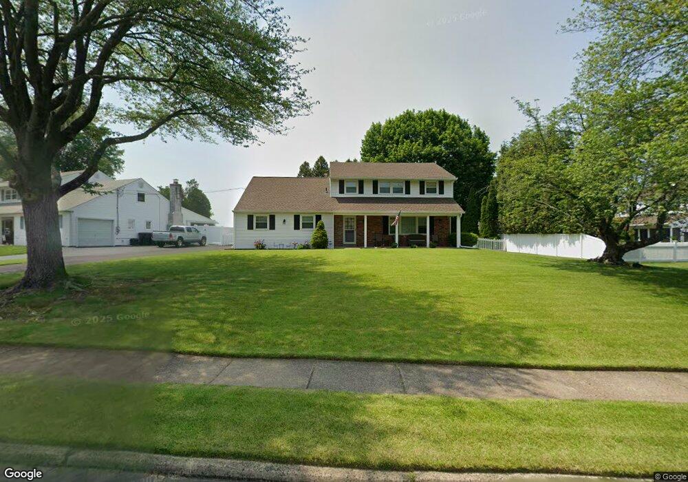
115 Charles Ln Hatboro, PA 19040
Estimated Value: $521,708 - $613,000
4
Beds
3
Baths
2,062
Sq Ft
$270/Sq Ft
Est. Value
About This Home
This home is located at 115 Charles Ln, Hatboro, PA 19040 and is currently estimated at $556,677, approximately $269 per square foot. 115 Charles Ln is a home located in Montgomery County with nearby schools including Hallowell Elementary School, Keith Valley Middle School, and Hatboro-Horsham Senior High School.
Ownership History
Date
Name
Owned For
Owner Type
Purchase Details
Closed on
Aug 9, 2013
Sold by
Owens Paul J
Bought by
Obrien Kevin and Obrien Amy
Current Estimated Value
Home Financials for this Owner
Home Financials are based on the most recent Mortgage that was taken out on this home.
Original Mortgage
$277,600
Outstanding Balance
$207,426
Interest Rate
4.51%
Mortgage Type
New Conventional
Estimated Equity
$349,251
Purchase Details
Closed on
Aug 23, 1999
Sold by
Owens Paul J
Bought by
Paul J Owens Tr and Owens Paul J
Create a Home Valuation Report for This Property
The Home Valuation Report is an in-depth analysis detailing your home's value as well as a comparison with similar homes in the area
Home Values in the Area
Average Home Value in this Area
Purchase History
| Date | Buyer | Sale Price | Title Company |
|---|---|---|---|
| Obrien Kevin | $347,000 | None Available | |
| Paul J Owens Tr | -- | None Available |
Source: Public Records
Mortgage History
| Date | Status | Borrower | Loan Amount |
|---|---|---|---|
| Open | Obrien Kevin | $277,600 |
Source: Public Records
Tax History Compared to Growth
Tax History
| Year | Tax Paid | Tax Assessment Tax Assessment Total Assessment is a certain percentage of the fair market value that is determined by local assessors to be the total taxable value of land and additions on the property. | Land | Improvement |
|---|---|---|---|---|
| 2025 | $6,106 | $155,300 | $48,170 | $107,130 |
| 2024 | $6,106 | $155,300 | $48,170 | $107,130 |
| 2023 | $5,811 | $155,300 | $48,170 | $107,130 |
| 2022 | $5,622 | $155,300 | $48,170 | $107,130 |
| 2021 | $5,489 | $155,300 | $48,170 | $107,130 |
| 2020 | $5,360 | $155,300 | $48,170 | $107,130 |
| 2019 | $5,257 | $155,300 | $48,170 | $107,130 |
| 2018 | $4,167 | $155,300 | $48,170 | $107,130 |
| 2017 | $5,022 | $155,300 | $48,170 | $107,130 |
| 2016 | $4,961 | $155,300 | $48,170 | $107,130 |
| 2015 | $4,738 | $155,300 | $48,170 | $107,130 |
| 2014 | $4,738 | $155,300 | $48,170 | $107,130 |
Source: Public Records
Map
Nearby Homes
- 204 Wilson Ave
- 890 Easton Rd
- 414 Watson Ave
- 604 Liberty Ridge Rd
- 616 Liberty Ridge Rd
- 603 Liberty Ridge Rd
- 605 Liberty Ridge Rd
- 607 Liberty Ridge Rd
- 611 Liberty Ridge Rd
- Faraday Plan at Liberty Ridge
- Westmont Plan at Liberty Ridge
- Northbrook Plan at Liberty Ridge
- 13 Eagle Ct
- 416 Aspen Ln
- 1309 Clyde Rd
- 125 Meetinghouse Rd
- 1274 Beverly Rd
- 1277 Beverly Rd
- 236 Oak Hill Dr
- 1130 Victoria Rd