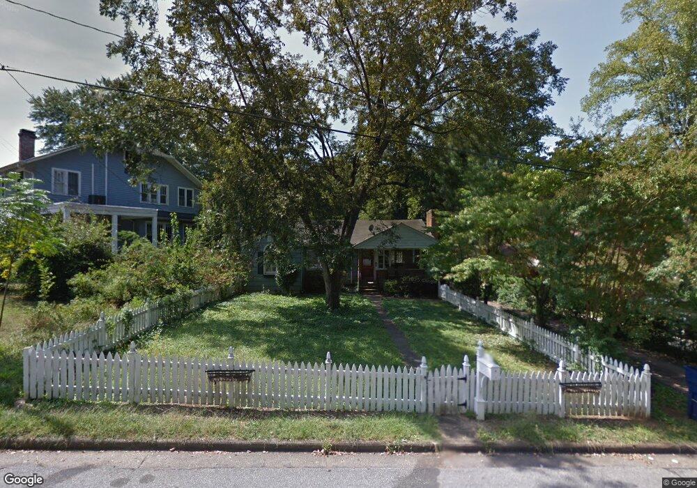
115 Cherokee Ave Athens, GA 30606
Five Points NeighborhoodEstimated Value: $607,306 - $807,000
3
Beds
2
Baths
1,428
Sq Ft
$483/Sq Ft
Est. Value
About This Home
This home is located at 115 Cherokee Ave, Athens, GA 30606 and is currently estimated at $689,327, approximately $482 per square foot. 115 Cherokee Ave is a home located in Clarke County with nearby schools including Barrow Elementary School, Clarke Middle School, and Clarke Central High School.
Ownership History
Date
Name
Owned For
Owner Type
Purchase Details
Closed on
Jun 30, 2020
Sold by
Atlanta Scholars Kollel Inc
Bought by
Md8594 Llc
Current Estimated Value
Purchase Details
Closed on
Jun 1, 2009
Sold by
Gelbtuch Stuart
Bought by
Atlanta Kollel Inc
Purchase Details
Closed on
Aug 2, 2004
Sold by
Moree Melissa S
Bought by
Gelbtuch Stuart
Purchase Details
Closed on
Mar 22, 2002
Sold by
Sinkwich Frank
Bought by
Moree Melissa S
Purchase Details
Closed on
Apr 11, 2001
Sold by
Breedlove Pamela D
Bought by
Sinkwich Frank
Create a Home Valuation Report for This Property
The Home Valuation Report is an in-depth analysis detailing your home's value as well as a comparison with similar homes in the area
Home Values in the Area
Average Home Value in this Area
Purchase History
| Date | Buyer | Sale Price | Title Company |
|---|---|---|---|
| Md8594 Llc | $318,000 | -- | |
| Atlanta Kollel Inc | -- | -- | |
| Gelbtuch Stuart | $269,000 | -- | |
| Moree Melissa S | $216,500 | -- | |
| Sinkwich Frank | $230,000 | -- |
Source: Public Records
Tax History Compared to Growth
Tax History
| Year | Tax Paid | Tax Assessment Tax Assessment Total Assessment is a certain percentage of the fair market value that is determined by local assessors to be the total taxable value of land and additions on the property. | Land | Improvement |
|---|---|---|---|---|
| 2025 | $5,448 | $175,474 | $80,000 | $95,474 |
| 2024 | $5,284 | $169,079 | $74,000 | $95,079 |
| 2023 | $5,284 | $166,908 | $74,000 | $92,908 |
| 2022 | $4,635 | $145,299 | $70,000 | $75,299 |
| 2021 | $4,287 | $148,474 | $70,000 | $78,474 |
| 2020 | $5,241 | $155,526 | $70,000 | $85,526 |
| 2019 | $5,087 | $150,040 | $70,000 | $80,040 |
| 2018 | $0 | $134,082 | $70,000 | $64,082 |
| 2017 | $4,340 | $127,848 | $70,000 | $57,848 |
| 2016 | -- | $122,362 | $70,000 | $52,362 |
| 2015 | -- | $109,869 | $60,000 | $49,869 |
| 2014 | -- | $107,195 | $54,000 | $53,195 |
Source: Public Records
Map
Nearby Homes
- 495 Woodlawn Ave
- 997 S Milledge Ave Unit 2
- 997 S Milledge Ave Unit 3
- 997 S Milledge Ave Unit 1
- 997 S Milledge Ave Unit 4
- 275 Westview Dr
- 490 Mcwhorter Dr
- 2019 S Lumpkin St
- 577 W Cloverhurst Ave
- 221 University Dr
- 183 Parkway Dr
- 590 Highland Ave
- 265 Springdale St
- 104 W Lake Ct
- 338 Springdale St
- 490 Ofarrell St
- 1697 S Milledge Ave
- 169 Fortson Cir
- 589 W Lake Dr
- 204 Gran Ellen Dr
- 300 Milledge Cir
- 121 Cherokee Ave
- 124 Cherokee Ave
- 340 Milledge Cir
- 183 Cherokee Ave
- 159 Catawba Ave
- 285 - 287 Milledge Cir
- 290.5 Milledge Cir
- 285 Milledge Cir
- 290 Milledge Cir
- 344 Milledge Cir
- 161 Catawba Ave
- 295 Milledge Cir
- 165 Catawba Ave
- 275 Milledge Cir
- 250 Milledge Cir
- 354 Milledge Cir
- 263 Milledge Cir
- 225 Cherokee Ave