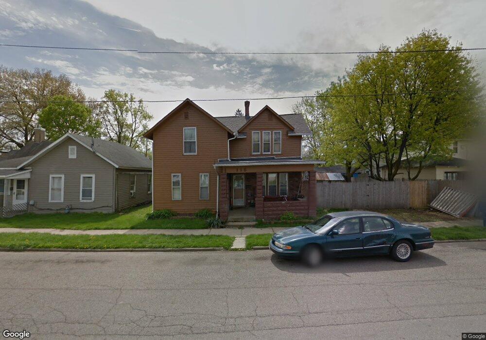
115 Chestnut St Newark, OH 43055
Estimated Value: $155,000 - $198,000
4
Beds
1
Bath
1,426
Sq Ft
$120/Sq Ft
Est. Value
About This Home
This home is located at 115 Chestnut St, Newark, OH 43055 and is currently estimated at $170,952, approximately $119 per square foot. 115 Chestnut St is a home located in Licking County with nearby schools including John Clem Elementary School, Liberty Middle School, and Newark High School.
Ownership History
Date
Name
Owned For
Owner Type
Purchase Details
Closed on
Oct 11, 2003
Sold by
Montgomery Thomas J
Bought by
Montgomery Thomas J and Lease Alma
Current Estimated Value
Home Financials for this Owner
Home Financials are based on the most recent Mortgage that was taken out on this home.
Original Mortgage
$73,100
Outstanding Balance
$34,160
Interest Rate
6.23%
Mortgage Type
Purchase Money Mortgage
Estimated Equity
$136,792
Purchase Details
Closed on
Dec 9, 1998
Sold by
Fleet Finance Inc
Bought by
Montgomery Thomas J
Create a Home Valuation Report for This Property
The Home Valuation Report is an in-depth analysis detailing your home's value as well as a comparison with similar homes in the area
Home Values in the Area
Average Home Value in this Area
Purchase History
| Date | Buyer | Sale Price | Title Company |
|---|---|---|---|
| Montgomery Thomas J | -- | First Class Title Agency | |
| Montgomery Thomas J | $53,500 | -- |
Source: Public Records
Mortgage History
| Date | Status | Borrower | Loan Amount |
|---|---|---|---|
| Open | Montgomery Thomas J | $73,100 |
Source: Public Records
Tax History
| Year | Tax Paid | Tax Assessment Tax Assessment Total Assessment is a certain percentage of the fair market value that is determined by local assessors to be the total taxable value of land and additions on the property. | Land | Improvement |
|---|---|---|---|---|
| 2024 | $1,045 | $39,000 | $9,140 | $29,860 |
| 2023 | $1,066 | $39,000 | $9,140 | $29,860 |
| 2022 | $819 | $29,090 | $5,110 | $23,980 |
| 2021 | $859 | $29,090 | $5,110 | $23,980 |
| 2020 | $879 | $29,090 | $5,110 | $23,980 |
| 2019 | $628 | $22,720 | $4,270 | $18,450 |
| 2018 | $628 | $0 | $0 | $0 |
| 2017 | $611 | $0 | $0 | $0 |
| 2016 | $607 | $0 | $0 | $0 |
| 2015 | $620 | $0 | $0 | $0 |
| 2014 | $656 | $0 | $0 | $0 |
| 2013 | $1,739 | $0 | $0 | $0 |
Source: Public Records
Map
Nearby Homes
- 99 Hoover St
- 210 Buckingham St
- 207 Buckingham St
- 191 Elmwood Ave
- 214-218 Hudson Ave
- 242 Hudson Ave
- 69 Wallace St
- 12 E Saint Clair St
- 218 Granville St
- 185 N 10th St
- 355 Eddy St
- 311 Clinton St
- 122 W Shields St
- 27 W North St
- 293 Merchant St
- 441 Mount Vernon Rd
- 385 Woods Ave
- 39 S 6th St
- 361 Granville St
- 45 S 6th St
- 113 Chestnut St
- 220 Buckingham St
- 226 Buckingham St
- 216 Buckingham St
- 109 Chestnut St
- 126 Chestnut St
- 118 Chestnut St
- 101 Chestnut St
- 112 Chestnut St
- 104 Chestnut St
- 208 Buckingham St
- 100 Chestnut St
- 100 Chestnut St Unit 100/102
- 100 Chestnut St
- 240 Buckingham St
- 102 Chestnut St
- 69 Pearl St
- 204 Buckingham St
- 246 Buckingham St
- 59 Pearl St
Your Personal Tour Guide
Ask me questions while you tour the home.