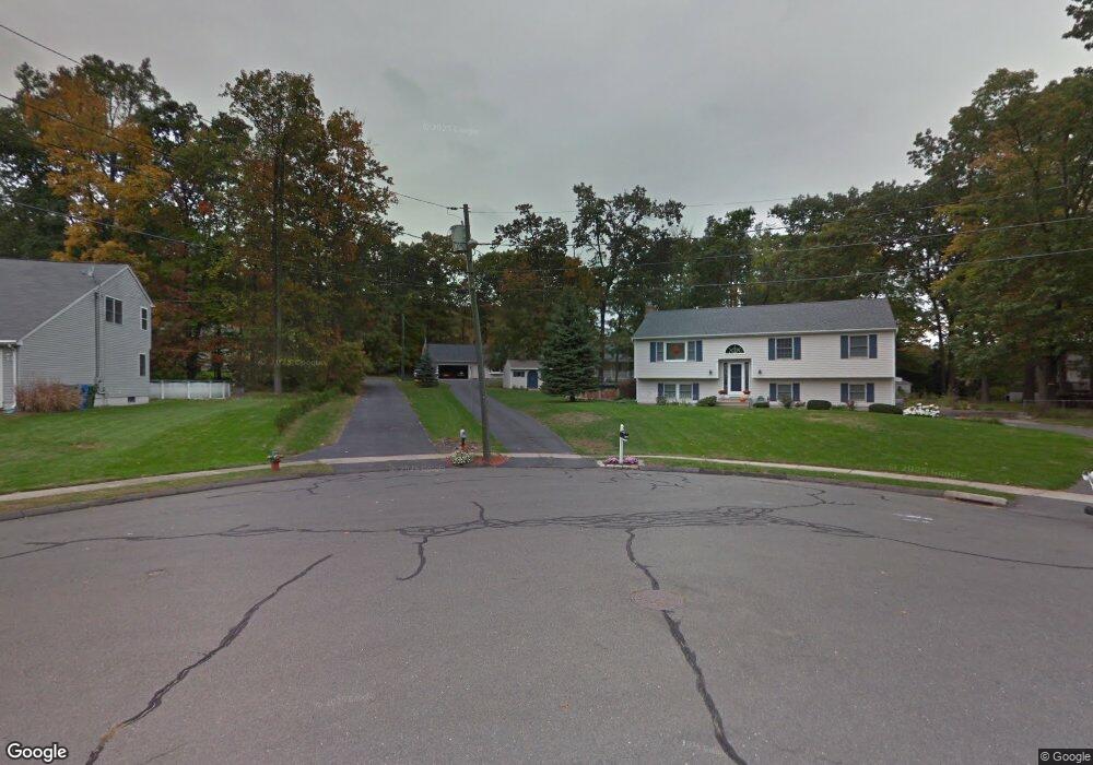
115 Deer Park Rd Bristol, CT 06010
North Bristol NeighborhoodEstimated Value: $368,000 - $417,000
3
Beds
3
Baths
1,182
Sq Ft
$333/Sq Ft
Est. Value
About This Home
This home is located at 115 Deer Park Rd, Bristol, CT 06010 and is currently estimated at $393,762, approximately $333 per square foot. 115 Deer Park Rd is a home located in Hartford County with nearby schools including Ivy Drive School, Northeast Middle School, and Bristol Eastern High School.
Ownership History
Date
Name
Owned For
Owner Type
Purchase Details
Closed on
Nov 30, 2006
Sold by
Bouchard Raymond R and Bouchard Sarah L
Bought by
Mayhew Eric K
Current Estimated Value
Home Financials for this Owner
Home Financials are based on the most recent Mortgage that was taken out on this home.
Original Mortgage
$209,600
Outstanding Balance
$122,430
Interest Rate
6.36%
Estimated Equity
$271,332
Purchase Details
Closed on
Oct 7, 1993
Sold by
Tabacco & Son Bldrs
Bought by
Bouchard Raymond R and Bouchard Sarah L
Home Financials for this Owner
Home Financials are based on the most recent Mortgage that was taken out on this home.
Original Mortgage
$137,700
Interest Rate
6.9%
Mortgage Type
Unknown
Create a Home Valuation Report for This Property
The Home Valuation Report is an in-depth analysis detailing your home's value as well as a comparison with similar homes in the area
Home Values in the Area
Average Home Value in this Area
Purchase History
| Date | Buyer | Sale Price | Title Company |
|---|---|---|---|
| Mayhew Eric K | $262,000 | -- | |
| Bouchard Raymond R | $145,830 | -- |
Source: Public Records
Mortgage History
| Date | Status | Borrower | Loan Amount |
|---|---|---|---|
| Open | Bouchard Raymond R | $209,600 | |
| Previous Owner | Bouchard Raymond R | $166,757 | |
| Previous Owner | Bouchard Raymond R | $150,000 | |
| Previous Owner | Bouchard Raymond R | $137,700 |
Source: Public Records
Tax History
| Year | Tax Paid | Tax Assessment Tax Assessment Total Assessment is a certain percentage of the fair market value that is determined by local assessors to be the total taxable value of land and additions on the property. | Land | Improvement |
|---|---|---|---|---|
| 2025 | $6,922 | $205,100 | $54,390 | $150,710 |
| 2024 | $6,463 | $202,930 | $54,390 | $148,540 |
| 2023 | $6,159 | $202,930 | $54,390 | $148,540 |
| 2022 | $5,503 | $143,500 | $37,800 | $105,700 |
| 2021 | $5,503 | $143,500 | $37,800 | $105,700 |
| 2020 | $5,503 | $143,500 | $37,800 | $105,700 |
| 2019 | $5,460 | $143,500 | $37,800 | $105,700 |
| 2018 | $5,292 | $143,500 | $37,800 | $105,700 |
| 2017 | $5,115 | $141,960 | $53,970 | $87,990 |
| 2016 | $5,115 | $141,960 | $53,970 | $87,990 |
| 2015 | $4,913 | $141,960 | $53,970 | $87,990 |
| 2014 | $4,913 | $141,960 | $53,970 | $87,990 |
Source: Public Records
Map
Nearby Homes
- 35 Jasmine St
- 104 Driftwood Rd
- 97 Jacqueline Dr
- 25 Sheffield Ln
- 3 Sandra St
- 1325 Farmington Ave Unit 52
- 84 Glen Eagle Dr
- 1469 Farmington Ave Unit 56
- 79 Beths Ave Unit 100
- 55 Beths Ave Unit 77
- 941 Farmington Ave
- 1004 Jerome Ave
- 81 Lancaster Rd
- 20 Westchester Dr
- 15 Cardinal Dr Unit 15
- 169 Morningside Dr E
- 36 Maxine Rd
- 206 Burton St
- 32 Farmington Chase Crescent Unit 32
- 179 Mark St
Your Personal Tour Guide
Ask me questions while you tour the home.