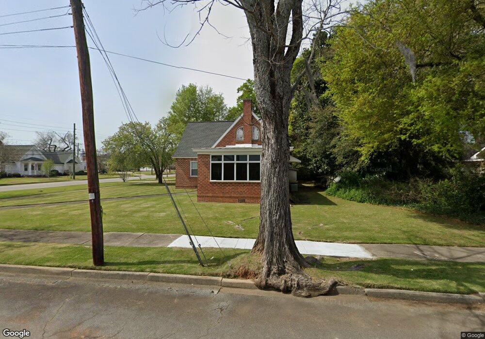
115 E 7th St Louisville, GA 30434
Estimated Value: $133,000 - $253,191
--
Bed
--
Bath
2,304
Sq Ft
$82/Sq Ft
Est. Value
About This Home
This home is located at 115 E 7th St, Louisville, GA 30434 and is currently estimated at $189,798, approximately $82 per square foot. 115 E 7th St is a home with nearby schools including Jefferson County High School and Thomas Jefferson Academy.
Ownership History
Date
Name
Owned For
Owner Type
Purchase Details
Closed on
Mar 2, 2017
Sold by
Brown Patrick M
Bought by
Queensborough National Bank
Current Estimated Value
Purchase Details
Closed on
Jun 19, 2007
Sold by
Louisville Storage & Loa
Bought by
Brown Patrick M
Home Financials for this Owner
Home Financials are based on the most recent Mortgage that was taken out on this home.
Original Mortgage
$80,456
Interest Rate
6.35%
Mortgage Type
New Conventional
Purchase Details
Closed on
Feb 13, 2007
Sold by
Romer Lee L
Bought by
Louisville Storage & Loan Co
Create a Home Valuation Report for This Property
The Home Valuation Report is an in-depth analysis detailing your home's value as well as a comparison with similar homes in the area
Home Values in the Area
Average Home Value in this Area
Purchase History
| Date | Buyer | Sale Price | Title Company |
|---|---|---|---|
| Queensborough National Bank | $122,956 | -- | |
| Brown Patrick M | $53,000 | -- | |
| Louisville Storage & Loan Co | $53,000 | -- |
Source: Public Records
Mortgage History
| Date | Status | Borrower | Loan Amount |
|---|---|---|---|
| Previous Owner | Brown Patrick M | $80,456 |
Source: Public Records
Tax History Compared to Growth
Tax History
| Year | Tax Paid | Tax Assessment Tax Assessment Total Assessment is a certain percentage of the fair market value that is determined by local assessors to be the total taxable value of land and additions on the property. | Land | Improvement |
|---|---|---|---|---|
| 2024 | $1,043 | $27,436 | $2,900 | $24,536 |
| 2023 | $1,065 | $26,026 | $2,900 | $23,126 |
| 2022 | $708 | $22,590 | $2,900 | $19,690 |
| 2021 | $756 | $23,139 | $2,900 | $20,239 |
| 2020 | $766 | $23,362 | $2,900 | $20,462 |
| 2019 | $774 | $23,188 | $2,900 | $20,288 |
| 2018 | $800 | $23,558 | $2,900 | $20,658 |
| 2017 | $812 | $23,866 | $2,900 | $20,966 |
| 2016 | $746 | $24,143 | $2,900 | $21,243 |
| 2015 | -- | $23,746 | $2,900 | $20,846 |
| 2014 | -- | $24,937 | $2,900 | $22,037 |
| 2013 | -- | $25,031 | $2,900 | $22,131 |
Source: Public Records
Map
Nearby Homes
- 802 Mulberry St
- 716 Screven St
- 0000 Pine St
- 311 E Broad St
- 818 Walnut St
- 0 Georgia 24
- 401 W Broad St
- 470 Forrest Dr
- 836 Mimosa Dr
- 0 Laurel Dr
- 605 Midville Rd
- * U S Route 1
- 315 Forest St
- 0 Middle Ground Rd Unit 540363
- 0 Middle Ground Rd Unit 10497061
- 0 N Highway 1 Unit 10595910
- 0 N Highway 1 Unit 7642159
- 1052 Fairlane Dr
- 1163 Fairlane Dr
- 1341 Ga Highway 171 N