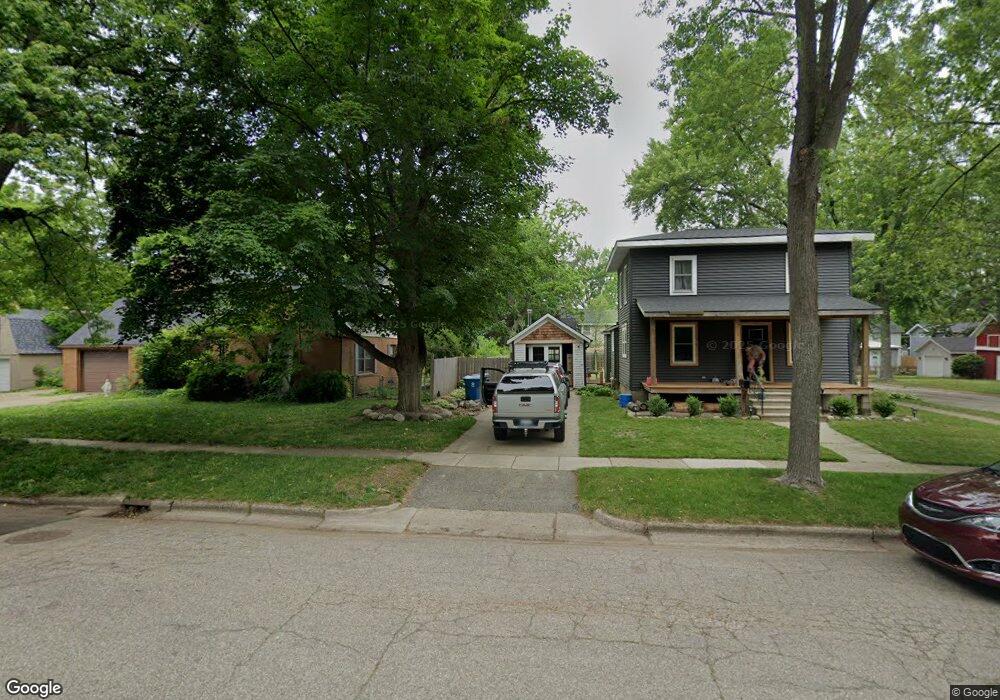
115 E Plainwell St Plainwell, MI 49080
Estimated Value: $256,663 - $310,000
3
Beds
1
Bath
2,320
Sq Ft
$121/Sq Ft
Est. Value
About This Home
This home is located at 115 E Plainwell St, Plainwell, MI 49080 and is currently estimated at $279,666, approximately $120 per square foot. 115 E Plainwell St is a home located in Allegan County with nearby schools including Plainwell High School and Otsego Christian Academy.
Ownership History
Date
Name
Owned For
Owner Type
Purchase Details
Closed on
Jun 22, 2016
Sold by
Kortes Barbara E
Bought by
Bevins Eric and Bevins Shawntell
Current Estimated Value
Home Financials for this Owner
Home Financials are based on the most recent Mortgage that was taken out on this home.
Original Mortgage
$128,000
Outstanding Balance
$102,106
Interest Rate
3.64%
Mortgage Type
VA
Estimated Equity
$177,560
Create a Home Valuation Report for This Property
The Home Valuation Report is an in-depth analysis detailing your home's value as well as a comparison with similar homes in the area
Home Values in the Area
Average Home Value in this Area
Purchase History
| Date | Buyer | Sale Price | Title Company |
|---|---|---|---|
| Bevins Eric | $125,000 | Devon Title Agency |
Source: Public Records
Mortgage History
| Date | Status | Borrower | Loan Amount |
|---|---|---|---|
| Open | Bevins Eric | $128,000 |
Source: Public Records
Tax History
| Year | Tax Paid | Tax Assessment Tax Assessment Total Assessment is a certain percentage of the fair market value that is determined by local assessors to be the total taxable value of land and additions on the property. | Land | Improvement |
|---|---|---|---|---|
| 2025 | $4,040 | $136,800 | $21,200 | $115,600 |
| 2024 | $3,662 | $125,600 | $18,900 | $106,700 |
| 2023 | $3,725 | $105,800 | $16,800 | $89,000 |
| 2022 | $3,662 | $93,800 | $14,200 | $79,600 |
| 2021 | $3,969 | $86,300 | $12,800 | $73,500 |
| 2020 | $3,471 | $80,600 | $11,000 | $69,600 |
| 2019 | $3,148 | $72,600 | $9,800 | $62,800 |
| 2018 | $0 | $74,200 | $11,000 | $63,200 |
| 2017 | $0 | $73,400 | $9,900 | $63,500 |
| 2016 | $0 | $70,400 | $8,500 | $61,900 |
| 2015 | -- | $70,400 | $8,500 | $61,900 |
| 2014 | -- | $59,000 | $8,300 | $50,700 |
| 2013 | -- | $57,400 | $8,300 | $49,100 |
Source: Public Records
Map
Nearby Homes
- 404 Park St
- 936 James St
- V/L Bronson Ave
- 551 W Bridge St
- 721 E Bridge St
- 1046 Bronson Ave
- 140 W 1st Ave
- 320 S Sunset St
- 355 12th St
- 1224 102nd Ave
- 830 Miller Rd Unit 26.98 Acres
- 1248 Keith St
- 10809 N 12th St
- 323 13th St
- V/L N 12th St
- 4613 W Ab Ave
- 1038 Allen Ct
- 575 Rushing Dr
- 1006 Goodsell St
- 909 Barton St
- 117 E Plainwell St
- 415 S Main St
- 415 S Main St Unit 415 S Main St. Lower
- 415 S Main St Unit 415 S Main St. Upper
- 421 S Main St
- 408 S Anderson St
- 112 E Hill St
- 409 S Main St
- 116 E Hill St
- 421 S Anderson St
- 112 E Plainwell St
- 116 E Plainwell St
- 503 S Main St
- 142 S Main St
- 202 E Plainwell St
- 403 S Main St
- 209 E Plainwell St
- 509 S Main St
- 204 E Hill St
- 208 E Hill St
Your Personal Tour Guide
Ask me questions while you tour the home.