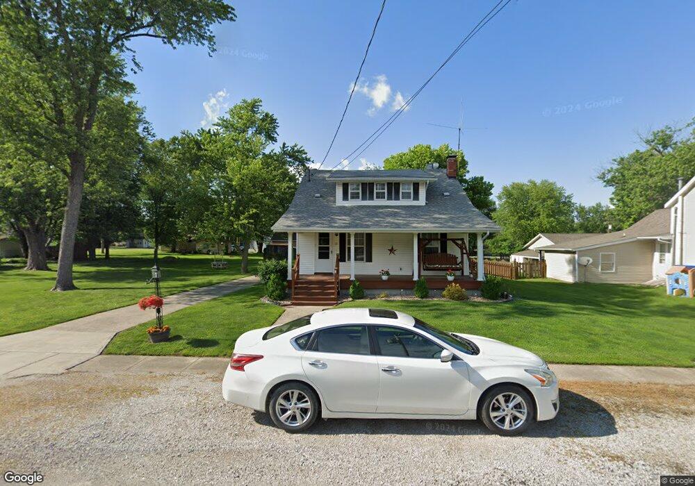
115 E Plum St Brighton, IL 62012
Estimated Value: $130,682 - $195,000
Studio
--
Bath
--
Sq Ft
8,712
Sq Ft Lot
About This Home
This home is located at 115 E Plum St, Brighton, IL 62012 and is currently estimated at $164,921. 115 E Plum St is a home located in Macoupin County with nearby schools including Southwestern High School.
Ownership History
Date
Name
Owned For
Owner Type
Purchase Details
Closed on
Sep 27, 2013
Sold by
Davis Sandra
Bought by
Davis Sandra and Robinson Leigha
Current Estimated Value
Purchase Details
Closed on
Feb 8, 2013
Sold by
Davis Sandra F and Robinson Leigham M
Bought by
Davis Sandra F
Home Financials for this Owner
Home Financials are based on the most recent Mortgage that was taken out on this home.
Original Mortgage
$41,604
Interest Rate
3.38%
Mortgage Type
Purchase Money Mortgage
Purchase Details
Closed on
Jul 29, 1999
Bought by
Davis Sandra F and Robinson Leigha M
Create a Home Valuation Report for This Property
The Home Valuation Report is an in-depth analysis detailing your home's value as well as a comparison with similar homes in the area
Home Values in the Area
Average Home Value in this Area
Purchase History
| Date | Buyer | Sale Price | Title Company |
|---|---|---|---|
| Davis Sandra | -- | -- | |
| Davis Sandra F | -- | -- | |
| Davis Sandra F | -- | -- |
Source: Public Records
Mortgage History
| Date | Status | Borrower | Loan Amount |
|---|---|---|---|
| Previous Owner | Davis Sandra F | $41,604 |
Source: Public Records
Tax History
| Year | Tax Paid | Tax Assessment Tax Assessment Total Assessment is a certain percentage of the fair market value that is determined by local assessors to be the total taxable value of land and additions on the property. | Land | Improvement |
|---|---|---|---|---|
| 2024 | $1,451 | $46,075 | $4,499 | $41,576 |
| 2023 | $1,533 | $42,662 | $4,166 | $38,496 |
| 2022 | $1,533 | $39,871 | $3,893 | $35,978 |
| 2021 | $1,666 | $53,193 | $3,638 | $49,555 |
| 2020 | $1,658 | $52,449 | $3,567 | $48,882 |
| 2019 | $1,761 | $34,464 | $3,365 | $31,099 |
| 2018 | $1,734 | $34,464 | $0 | $0 |
| 2017 | $1,813 | $32,331 | $3,157 | $29,174 |
| 2016 | $1,783 | $32,331 | $3,157 | $29,174 |
| 2015 | $1,827 | $32,331 | $3,157 | $29,174 |
| 2014 | $1,740 | $32,331 | $3,157 | $29,174 |
| 2013 | $1,699 | $32,331 | $3,157 | $29,174 |
Source: Public Records
Map
Nearby Homes
- 107 Park St
- 207 South St
- 109 Spruce Ct
- 205 Jersey St
- 207 W Vine St
- 0 W County Line Rd Unit Tract 4
- 0 W County Line Rd Unit Tract 2
- 3305 Brown Rd
- 10 Austin Ct
- Tbd County Line Rd
- Tbd County Line Rd
- Tbd County Line Rd
- 34113 Canoe Ct
- 34150 Teakwood Place
- 34105 Teakwood Place
- 16677 Oak Bridge Rd
- 0 Lageman Ln Unit MAR25022629
- 31899 Red Oak Dr
- 15964 Lageman Ln
- 32952 Crystal Lake Rd
Your Personal Tour Guide
Ask me questions while you tour the home.