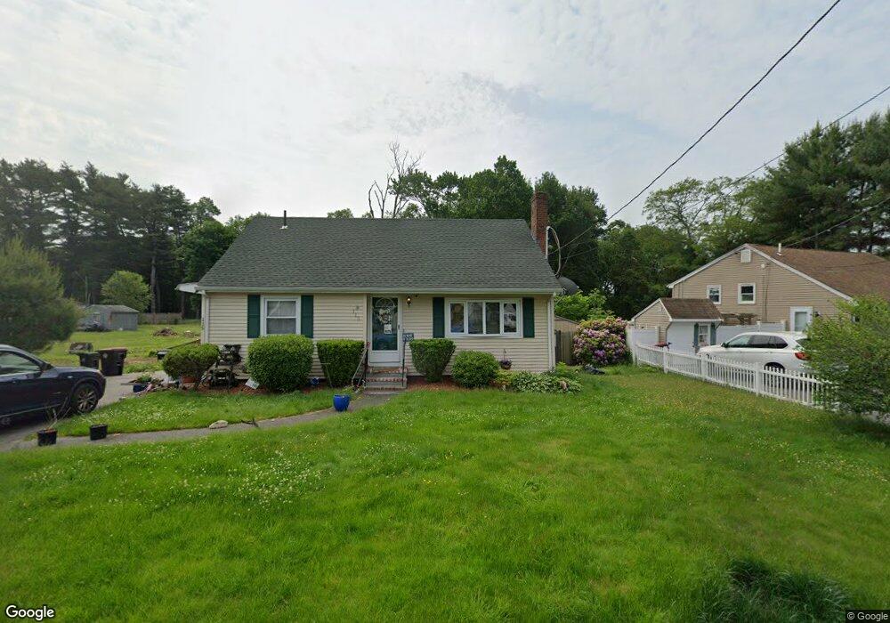
115 Edson St Brockton, MA 02302
Estimated Value: $489,000 - $503,000
3
Beds
1
Bath
968
Sq Ft
$511/Sq Ft
Est. Value
About This Home
This home is located at 115 Edson St, Brockton, MA 02302 and is currently estimated at $494,339, approximately $510 per square foot. 115 Edson St is a home located in Plymouth County with nearby schools including Davis K-8 School, John F. Kennedy Elementary School, and South Middle School.
Ownership History
Date
Name
Owned For
Owner Type
Purchase Details
Closed on
Jul 31, 2008
Sold by
Jacobs Kalise D
Bought by
Federal National Mortgage Association
Current Estimated Value
Purchase Details
Closed on
Jan 7, 2005
Sold by
Viel Marie J
Bought by
Jacobs Kalise D
Home Financials for this Owner
Home Financials are based on the most recent Mortgage that was taken out on this home.
Original Mortgage
$277,000
Interest Rate
5.75%
Mortgage Type
Purchase Money Mortgage
Purchase Details
Closed on
May 3, 1999
Sold by
Kuskoski Cheste E
Bought by
Kuskoski Chester E
Purchase Details
Closed on
Apr 26, 1993
Sold by
Fhlmc
Bought by
Kusoski Chester E
Purchase Details
Closed on
Mar 9, 1992
Sold by
Hopkins Debra
Bought by
Citicorp Mtg Inc
Purchase Details
Closed on
Dec 6, 1989
Sold by
Jackson Precious
Bought by
Hopkins Debra A
Create a Home Valuation Report for This Property
The Home Valuation Report is an in-depth analysis detailing your home's value as well as a comparison with similar homes in the area
Home Values in the Area
Average Home Value in this Area
Purchase History
| Date | Buyer | Sale Price | Title Company |
|---|---|---|---|
| Federal National Mortgage Association | $307,532 | -- | |
| Jacobs Kalise D | $277,000 | -- | |
| Kuskoski Chester E | $110,000 | -- | |
| Kusoski Chester E | $74,900 | -- | |
| Citicorp Mtg Inc | $90,492 | -- | |
| Hopkins Debra A | $122,500 | -- |
Source: Public Records
Mortgage History
| Date | Status | Borrower | Loan Amount |
|---|---|---|---|
| Previous Owner | Hopkins Debra A | $277,000 | |
| Previous Owner | Hopkins Debra A | $239,310 |
Source: Public Records
Tax History Compared to Growth
Tax History
| Year | Tax Paid | Tax Assessment Tax Assessment Total Assessment is a certain percentage of the fair market value that is determined by local assessors to be the total taxable value of land and additions on the property. | Land | Improvement |
|---|---|---|---|---|
| 2025 | $5,136 | $424,100 | $159,800 | $264,300 |
| 2024 | $4,843 | $402,900 | $159,800 | $243,100 |
| 2023 | $4,565 | $351,700 | $110,100 | $241,600 |
| 2022 | $4,624 | $331,000 | $100,100 | $230,900 |
| 2021 | $4,157 | $286,700 | $92,800 | $193,900 |
| 2020 | $3,986 | $263,100 | $81,500 | $181,600 |
| 2019 | $4,171 | $268,400 | $77,700 | $190,700 |
| 2018 | $3,572 | $222,400 | $77,700 | $144,700 |
| 2017 | $3,410 | $211,800 | $77,700 | $134,100 |
| 2016 | $3,113 | $179,300 | $74,100 | $105,200 |
| 2015 | $2,997 | $165,100 | $74,100 | $91,000 |
| 2014 | $2,928 | $161,500 | $74,100 | $87,400 |
Source: Public Records
Map
Nearby Homes
- 28 Wallace St
- 34 Carl Ave
- 112 Hillside Ave
- 12 Paulin Ave
- 44 Baker St
- 16 Yuba Cir
- 54 Ferris Ave
- 74 Oakland St
- 229 Sinclair Rd
- 70 Carlisle St
- 221 Sinclair Rd
- 34 Oakland St
- 265 Summer St
- 597 East St
- 24 Ithica Rd
- 163 S Leyden St
- 122 Sinclair Rd
- 45 Thatcher St
- 223 Clinton St Unit 10
- 223 Clinton St Unit 3