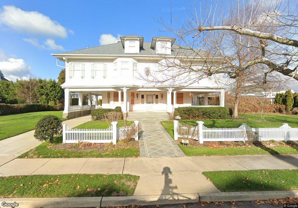
115 Elberon Ave Allenhurst, NJ 07711
Estimated Value: $4,314,000 - $5,795,223
8
Beds
5
Baths
5,528
Sq Ft
$952/Sq Ft
Est. Value
About This Home
This home is located at 115 Elberon Ave, Allenhurst, NJ 07711 and is currently estimated at $5,260,056, approximately $951 per square foot. 115 Elberon Ave is a home located in Monmouth County with nearby schools including Hope Academy Charter School, St. Mary of the Assumption School, and Our Lady of Mount Carmel School.
Ownership History
Date
Name
Owned For
Owner Type
Purchase Details
Closed on
Oct 13, 2025
Sold by
Russo Steven
Bought by
115 Elberon Ave Llc
Current Estimated Value
Home Financials for this Owner
Home Financials are based on the most recent Mortgage that was taken out on this home.
Original Mortgage
$6,300,000
Outstanding Balance
$6,292,774
Interest Rate
5.25%
Mortgage Type
New Conventional
Estimated Equity
-$1,032,718
Purchase Details
Closed on
Jun 19, 2003
Sold by
Sims Charles
Bought by
Russo Steven
Home Financials for this Owner
Home Financials are based on the most recent Mortgage that was taken out on this home.
Original Mortgage
$1,000,000
Interest Rate
5.53%
Create a Home Valuation Report for This Property
The Home Valuation Report is an in-depth analysis detailing your home's value as well as a comparison with similar homes in the area
Home Values in the Area
Average Home Value in this Area
Purchase History
| Date | Buyer | Sale Price | Title Company |
|---|---|---|---|
| 115 Elberon Ave Llc | $9,000,000 | First American Title Insurance | |
| Russo Steven | $2,100,000 | -- |
Source: Public Records
Mortgage History
| Date | Status | Borrower | Loan Amount |
|---|---|---|---|
| Open | 115 Elberon Ave Llc | $6,300,000 | |
| Previous Owner | Russo Steven | $1,000,000 |
Source: Public Records
Tax History Compared to Growth
Tax History
| Year | Tax Paid | Tax Assessment Tax Assessment Total Assessment is a certain percentage of the fair market value that is determined by local assessors to be the total taxable value of land and additions on the property. | Land | Improvement |
|---|---|---|---|---|
| 2025 | $28,716 | $5,111,900 | $3,471,200 | $1,640,700 |
| 2024 | $25,558 | $4,875,400 | $3,241,600 | $1,633,800 |
| 2023 | $25,558 | $4,095,800 | $2,558,400 | $1,537,400 |
| 2022 | $25,724 | $3,786,800 | $2,415,000 | $1,371,800 |
| 2021 | $23,860 | $3,398,100 | $2,220,900 | $1,177,200 |
| 2020 | $25,556 | $3,230,800 | $2,080,200 | $1,150,600 |
| 2019 | $23,860 | $3,001,300 | $1,857,300 | $1,144,000 |
| 2018 | $23,467 | $2,948,100 | $1,857,300 | $1,090,800 |
| 2017 | $21,156 | $2,719,300 | $1,688,500 | $1,030,800 |
| 2016 | $25,191 | $3,027,800 | $1,550,100 | $1,477,700 |
| 2015 | $25,015 | $2,713,100 | $1,384,000 | $1,329,100 |
| 2014 | $25,923 | $3,049,800 | $1,599,600 | $1,450,200 |
Source: Public Records
Map
Nearby Homes
- 205 Edgemont Dr Unit 3
- 205 Edgemont Dr Unit 1
- 400 Deal Lake Dr Unit 3J
- 400 Deal Lake Dr Unit 8F
- 400 Deal Lake Dr Unit 3K
- 400 Deal Lake Dr Unit 4G
- 400 Deal Lake Dr Unit 5F
- 400 Deal Lake Dr Unit 7H & 7G
- 400 Deal Lake Dr Unit 7J
- 400 Deal Lake Dr Unit 3F
- 312 Hume St
- 309 Hume St
- 15 Buena Vista Ct
- 500 Deal Lake Dr Unit 1E
- 500 Deal Lake Dr Unit 3B
- 127 Cedar Ave
- 1702 Grand Ave
- 48 Neptune Ave
- 222 Cedar Ave
- 505 8th Ave
- 107 Elberon Ave
- 44 Norwood Ave S
- 114 Allen Ave
- 116 Allen Ave
- 110 Allen Ave
- 108 Allen Ave
- 116 Elberon Ave
- 42 Norwood Ave S
- 110 Norwood Ave S
- 105 Elberon Ave
- 106 Elberon Ave
- 118 Allen Ave
- 103 Elberon Ave
- 106 Norwood Ave S
- 104 Elberon Ave
- 45 Ocean Ave S
- 104 Allen Ave
- 49 Ocean Ave S
- 102 Elberon Ave
- 213 Euclid Ave