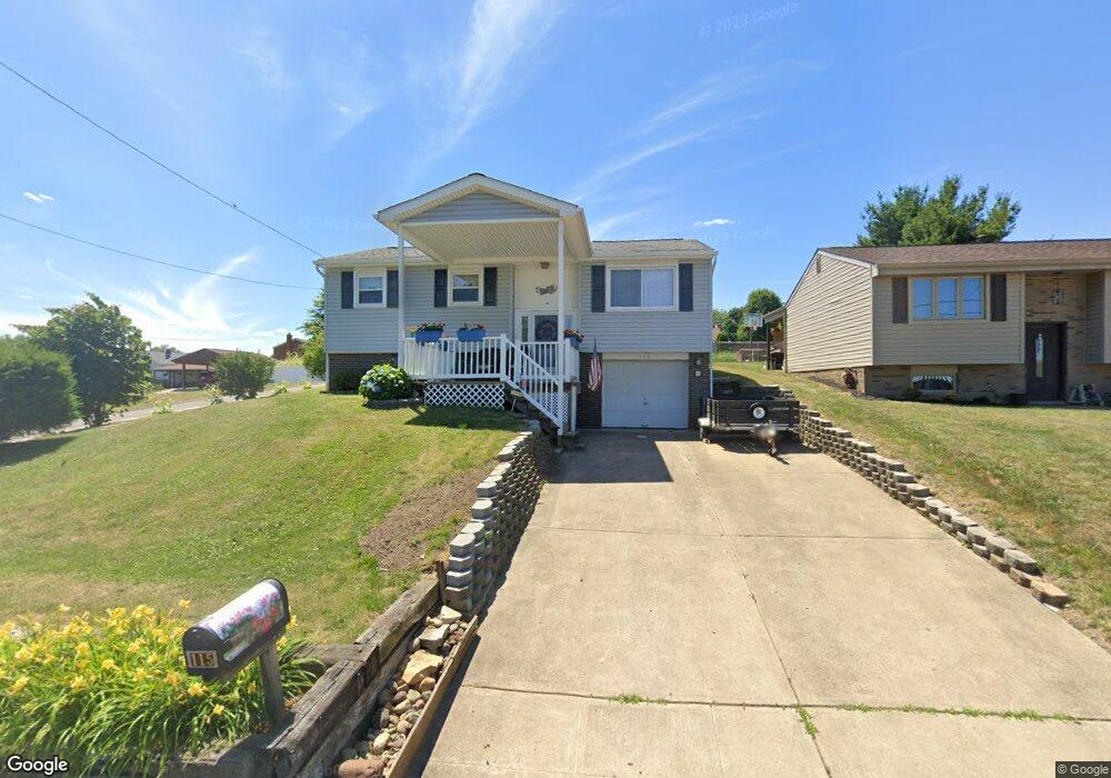
115 Euclid Ave Mc Kees Rocks, PA 15136
Stowe Township NeighborhoodEstimated Value: $181,000 - $264,000
3
Beds
3
Baths
2,086
Sq Ft
$107/Sq Ft
Est. Value
About This Home
This home is located at 115 Euclid Ave, Mc Kees Rocks, PA 15136 and is currently estimated at $222,279, approximately $106 per square foot. 115 Euclid Ave is a home located in Allegheny County with nearby schools including Sto-Rox Upper Elementary School, Sto-Rox Primary Center, and Sto-Rox Junior/Senior High School.
Ownership History
Date
Name
Owned For
Owner Type
Purchase Details
Closed on
Aug 31, 2004
Sold by
Pl P L E Money Pruch Pens
Bought by
Kotek Walt
Current Estimated Value
Home Financials for this Owner
Home Financials are based on the most recent Mortgage that was taken out on this home.
Original Mortgage
$67,000
Outstanding Balance
$33,503
Interest Rate
6.02%
Mortgage Type
New Conventional
Estimated Equity
$188,776
Create a Home Valuation Report for This Property
The Home Valuation Report is an in-depth analysis detailing your home's value as well as a comparison with similar homes in the area
Home Values in the Area
Average Home Value in this Area
Purchase History
| Date | Buyer | Sale Price | Title Company |
|---|---|---|---|
| Kotek Walt | $70,000 | -- |
Source: Public Records
Mortgage History
| Date | Status | Borrower | Loan Amount |
|---|---|---|---|
| Open | Kotek Walt | $67,000 |
Source: Public Records
Tax History Compared to Growth
Tax History
| Year | Tax Paid | Tax Assessment Tax Assessment Total Assessment is a certain percentage of the fair market value that is determined by local assessors to be the total taxable value of land and additions on the property. | Land | Improvement |
|---|---|---|---|---|
| 2025 | $4,144 | $95,900 | $20,100 | $75,800 |
| 2024 | $4,144 | $95,900 | $20,100 | $75,800 |
| 2023 | $3,983 | $95,900 | $20,100 | $75,800 |
| 2022 | $3,856 | $95,900 | $20,100 | $75,800 |
| 2021 | $454 | $95,900 | $20,100 | $75,800 |
| 2020 | $3,769 | $95,900 | $20,100 | $75,800 |
| 2019 | $3,769 | $95,900 | $20,100 | $75,800 |
| 2018 | $454 | $95,900 | $20,100 | $75,800 |
| 2017 | $3,683 | $95,900 | $20,100 | $75,800 |
| 2016 | $454 | $95,900 | $20,100 | $75,800 |
| 2015 | $454 | $95,900 | $20,100 | $75,800 |
| 2014 | $3,683 | $95,900 | $20,100 | $75,800 |
Source: Public Records
Map
Nearby Homes
- 179 William Cir
- 214 Barbara Dr
- 1550 Glenn Way
- 104 Thorncrest Dr
- 86 Thorncrest Dr
- 155 Roosevelt Ave
- 1490 Island Ave
- 270 Wheeler Ave
- 1421 Fleming Ave
- 543 Elizabeth Ave
- 23 Castle View Dr
- 8 Court Place
- 124 Pleasant Ridge Rd
- 1408 Broadway Ave
- 1406 Broadway Ave
- 1212 Woodward Ave
- 1017 Mccoy Rd
- 932 Ridge Ave
- 809 11th St
- 802 10th St