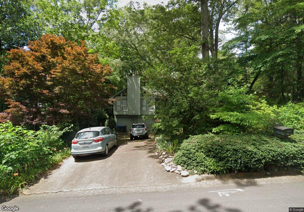
115 Farm Dale Unit 1 Roswell, GA 30075
Estimated Value: $527,834 - $575,000
3
Beds
3
Baths
1,797
Sq Ft
$308/Sq Ft
Est. Value
About This Home
This home is located at 115 Farm Dale Unit 1, Roswell, GA 30075 and is currently estimated at $552,709, approximately $307 per square foot. 115 Farm Dale Unit 1 is a home located in Fulton County with nearby schools including Roswell North Elementary School, Crabapple Middle School, and Roswell High School.
Ownership History
Date
Name
Owned For
Owner Type
Purchase Details
Closed on
Nov 20, 2000
Sold by
Pool Gary M and Pool Leslee
Bought by
Romfh John H and Romfh Joanne H
Current Estimated Value
Home Financials for this Owner
Home Financials are based on the most recent Mortgage that was taken out on this home.
Original Mortgage
$143,900
Outstanding Balance
$52,986
Interest Rate
7.87%
Mortgage Type
New Conventional
Estimated Equity
$499,723
Create a Home Valuation Report for This Property
The Home Valuation Report is an in-depth analysis detailing your home's value as well as a comparison with similar homes in the area
Home Values in the Area
Average Home Value in this Area
Purchase History
| Date | Buyer | Sale Price | Title Company |
|---|---|---|---|
| Romfh John H | $179,900 | -- |
Source: Public Records
Mortgage History
| Date | Status | Borrower | Loan Amount |
|---|---|---|---|
| Open | Romfh John H | $143,900 |
Source: Public Records
Tax History Compared to Growth
Tax History
| Year | Tax Paid | Tax Assessment Tax Assessment Total Assessment is a certain percentage of the fair market value that is determined by local assessors to be the total taxable value of land and additions on the property. | Land | Improvement |
|---|---|---|---|---|
| 2025 | $562 | $146,920 | $26,920 | $120,000 |
| 2023 | $4,923 | $174,400 | $42,160 | $132,240 |
| 2022 | $2,126 | $159,400 | $35,680 | $123,720 |
| 2021 | $2,547 | $128,360 | $22,120 | $106,240 |
| 2020 | $2,578 | $119,480 | $33,480 | $86,000 |
| 2019 | $458 | $117,360 | $32,880 | $84,480 |
| 2018 | $2,126 | $114,600 | $32,080 | $82,520 |
| 2017 | $2,203 | $87,440 | $20,800 | $66,640 |
| 2016 | $2,170 | $86,360 | $20,800 | $65,560 |
| 2015 | $2,639 | $86,360 | $20,800 | $65,560 |
| 2014 | $1,632 | $66,000 | $15,880 | $50,120 |
Source: Public Records
Map
Nearby Homes
- 340 Farm Path Unit 2
- 525 Wickerberry Ln
- 130 Farm Hill Cir
- 325 Farm Trace
- 145 Grayton Ln
- 300 Farm Track Unit 3
- 545 Longleaf Dr Unit 1
- 175 Grayton Ln
- 135 Grayton Ln
- 9705 Coleman Rd
- 9760 Loblolly Ln
- 420 Longleaf Dr
- 445 Longleaf Dr
- 2130 Federal Rd Unit II
- 610 Pine Grove Rd
- 657 Willeo Rd
- 5060 Magnolia Walk
- 125 Farm Dale
- 380 Farm Path
- 0 Farm Dale
- 390 Farm Path
- 210 Farm Track
- 220 Farm Track
- 360 Farm Path
- 135 Farm Dale Unit 2
- 400 Farm Path Unit 1
- 120 Farm Dale
- 130 Farm Dale
- 230 Farm Track
- 350 Farm Path
- 375 Farm Path
- 385 Farm Path Unit 1
- 365 Farm Path Unit 1
- 395 Farm Path Unit 1
- 170 Farm Track Unit 1
- 195 Farm Hill Cir
- 195 Farm Hill Cir Unit 195