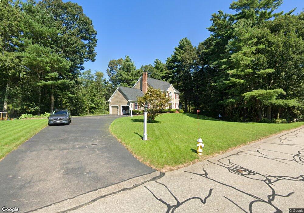
115 Laurie Ln Wrentham, MA 02093
Estimated Value: $880,010 - $1,121,000
4
Beds
3
Baths
2,596
Sq Ft
$381/Sq Ft
Est. Value
About This Home
This home is located at 115 Laurie Ln, Wrentham, MA 02093 and is currently estimated at $989,003, approximately $380 per square foot. 115 Laurie Ln is a home located in Norfolk County with nearby schools including Delaney Elementary School and Charles E Roderick.
Ownership History
Date
Name
Owned For
Owner Type
Purchase Details
Closed on
May 20, 2019
Sold by
Wojcik Robert S and Wojcik Ellen C
Bought by
Wojcik Ret
Current Estimated Value
Purchase Details
Closed on
Apr 25, 1995
Sold by
Sansevero Paul A and Sansevero Roberta A
Bought by
Wojcik Roberts and Wojcik Ellen C
Home Financials for this Owner
Home Financials are based on the most recent Mortgage that was taken out on this home.
Original Mortgage
$105,000
Interest Rate
8.55%
Mortgage Type
Purchase Money Mortgage
Purchase Details
Closed on
Oct 30, 1992
Sold by
New Hoover Rt
Bought by
Sansevero Paul A and Sansevero Roberta R
Home Financials for this Owner
Home Financials are based on the most recent Mortgage that was taken out on this home.
Original Mortgage
$175,000
Interest Rate
7.85%
Mortgage Type
Purchase Money Mortgage
Create a Home Valuation Report for This Property
The Home Valuation Report is an in-depth analysis detailing your home's value as well as a comparison with similar homes in the area
Home Values in the Area
Average Home Value in this Area
Purchase History
| Date | Buyer | Sale Price | Title Company |
|---|---|---|---|
| Wojcik Ret | -- | -- | |
| Wojcik Roberts | $265,500 | -- | |
| Sansevero Paul A | $240,000 | -- |
Source: Public Records
Mortgage History
| Date | Status | Borrower | Loan Amount |
|---|---|---|---|
| Previous Owner | Sansevero Paul A | $104,500 | |
| Previous Owner | Sansevero Paul A | $105,000 | |
| Previous Owner | Sansevero Paul A | $175,000 |
Source: Public Records
Tax History Compared to Growth
Tax History
| Year | Tax Paid | Tax Assessment Tax Assessment Total Assessment is a certain percentage of the fair market value that is determined by local assessors to be the total taxable value of land and additions on the property. | Land | Improvement |
|---|---|---|---|---|
| 2025 | $9,124 | $787,200 | $288,900 | $498,300 |
| 2024 | $8,698 | $724,800 | $288,900 | $435,900 |
| 2023 | $8,603 | $681,700 | $262,700 | $419,000 |
| 2022 | $7,588 | $555,100 | $202,100 | $353,000 |
| 2021 | $7,547 | $536,400 | $211,700 | $324,700 |
| 2020 | $8,134 | $570,800 | $212,300 | $358,500 |
| 2019 | $7,678 | $543,800 | $201,700 | $342,100 |
| 2018 | $7,364 | $517,100 | $201,800 | $315,300 |
| 2017 | $7,364 | $516,800 | $208,300 | $308,500 |
| 2016 | $7,211 | $505,000 | $202,300 | $302,700 |
| 2015 | $6,964 | $464,900 | $179,500 | $285,400 |
| 2014 | $6,900 | $450,700 | $172,600 | $278,100 |
Source: Public Records
Map
Nearby Homes
- 570 Franklin St
- 50 Reed Fulton Ave Unit Lot 61
- 45 Joshua Rd
- 131 Creek St Unit 7
- 10 Nature View Dr
- 15 Nature View Dr
- 246 Forest Grove Ave
- 11 Earle Stewart Ln
- Lot 3 - 14 Earle Stewart Ln
- Lot 1 - Blueberry 2 Car Plan at King Philip Estates
- Lot 8 - Blueberry 2 Car Plan at King Philip Estates
- Lot 5 - Hughes 2 car Plan at King Philip Estates
- Lot 6 - Blueberry 3 Car Plan at King Philip Estates
- Lot 2 - Camden 2 Car Plan at King Philip Estates
- Lot 7 - Cedar Plan at King Philip Estates
- Lot 4 - Hemingway 2 Car Plan at King Philip Estates
- Lot 3 - Blueberry 2 Car Plan at King Philip Estates
- 12 Waites Crossing Way
- 11 Elliot Mills Unit 11
- 270 Dedham St