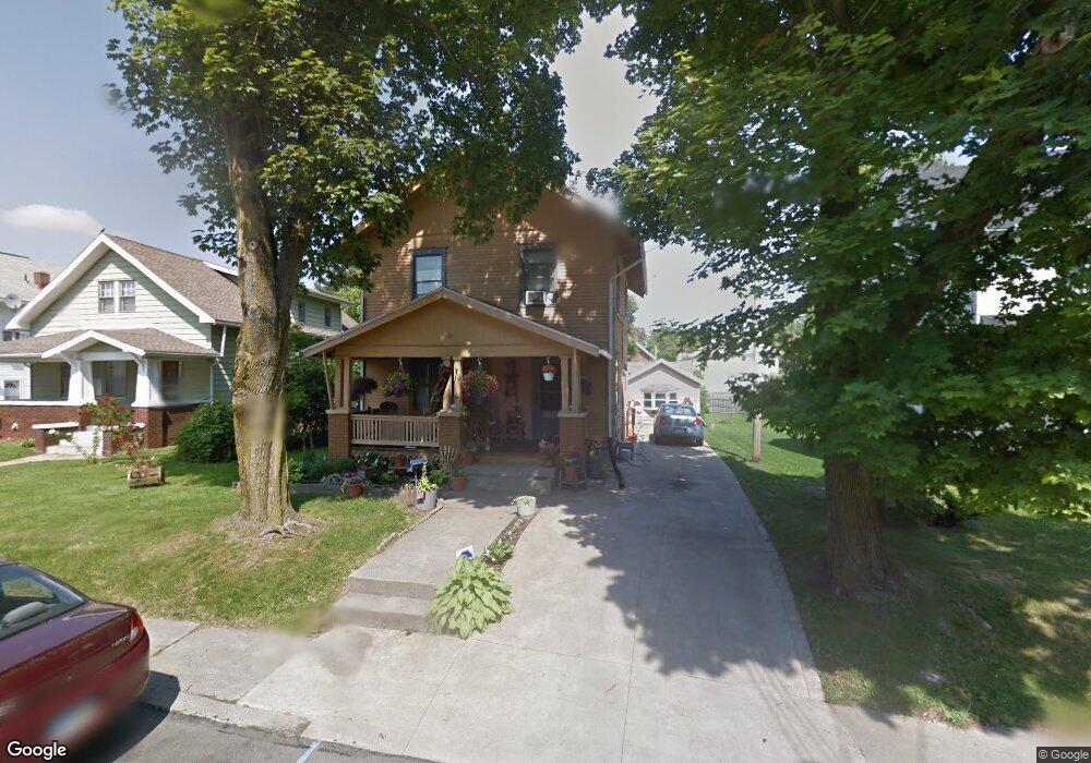
115 Lind Ave Mansfield, OH 44903
Estimated Value: $100,000 - $126,860
3
Beds
2
Baths
1,430
Sq Ft
$78/Sq Ft
Est. Value
About This Home
This home is located at 115 Lind Ave, Mansfield, OH 44903 and is currently estimated at $111,465, approximately $77 per square foot. 115 Lind Ave is a home located in Richland County with nearby schools including Goal Digital Academy, St. Peter's High School/Junior High, and St. Peter's Elementary/Montessori School.
Ownership History
Date
Name
Owned For
Owner Type
Purchase Details
Closed on
Mar 16, 2001
Sold by
Supreme Properties Inc
Bought by
James Colon B Nancy A
Current Estimated Value
Home Financials for this Owner
Home Financials are based on the most recent Mortgage that was taken out on this home.
Original Mortgage
$67,933
Outstanding Balance
$24,940
Interest Rate
7.13%
Mortgage Type
FHA
Estimated Equity
$86,525
Purchase Details
Closed on
Sep 11, 1998
Sold by
Ritchey Donald B
Bought by
Supreme Properties Inc
Purchase Details
Closed on
Dec 31, 1996
Sold by
Ritchey Donald
Bought by
Supreme Properties
Create a Home Valuation Report for This Property
The Home Valuation Report is an in-depth analysis detailing your home's value as well as a comparison with similar homes in the area
Home Values in the Area
Average Home Value in this Area
Purchase History
| Date | Buyer | Sale Price | Title Company |
|---|---|---|---|
| James Colon B Nancy A | $69,000 | -- | |
| Supreme Properties Inc | $32,400 | -- | |
| Supreme Properties | $32,400 | -- |
Source: Public Records
Mortgage History
| Date | Status | Borrower | Loan Amount |
|---|---|---|---|
| Open | James Colon B Nancy A | $67,933 |
Source: Public Records
Tax History Compared to Growth
Tax History
| Year | Tax Paid | Tax Assessment Tax Assessment Total Assessment is a certain percentage of the fair market value that is determined by local assessors to be the total taxable value of land and additions on the property. | Land | Improvement |
|---|---|---|---|---|
| 2024 | $1,207 | $25,780 | $3,980 | $21,800 |
| 2023 | $1,207 | $25,780 | $3,980 | $21,800 |
| 2022 | $993 | $17,770 | $3,260 | $14,510 |
| 2021 | $1,000 | $17,770 | $3,260 | $14,510 |
| 2020 | $1,022 | $17,770 | $3,260 | $14,510 |
| 2019 | $1,133 | $17,770 | $3,260 | $14,510 |
| 2018 | $1,118 | $17,770 | $3,260 | $14,510 |
| 2017 | $1,087 | $17,770 | $3,260 | $14,510 |
| 2016 | $1,379 | $21,860 | $3,440 | $18,420 |
| 2015 | $1,318 | $21,860 | $3,440 | $18,420 |
| 2014 | $1,301 | $21,860 | $3,440 | $18,420 |
| 2012 | $522 | $23,020 | $3,630 | $19,390 |
Source: Public Records
Map
Nearby Homes
- 118 Lind Ave
- 114 Vennum Ave
- 37 Baldwin Ave
- 135 Wood St
- 76 Bartley Ave
- 38 Baldwin Ave
- 450 Glessner Ave
- 88 Sherman Ave
- 257 Wood St
- 131 Sturges Ave
- 126 Dawson Ave
- 2 Bowman St
- 470 Woodward Ave
- 406 Sherman Place
- 80 Rowland Ave
- 24 Stewart Ave S
- 71 Glenwood Blvd
- 116 Penn Ave
- 21 Glenwood Blvd
- 132 Sycamore St
- 109 Lind Ave
- 119 Lind Ave
- 105 Lind Ave
- 99 Lind Ave
- 114 Lind Ave Unit 116
- 127 Lind Ave
- 110 Carpenter Rd
- 106 Lind Ave
- Carpenter St
- 120 Lind Ave
- 104 Lind Ave
- 120 Carpenter Rd
- 124 Lind Ave
- 91 Lind Ave
- 100 Carpenter Rd
- 106 Carpenter Rd
- 106 Carpenter Rd Unit 3
- 106 Carpenter Rd
- 112 Carpenter Rd Unit 114
- 133 Lind Ave