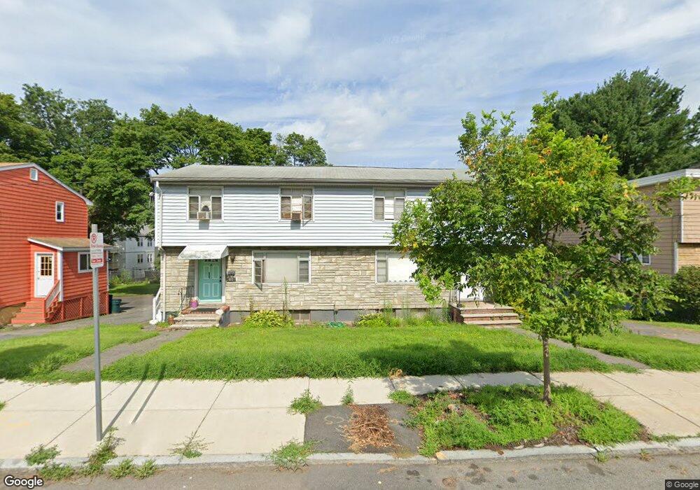
115 Lorna Rd Unit 117 Mattapan, MA 02126
Southern Mattapan NeighborhoodEstimated Value: $785,000 - $894,000
6
Beds
4
Baths
2,352
Sq Ft
$362/Sq Ft
Est. Value
About This Home
This home is located at 115 Lorna Rd Unit 117, Mattapan, MA 02126 and is currently estimated at $851,763, approximately $362 per square foot. 115 Lorna Rd Unit 117 is a home located in Suffolk County with nearby schools including KIPP Academy Boston Charter School and Berea Seventh-day Adventist Academy.
Ownership History
Date
Name
Owned For
Owner Type
Purchase Details
Closed on
Jul 26, 2007
Sold by
Mason Alice A and Mason Pamela A
Bought by
Reid Renee
Current Estimated Value
Home Financials for this Owner
Home Financials are based on the most recent Mortgage that was taken out on this home.
Original Mortgage
$384,750
Outstanding Balance
$245,094
Interest Rate
6.78%
Mortgage Type
Purchase Money Mortgage
Estimated Equity
$606,669
Create a Home Valuation Report for This Property
The Home Valuation Report is an in-depth analysis detailing your home's value as well as a comparison with similar homes in the area
Home Values in the Area
Average Home Value in this Area
Purchase History
| Date | Buyer | Sale Price | Title Company |
|---|---|---|---|
| Reid Renee | $405,000 | -- |
Source: Public Records
Mortgage History
| Date | Status | Borrower | Loan Amount |
|---|---|---|---|
| Open | Reid Renee | $384,750 |
Source: Public Records
Tax History Compared to Growth
Tax History
| Year | Tax Paid | Tax Assessment Tax Assessment Total Assessment is a certain percentage of the fair market value that is determined by local assessors to be the total taxable value of land and additions on the property. | Land | Improvement |
|---|---|---|---|---|
| 2025 | $9,060 | $782,400 | $284,200 | $498,200 |
| 2024 | $8,336 | $764,800 | $241,400 | $523,400 |
| 2023 | $7,604 | $708,000 | $223,400 | $484,600 |
| 2022 | $7,703 | $708,000 | $223,400 | $484,600 |
| 2021 | $7,126 | $667,900 | $210,800 | $457,100 |
| 2020 | $5,592 | $529,500 | $202,900 | $326,600 |
| 2019 | $4,980 | $472,500 | $153,400 | $319,100 |
| 2018 | $4,671 | $445,700 | $153,400 | $292,300 |
| 2017 | $4,538 | $428,500 | $153,400 | $275,100 |
| 2016 | $4,404 | $400,400 | $153,400 | $247,000 |
| 2015 | $3,755 | $310,100 | $127,500 | $182,600 |
| 2014 | $3,483 | $276,900 | $127,500 | $149,400 |
Source: Public Records
Map
Nearby Homes
- 30 Glenhill Rd
- 15-17 W Selden St
- 18 Astoria St
- 157 Delhi St
- 808 Morton St Unit 3
- 139 Selden St
- 32 Violet St
- 124 Selden St
- 567B Norfolk St
- 11 French St
- 25 Fessenden St
- 10 Sutton St
- 23 Fessenden St
- 4 Crossman St Unit 4
- 23 Maryknoll St
- 5 Sutton St
- 5 Sutton St Unit 3B
- 32 Crowell St
- 10 Hosmer St
- 24 Constitution Rd
- 115-117 Lorna Rd
- 111 Lorna Rd
- 119 Lorna Rd Unit 121
- 114-116 W Selden St
- 114 W Selden St Unit 116
- 110 W Selden St
- 118 W Selden St Unit 120
- 118 W Selden St Unit 1
- 123 Lorna Rd
- 122 W Selden St Unit 124
- 107 Lorna Rd Unit 2
- 107 Lorna Rd
- 106 W Selden St
- 112 Lorna Rd Unit 114
- 126 W Selden St Unit 1
- 128 W Selden St Unit 2
- 126 W Selden St Unit 2
- 126 W Selden St Unit 128
- 128 W Selden St
- 127 Lorna Rd