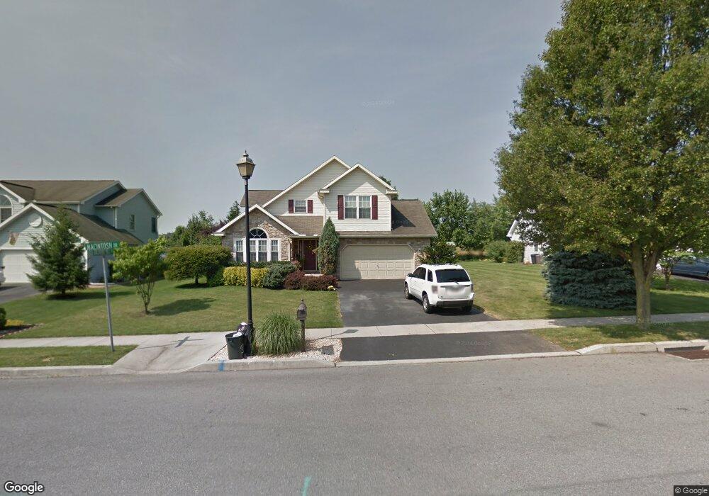
115 Macintosh Dr Palmyra, PA 17078
Estimated Value: $416,541 - $490,000
4
Beds
3
Baths
1,756
Sq Ft
$258/Sq Ft
Est. Value
About This Home
This home is located at 115 Macintosh Dr, Palmyra, PA 17078 and is currently estimated at $452,635, approximately $257 per square foot. 115 Macintosh Dr is a home located in Lebanon County with nearby schools including Palmyra Area Senior High School and St. Joan of Arc Elementary School.
Ownership History
Date
Name
Owned For
Owner Type
Purchase Details
Closed on
Aug 13, 2012
Sold by
Suraci Connie and Suraci Joseph
Bought by
Suraci Connie and Suraci Joseph
Current Estimated Value
Home Financials for this Owner
Home Financials are based on the most recent Mortgage that was taken out on this home.
Original Mortgage
$237,960
Interest Rate
4.4%
Mortgage Type
FHA
Create a Home Valuation Report for This Property
The Home Valuation Report is an in-depth analysis detailing your home's value as well as a comparison with similar homes in the area
Home Values in the Area
Average Home Value in this Area
Purchase History
| Date | Buyer | Sale Price | Title Company |
|---|---|---|---|
| Suraci Connie | -- | Transta Rnational Title |
Source: Public Records
Mortgage History
| Date | Status | Borrower | Loan Amount |
|---|---|---|---|
| Closed | Suraci Connie | $237,960 |
Source: Public Records
Tax History Compared to Growth
Tax History
| Year | Tax Paid | Tax Assessment Tax Assessment Total Assessment is a certain percentage of the fair market value that is determined by local assessors to be the total taxable value of land and additions on the property. | Land | Improvement |
|---|---|---|---|---|
| 2025 | $6,707 | $234,700 | $52,600 | $182,100 |
| 2024 | $5,925 | $234,700 | $52,600 | $182,100 |
| 2023 | $5,925 | $234,700 | $52,600 | $182,100 |
| 2022 | $5,652 | $234,700 | $52,600 | $182,100 |
| 2021 | $5,254 | $234,700 | $52,600 | $182,100 |
| 2020 | $5,187 | $234,700 | $52,600 | $182,100 |
| 2019 | $5,076 | $234,700 | $52,600 | $182,100 |
| 2018 | $4,915 | $234,700 | $52,600 | $182,100 |
| 2017 | $1,456 | $234,700 | $52,600 | $182,100 |
| 2016 | $4,615 | $234,700 | $52,600 | $182,100 |
| 2015 | -- | $234,700 | $52,600 | $182,100 |
| 2014 | -- | $234,700 | $52,600 | $182,100 |
Source: Public Records
Map
Nearby Homes
- 75 Cortland Crossing
- 81 Cortland Crossing
- 701 N Grant St
- 136 N Penn St
- Sedona Plan at Melrose
- Ashton Plan at Melrose
- Sloane II Plan at Melrose
- 914 N Lincoln St
- 934 N Lincoln St
- 934 N Lincoln St Unit 8-04
- 918 N Lincoln St Unit 4-02
- 0 N Railroad St
- 30 Willow St
- 22 Willow St
- 14 Willow St
- 40 N Grant St
- 28 Evergreen Aly
- 13 Evergreen Aly
- 44 Evergreen Aly
- 4 Evergreen Aly
- 77 Macintosh Dr
- 123 Macintosh Dr
- 131 Macintosh Dr
- 685 E Spruce St
- 699 E Spruce St
- 128 Macintosh Dr
- 26 Orchard Hill Dr
- 139 Macintosh Dr
- 136 Macintosh Dr
- 34 Macintosh Dr
- 84 Orchard Hill Dr
- 85 Orchard Hill Dr
- 725 E Spruce St
- 147 Macintosh Dr
- 144 Macintosh Dr
- 102 Winesap Ln
- 10 Braeburn Way
- 94 Braeburn Way
- 117 Orchard Hill Dr
- 739 E Spruce St