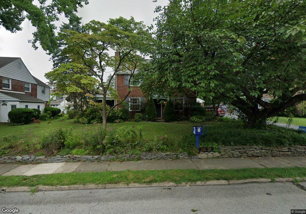
115 Madison Rd Lansdowne, PA 19050
Estimated Value: $373,000 - $419,000
4
Beds
4
Baths
1,724
Sq Ft
$227/Sq Ft
Est. Value
About This Home
This home is located at 115 Madison Rd, Lansdowne, PA 19050 and is currently estimated at $390,962, approximately $226 per square foot. 115 Madison Rd is a home located in Delaware County with nearby schools including Ardmore Avenue School, Penn Wood Middle School, and Penn Wood High School - Cypress Street Campus.
Ownership History
Date
Name
Owned For
Owner Type
Purchase Details
Closed on
Aug 6, 2021
Sold by
Pearsall Judith R
Bought by
Wentworth Rachel and Hover Benjamin D
Current Estimated Value
Home Financials for this Owner
Home Financials are based on the most recent Mortgage that was taken out on this home.
Original Mortgage
$275,000
Outstanding Balance
$249,683
Interest Rate
2.8%
Mortgage Type
New Conventional
Estimated Equity
$141,279
Purchase Details
Closed on
Apr 18, 1983
Sold by
Linehan Katherine
Bought by
Pearsall Thomas W and Pearsall Judith R
Create a Home Valuation Report for This Property
The Home Valuation Report is an in-depth analysis detailing your home's value as well as a comparison with similar homes in the area
Home Values in the Area
Average Home Value in this Area
Purchase History
| Date | Buyer | Sale Price | Title Company |
|---|---|---|---|
| Wentworth Rachel | $290,000 | Suburban Abstract Agency Inc | |
| Pearsall Thomas W | $71,500 | -- |
Source: Public Records
Mortgage History
| Date | Status | Borrower | Loan Amount |
|---|---|---|---|
| Open | Wentworth Rachel | $275,000 |
Source: Public Records
Tax History
| Year | Tax Paid | Tax Assessment Tax Assessment Total Assessment is a certain percentage of the fair market value that is determined by local assessors to be the total taxable value of land and additions on the property. | Land | Improvement |
|---|---|---|---|---|
| 2025 | $7,815 | $189,810 | $56,430 | $133,380 |
| 2024 | $7,815 | $189,810 | $56,430 | $133,380 |
| 2023 | $7,451 | $189,810 | $56,430 | $133,380 |
| 2022 | $7,304 | $189,810 | $56,430 | $133,380 |
| 2021 | $10,969 | $189,810 | $56,430 | $133,380 |
| 2020 | $7,071 | $107,820 | $31,060 | $76,760 |
| 2019 | $6,952 | $107,820 | $31,060 | $76,760 |
| 2018 | $6,833 | $107,820 | $0 | $0 |
| 2017 | $6,683 | $107,820 | $0 | $0 |
| 2016 | $592 | $107,820 | $0 | $0 |
| 2015 | $604 | $107,820 | $0 | $0 |
| 2014 | $592 | $107,820 | $0 | $0 |
Source: Public Records
Map
Nearby Homes
- 233 Scottdale Rd
- 53 Eldon Ave
- 65 Eldon Ave
- 120 Abbey Terrace
- 82 Marple Ave
- 29 Roselawn Ave
- 257 W Greenwood Ave
- 80 W Baltimore Ave Unit C607
- 80 W Baltimore Ave Unit B607
- 442 E Baltimore Ave
- 3825 Dennison Ave
- 85 Bridge St
- 164 Abbey Terrace
- 222 Holly St
- 220 Birchwood Rd
- 3941 Bridge St
- 162 Burmont Rd
- 182 Berkley Ave
- 120 W Essex Ave
- 17 Hillview Cir
- 119 Madison Rd
- 111 Madison Rd
- 120 Gladstone Rd
- 122 Gladstone Rd
- 118 Gladstone Rd
- 124 Gladstone Rd
- 116 Gladstone Rd
- 126 Gladstone Rd
- 120 Madison Rd
- 118 Madison Rd
- 123 Madison Rd
- 107 Madison Rd
- 128 Gladstone Rd
- 122 Madison Rd
- 112 Gladstone Rd
- 130 Gladstone Rd
- 116 Madison Rd
- 124 Madison Rd
- 110 Gladstone Rd
- 126 Walsh Rd
Your Personal Tour Guide
Ask me questions while you tour the home.