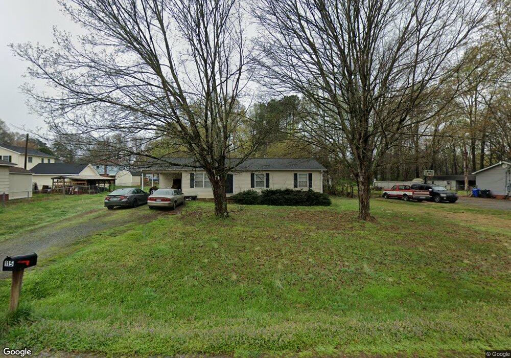
115 Mae Rd Salisbury, NC 28146
Estimated Value: $215,627 - $284,000
--
Bed
2
Baths
1,056
Sq Ft
$240/Sq Ft
Est. Value
About This Home
This home is located at 115 Mae Rd, Salisbury, NC 28146 and is currently estimated at $253,907, approximately $240 per square foot. 115 Mae Rd is a home located in Rowan County with nearby schools including China Grove Elementary School, Southeast Middle School, and Jesse C Carson High School.
Ownership History
Date
Name
Owned For
Owner Type
Purchase Details
Closed on
Aug 3, 2009
Sold by
Ballard Mark A and Ballard Evelyn B
Bought by
Galloway Mickey D and Galloway Tina L
Current Estimated Value
Home Financials for this Owner
Home Financials are based on the most recent Mortgage that was taken out on this home.
Original Mortgage
$94,400
Outstanding Balance
$62,050
Interest Rate
5.37%
Mortgage Type
New Conventional
Estimated Equity
$191,857
Purchase Details
Closed on
Oct 11, 2005
Sold by
Hudson John T
Bought by
Ballard Mark A and Ballard Evelyn B
Create a Home Valuation Report for This Property
The Home Valuation Report is an in-depth analysis detailing your home's value as well as a comparison with similar homes in the area
Home Values in the Area
Average Home Value in this Area
Purchase History
| Date | Buyer | Sale Price | Title Company |
|---|---|---|---|
| Galloway Mickey D | $118,000 | None Available | |
| Ballard Mark A | $20,000 | -- |
Source: Public Records
Mortgage History
| Date | Status | Borrower | Loan Amount |
|---|---|---|---|
| Open | Galloway Mickey D | $94,400 |
Source: Public Records
Tax History Compared to Growth
Tax History
| Year | Tax Paid | Tax Assessment Tax Assessment Total Assessment is a certain percentage of the fair market value that is determined by local assessors to be the total taxable value of land and additions on the property. | Land | Improvement |
|---|---|---|---|---|
| 2025 | $1,065 | $159,012 | $26,496 | $132,516 |
| 2024 | $1,065 | $159,012 | $26,496 | $132,516 |
| 2023 | $1,065 | $159,012 | $26,496 | $132,516 |
| 2022 | $850 | $113,737 | $22,963 | $90,774 |
| 2021 | $844 | $113,737 | $22,963 | $90,774 |
| 2020 | $844 | $113,737 | $22,963 | $90,774 |
| 2019 | $844 | $113,737 | $22,963 | $90,774 |
| 2018 | $705 | $95,852 | $22,963 | $72,889 |
| 2017 | $705 | $95,852 | $22,963 | $72,889 |
| 2016 | $705 | $95,852 | $22,963 | $72,889 |
| 2015 | $716 | $95,852 | $22,963 | $72,889 |
| 2014 | $643 | $90,322 | $19,052 | $71,270 |
Source: Public Records
Map
Nearby Homes
- 1352 Eva Ln
- 0 Ed Weavers Rd
- 0 Brookfield Cir Unit CAR4292885
- 6000 S Main St
- 0 Swink Ave
- 1675 N Main St
- 1365 Safrit Rd
- 1925 Mount Hope Church Rd
- 6255 Meadow Ln
- 6115 Southern Ln
- 850 and 830 E Nc 152 Hwy E
- 355 Swink Ave
- 00 Neelytown Rd
- 179 Spring Oak Dr
- TA3000 Plan at Kensington
- Hudson Plan at Kensington
- Devin Plan at Kensington
- Bayside Plan at Kensington
- TA4000 Plan at Kensington
- Kipling Plan at Kensington
- 980 Ed Weavers Rd
- 980 Ed Weaver Rd
- 1030 Ed Weavers Rd
- 1070 Ed Weavers Rd
- 120 Mae Rd
- 110 Mae Rd
- 210 Mae Rd
- 985 Ed Weavers Rd
- 1120 Ed Weavers Rd
- 985 Ed Weavers Rd
- 220 Mae Rd
- 340 Kings Terrace
- 330 Kings Terrace
- 838 Mt Hope Church Rd
- 1069 Sheila Ln
- 350 Kings Terrace
- 965 Ed Weavers Rd
- 1053 Sheila Ln
- 225 Mae Rd
- 360 Kings Terrace