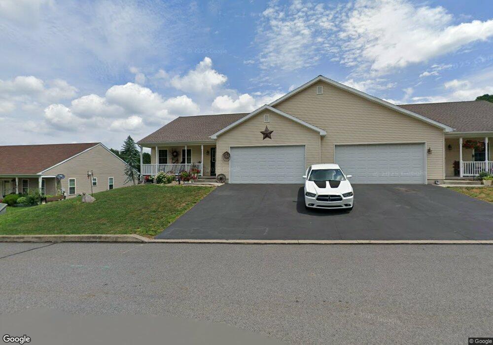
115 Mcknight St Ashland, PA 17921
Estimated Value: $204,000 - $278,338
2
Beds
3
Baths
1,580
Sq Ft
$154/Sq Ft
Est. Value
About This Home
This home is located at 115 Mcknight St, Ashland, PA 17921 and is currently estimated at $242,835, approximately $153 per square foot. 115 Mcknight St is a home with nearby schools including North Schuylkill Elementary School and North Schuylkill Junior/Senior High School.
Ownership History
Date
Name
Owned For
Owner Type
Purchase Details
Closed on
Jan 25, 2019
Sold by
Bann E Charles and Bann Bernard J
Bought by
Hampton Deborah M
Current Estimated Value
Purchase Details
Closed on
Aug 4, 2017
Sold by
Bann Bann E and Bann Sueann
Bought by
Withelder Melissa M
Home Financials for this Owner
Home Financials are based on the most recent Mortgage that was taken out on this home.
Original Mortgage
$95,000
Interest Rate
3.9%
Mortgage Type
New Conventional
Purchase Details
Closed on
Oct 2, 2014
Sold by
Rattling Run Lp
Bought by
Bann E Charles and Bann Bernard J
Purchase Details
Closed on
May 6, 2014
Sold by
Hampton John M
Bought by
Rattling Run Lp
Create a Home Valuation Report for This Property
The Home Valuation Report is an in-depth analysis detailing your home's value as well as a comparison with similar homes in the area
Home Values in the Area
Average Home Value in this Area
Purchase History
| Date | Buyer | Sale Price | Title Company |
|---|---|---|---|
| Hampton Deborah M | $153,000 | None Available | |
| Withelder Melissa M | $145,000 | None Available | |
| Bann E Charles | $40,000 | None Available | |
| Rattling Run Lp | -- | None Available |
Source: Public Records
Mortgage History
| Date | Status | Borrower | Loan Amount |
|---|---|---|---|
| Previous Owner | Withelder Melissa M | $95,000 |
Source: Public Records
Tax History Compared to Growth
Tax History
| Year | Tax Paid | Tax Assessment Tax Assessment Total Assessment is a certain percentage of the fair market value that is determined by local assessors to be the total taxable value of land and additions on the property. | Land | Improvement |
|---|---|---|---|---|
| 2025 | $4,879 | $62,925 | $3,500 | $59,425 |
| 2024 | $4,508 | $62,925 | $3,500 | $59,425 |
| 2023 | $4,508 | $62,925 | $3,500 | $59,425 |
| 2022 | $4,406 | $62,925 | $3,500 | $59,425 |
| 2021 | $4,287 | $62,925 | $3,500 | $59,425 |
| 2020 | $4,205 | $62,925 | $3,500 | $59,425 |
| 2018 | $226 | $3,500 | $3,500 | $0 |
| 2017 | $220 | $3,500 | $3,500 | $0 |
| 2015 | -- | $3,500 | $3,500 | $0 |
Source: Public Records
Map
Nearby Homes
- 310 Hobart St
- 323 N Hobart St
- 505 Mcknight St
- 0 Dutchtown Rd
- 416 Dutchtown Rd
- 604 Airport Rd
- Cambridge Plan at Country Club Estates
- New Yorker Plan at Country Club Estates
- Juniper Plan at Country Club Estates
- Stafford Plan at Country Club Estates
- Iowa Plan at Country Club Estates
- 132 Turnpike Rd
- 572 Airport Rd
- 630 S Hoffman Blvd
- 1004 Brock St
- 924 Brock St
- 730 Brock St
- 923 Brock St
- 1038 Spruce St
- 1320 Spruce St
- 113 Mcknight St
- 113 McNight St
- 117 Mcknight St
- 117 Mcknight St
- 111 Mcknight
- 103 Mcknight St
- 111 Mcknight St
- 101 Mcknight St
- 101 Mcknight St
- 119 Mcknight St
- 105 Mcknight St
- 109 Mcknight St
- 5 Mcknight St
- 121 S Mcknight St
- 107 S Mcknight St
- 123 Mcknight St
- 189 S Mcknight St
- 102 Mcknight St
- 102 Mcknight St
- 126 Mcknight St