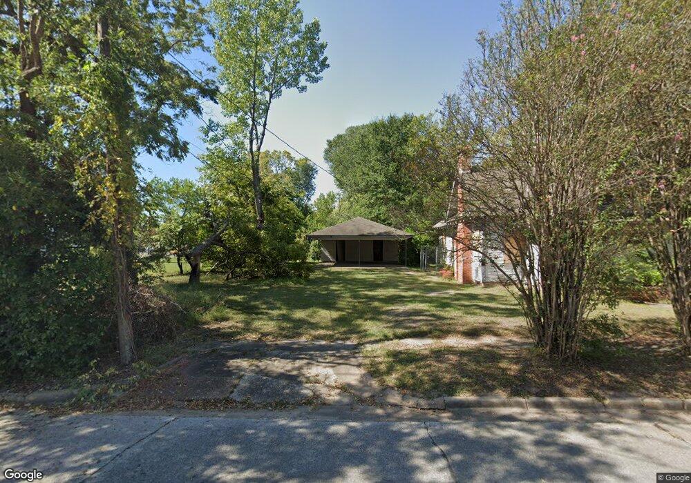
115 N Bonner St Lufkin, TX 75904
Estimated Value: $82,151 - $143,000
--
Bed
7
Baths
1,281
Sq Ft
$97/Sq Ft
Est. Value
About This Home
This home is located at 115 N Bonner St, Lufkin, TX 75904 and is currently estimated at $124,038, approximately $96 per square foot. 115 N Bonner St is a home located in Angelina County with nearby schools including Trout Primary School, Brookhollow Elementary School, and Lufkin Middle School.
Ownership History
Date
Name
Owned For
Owner Type
Purchase Details
Closed on
Nov 13, 2020
Sold by
Berkham Carol and Berkham Blair
Bought by
Lhw Holdings Llc
Current Estimated Value
Home Financials for this Owner
Home Financials are based on the most recent Mortgage that was taken out on this home.
Original Mortgage
$28,000
Outstanding Balance
$998
Interest Rate
2.8%
Mortgage Type
Future Advance Clause Open End Mortgage
Estimated Equity
$123,040
Purchase Details
Closed on
Feb 3, 2015
Sold by
Luna Joel and Luna Eva Marie
Bought by
Estate Of Joe Warren Beckham
Create a Home Valuation Report for This Property
The Home Valuation Report is an in-depth analysis detailing your home's value as well as a comparison with similar homes in the area
Home Values in the Area
Average Home Value in this Area
Purchase History
| Date | Buyer | Sale Price | Title Company |
|---|---|---|---|
| Lhw Holdings Llc | -- | None Available | |
| Estate Of Joe Warren Beckham | $48,996 | None Available |
Source: Public Records
Mortgage History
| Date | Status | Borrower | Loan Amount |
|---|---|---|---|
| Open | Lhw Holdings Llc | $28,000 |
Source: Public Records
Tax History Compared to Growth
Tax History
| Year | Tax Paid | Tax Assessment Tax Assessment Total Assessment is a certain percentage of the fair market value that is determined by local assessors to be the total taxable value of land and additions on the property. | Land | Improvement |
|---|---|---|---|---|
| 2025 | $827 | $39,580 | $18,470 | $21,110 |
| 2024 | $818 | $39,120 | $18,470 | $20,650 |
| 2023 | $771 | $38,820 | $18,470 | $20,350 |
| 2022 | $712 | $31,260 | $12,680 | $18,580 |
| 2021 | $728 | $29,550 | $12,680 | $16,870 |
| 2020 | $688 | $27,990 | $12,680 | $15,310 |
| 2019 | $728 | $27,990 | $12,680 | $15,310 |
| 2018 | $644 | $27,560 | $12,680 | $14,880 |
| 2017 | $644 | $27,020 | $12,680 | $14,340 |
| 2016 | $684 | $28,690 | $12,680 | $16,010 |
| 2015 | -- | $56,760 | $12,680 | $44,080 |
| 2014 | -- | $55,190 | $12,680 | $42,510 |
Source: Public Records
Map
Nearby Homes
- 420 Mantooth Ave
- 620 Mantooth Ave
- 301 Culverhouse St
- 803 Moore Ave
- 122 Pine Branch Ct
- 112 Pine Branch Ct
- 4421 Farm-To-market
- 117 Pine Branch Ct
- 5700 Fm 2497
- 8250 Hwy 103w
- 10683 Hwy 103w
- 1305 West Grove
- Lot 1B Welch Hill Top Rd
- Lot 2 Fm 326
- 10111 Hwy 94w
- 1417 Fm 706s
- Lot 1C Welch Hill Top Rd
- 128 Stoney Ridge
- 3295 Fm 2108
- 505 N 1st St
- 415 Moore Ave
- 419 Moore Ave
- 112 N Douglas St
- 412 Moore Ave
- 418 Moore Ave
- 117 N Douglas St
- 205 Herndon St
- 502 Ellis Ave
- 111 N Douglas St
- 419 Frank St
- 121 Herndon St
- 419 W Frank Ave
- 504 Ellis Ave Unit 506
- 510 Moore Ave
- 501 Frank St
- 501 W Frank Ave
- 501 W Frank Ave
- 110 N Raguet St
- 509 W Frank Ave
- 420 W Frank Ave