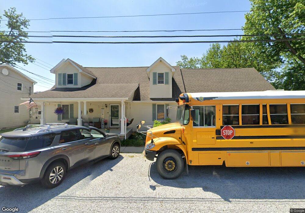
115 N Front St Thorntown, IN 46071
Estimated Value: $253,000 - $391,239
3
Beds
3
Baths
2,560
Sq Ft
$125/Sq Ft
Est. Value
About This Home
This home is located at 115 N Front St, Thorntown, IN 46071 and is currently estimated at $318,810, approximately $124 per square foot. 115 N Front St is a home located in Boone County with nearby schools including Western Boone Junior/Senior High School.
Ownership History
Date
Name
Owned For
Owner Type
Purchase Details
Closed on
Sep 20, 2010
Sold by
Ballard Thomas A and Ballard Donna B
Bought by
Oldham Thomas P and Oldham Diana J
Current Estimated Value
Home Financials for this Owner
Home Financials are based on the most recent Mortgage that was taken out on this home.
Original Mortgage
$110,000
Outstanding Balance
$72,536
Interest Rate
4.49%
Mortgage Type
New Conventional
Estimated Equity
$246,274
Create a Home Valuation Report for This Property
The Home Valuation Report is an in-depth analysis detailing your home's value as well as a comparison with similar homes in the area
Home Values in the Area
Average Home Value in this Area
Purchase History
| Date | Buyer | Sale Price | Title Company |
|---|---|---|---|
| Oldham Thomas P | -- | -- |
Source: Public Records
Mortgage History
| Date | Status | Borrower | Loan Amount |
|---|---|---|---|
| Open | Oldham Thomas P | $110,000 |
Source: Public Records
Tax History Compared to Growth
Tax History
| Year | Tax Paid | Tax Assessment Tax Assessment Total Assessment is a certain percentage of the fair market value that is determined by local assessors to be the total taxable value of land and additions on the property. | Land | Improvement |
|---|---|---|---|---|
| 2025 | $3,131 | $371,900 | $11,600 | $360,300 |
| 2024 | $3,131 | $348,400 | $11,600 | $336,800 |
| 2023 | $2,904 | $322,400 | $11,600 | $310,800 |
| 2022 | $2,971 | $305,600 | $11,600 | $294,000 |
| 2021 | $2,662 | $263,000 | $11,600 | $251,400 |
| 2020 | $1,553 | $171,600 | $11,600 | $160,000 |
| 2019 | $1,511 | $170,300 | $11,600 | $158,700 |
| 2018 | $1,421 | $164,200 | $11,600 | $152,600 |
| 2017 | $1,282 | $154,900 | $11,600 | $143,300 |
| 2016 | $1,124 | $145,800 | $11,600 | $134,200 |
| 2014 | $995 | $136,600 | $11,600 | $125,000 |
| 2013 | $1,061 | $136,600 | $11,600 | $125,000 |
Source: Public Records
Map
Nearby Homes
- 117 N Market St
- 328 N Front St
- 223 S West St
- 6691 Indiana 47
- 6433 W State Road 47
- 1321 Locust Place
- 1323 Locust Place
- Ironwood Plan at Northwood Haven
- Spruce Plan at Northwood Haven
- Ashton Plan at Northwood Haven
- Palmetto Plan at Northwood Haven
- Bradford Plan at Northwood Haven
- Aspen II Plan at Northwood Haven
- Empress Plan at Northwood Haven
- Juniper Plan at Northwood Haven
- Chestnut Plan at Northwood Haven
- Norway Plan at Northwood Haven
- Cooper Plan at Northwood Haven
- 6139 Westfall Dr
- Juniper Plan at Westfall Place